rIBERIA BIKEPACKING TOUR


rIBERIA An imaginary country but undeniably real
rIBERIA The Gravel of the River ...and of its mountains
New bikepacking route for GRAVEL bikes in northern Spain.
A 740-kilometer story
What is rIBERIA ?
First things first... rIBERIA is An imaginary country. Let no one look for it on maps, encyclopedias, or Wikipedias. Or at least, that is how it has been until now.
One of the stories you can read on this website will tell you about a route of 740 kilometers and a positive elevation gain of 12.300 meters, designed to be ridden by bicycle —preferably a gravel bike— spanning four Autonomous Communities in northern Spain: Aragon, Navarre, the Basque Country, and La Rioja. It is the story of The Gravel of the River ...and of its mountains.
...
The technical aspects, geographical details, and descriptions required for a route of these characteristics are revealed below in the different tabs of the website. The resources needed to approach and ride it are freely available with no requirements whatsoever.
The second story you can also read on this website is perhaps the most important one. It tells you about the Imaginary country but undeniably real. A Country that arises from a common unwritten culture—or at least, rarely written—but shared by the people who inhabit this part of the Ebro riverbank, regardless of the region they belong to.
It is the culture of the River, of the fertile river valleys, of living off the land, and of the tension or calmness that this brings. It is also the relationship between the people of the River and the people of the Mountains, a relationship that has existed since olden times on both the north and south banks of the Ebro.
There is something else that defines rIBERIA and, for better or worse, shapes its character. Here, things are rarely meant for the traveler to just look at... they are not designed to attract tourism; they are meant to be lived and used, plain and simple. It won't take long for the traveler to realize this. There are, however, exceptions: some towns in the Middle Zone of Navarre or Rioja Alavesa in the Basque Country break the rule and "dress up" their streets, as do the spots where the track meets the Camino de Santiago, but generally speaking, we stand by what has been said.
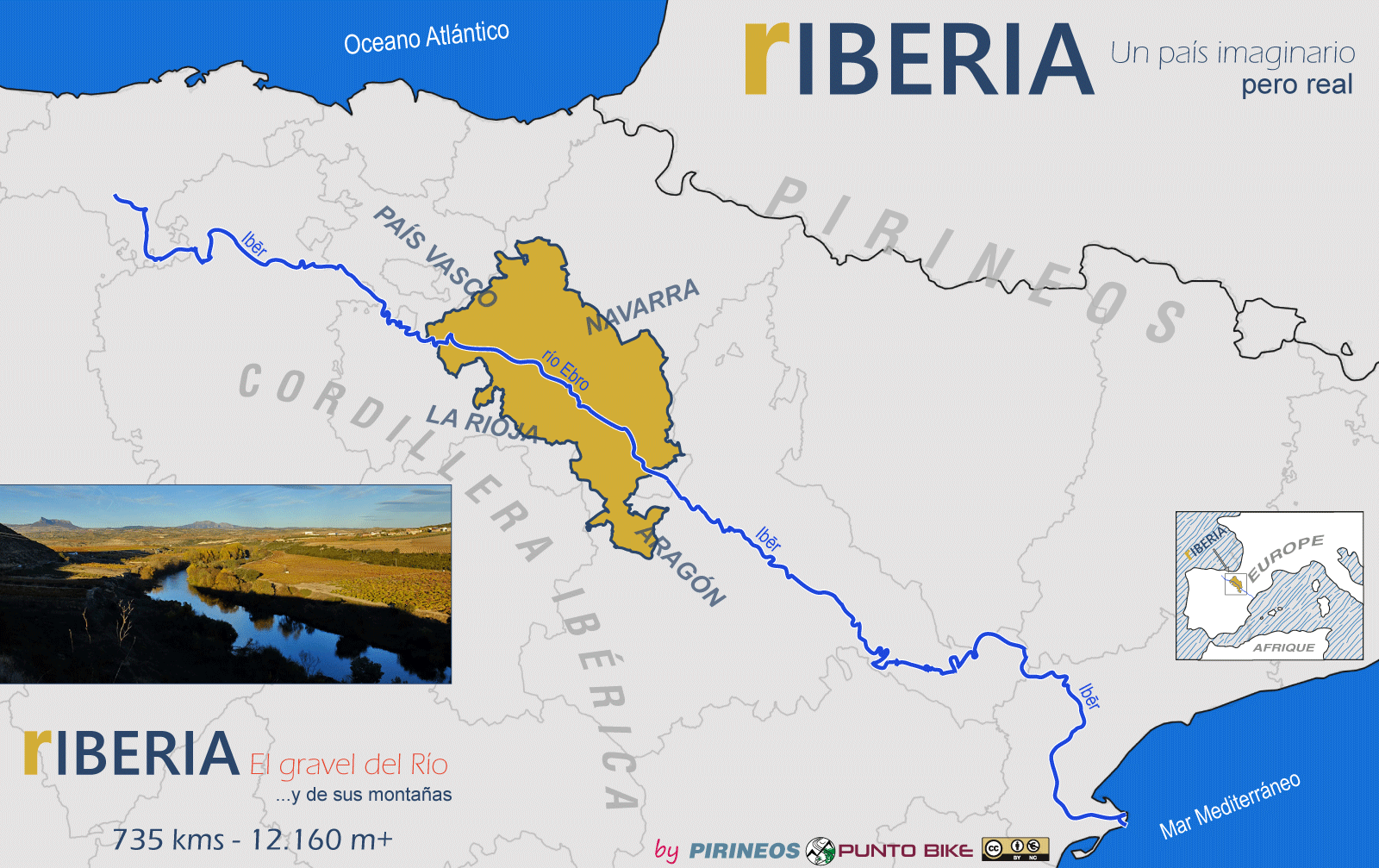
The River was so much of a River, and its name sounded so vibrant —IBĒR— that the name stuck and extended its influence across the entire territory, eventually naming the Iberian Peninsula.
In today's IBERIA, the route presented here spans its kilometers across four of the autonomous communities in the north of the peninsula: Aragon, Navarre, the Basque Country, and La Rioja.
THE ROUTE
If we are in Tafalla—one of the few passing points on the main rIBERIA track with a city "vibe"—we could practically say we are in the capital of the so-called Zona Media de Navarra (Middle Zone of Navarre). This toponym, applied to our route, helps define the territory's cycling profile: during the 80 kilometers that the track runs through it, the difficulty also remains "medium"; there are no major mountain passes, but it is by no means flat.
We could have also opened this text in nearby Olite (just 4 kilometers from Tafalla), though in that case, we would be speaking of a capital from a tourism standpoint, as we would find ourselves in one of the towns that has rightfully become one of the most visited in Navarre.
The towns that will emerge along our path once the ride begins will almost all be strategically perched on elevated promontories with a clearly defensive character, overlooking cereal fields and scrubland occasionally dotted with vineyards and olive groves. It will be common to put some serious effort into the pedals when navigating their steep, cobblestone streets.
Between Puente la Reina and Estella—optional points along the route—we will share geography and occasional track sections with the Camino de Santiago and its pilgrims. You will undoubtedly notice this if you stay overnight in any of the villages that the route crosses in this section.
The "medium" difficulties end when the track begins to climb towards the Sierra de Andia in the town of Arínzano. Although administratively it remains the Middle Zone, for our bikes it is already the "High Zone."
We leave behind the banks of the Ebro's tributaries—the Cidacos, Arga, and Ega rivers—between which we have been hopping until now, to plunge abruptly into the world of sierras and mountains.
It is worth noting this piece of data: the difficulty of this first ascent sets the tone, to some extent, for the rest of the major climbs in rIBERIA. The road we encounter during the climb, which we follow for 2 kilometers to the Lizarraga Pass, acts as a dividing line between the Andia and Urbasa mountain ranges—two different names for the same geological unit.
During the 115 kilometers of the "High Zone," the common denominator will be the intense green of the vegetation. The vast Urbasa Meadows will be broken up by the "cliffs" of Ubaba and the extremely solitary Sierra de Lókiz.
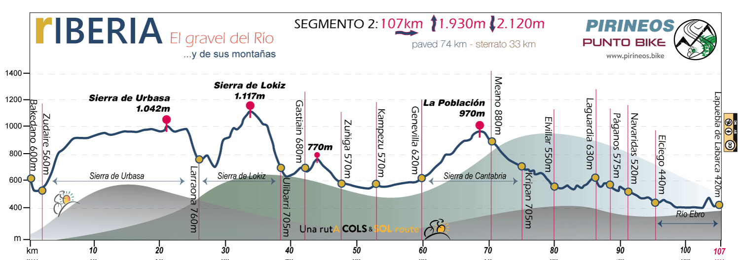
The track has already turned southwest, and green continues to paint the landscape when, in the town of Kampezu, we enter the Autonomous Community of the Basque Country and the region known as the Montaña Alavesa. The stay will be brief: with barely any rest, the climb—not as demanding as the previous ones—to the Sierra de Cantabria will begin. For our bikes, this mountain range will be a simple gateway to the "universe" of La Rioja, but in geographical terms, it forms a long "spine" that connects the mountain chains running completely across the north of the Iberian Peninsula, serving as a link between the Pyrenees and the Cantabrian Mountains—1,500 kilometers of peaks between Cap de Creus on the Mediterranean and Cape Finisterre, the ancient "End of the Earth" on the Atlantic Ocean.
We can assure you that our entry into the Rioja Universe will be "in grand style." The pass-village of La Población—once again in Navarre—at an altitude of 987 meters, becomes a privileged viewpoint ushering in a new setting for rIBERIA. Emerging before our wheels is the great depression carved out—this time indeed—by the Ebro river between the Sierra de Cantabria to the north and the Sistema Ibérico with the Sierras of Cameros and La Demanda to the south. We enter La Rioja.
The most logical line to follow is the road, perfectly adapted to the folds of the sierra, which we will practically not leave until reaching the walled town of Laguardia. Here, the past is palpable and somehow highlighted on every side... if you follow the sequence, it will lead you step-by-step all the way back to prehistory.
In Laguardia, we are in the heart of Rioja Alavesa. We are wrapping up the 45 kilometers of the track that, administratively speaking, correspond to the rIBERIA kilometers in the Basque Country.
Viticulture is the almost absolute ruler of the landscape; no matter where we look, there will be a vine nearby. And always, not far off, some winery standing out against the scenery—sometimes avant-garde and seeking to make a statement, other times traditional and occasionally even wanting to hide beneath the earth. It will be difficult to remember them all.
After crossing the medieval town of Elciego, the track dresses up in style at the Guggenheim-esque Marqués de Riscal winery and guides us to present ourselves, for the first time since the beginning of this text, before the waters of the Ebro—the River of our Gravel.
Once the introductions are over, we will continue along the solitude of the left bank until the bridge at Lapuebla de Labarca allows us to cross the river, enter what is now formally the Community of La Rioja, and begin to climb almost stealthily up the slopes—still close to the river but already part of the foothills of the Iberian Range.
The first towns we cross in these opening kilometers through Rioja Alta will bring us back to the medieval atmosphere we experienced earlier in some of the Navarrese towns traversed by the Camino de Santiago. That atmosphere will not last long: as the wheels begin to descend toward the Iregua Valley and the track undulates, now adapting to the folds of the Sierra de Cameros, we will have entered Rioja Oriental. Vineyards will cease to be hegemonic, and rIBERIA will begin to acquire its more austere character.
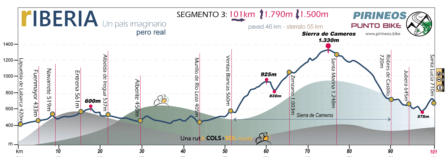
We have plenty of Rioja Oriental ahead... after the first few kilometers skirting Logroño, where we pass through different towns across typical riverside territory, the track leads us into the Jubera Valley and begins to climb—first gently, and then relentlessly—toward the Sierra de Cameros. Here we travel through a territory that, due to its isolation, is beginning to be known in literature as "the Riojan Alpujarras," home to some of the highest inhabited settlements in La Rioja, such as Zenzano (1,003m) and Santa Marina (1,248m).
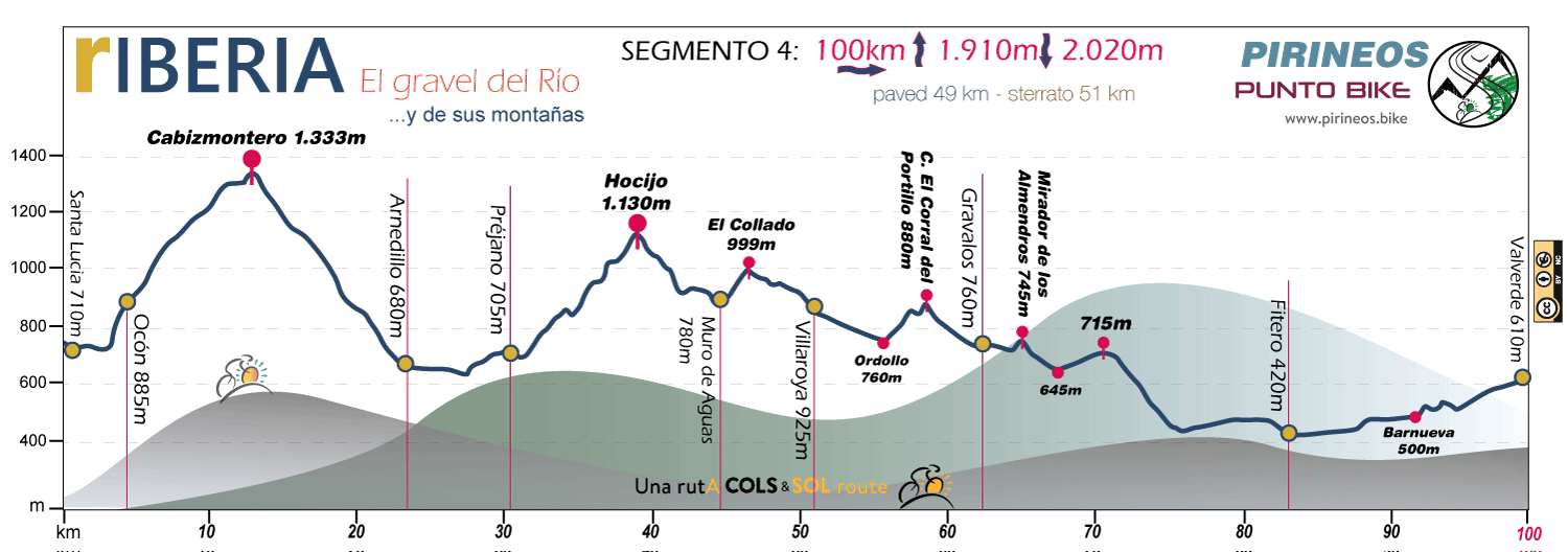
In sporting terms, we are in demanding territory: from the 1,330-meter altitude of the Zenzano Mountains, the track drops to 575 meters at the bridge crossing the Jubera River and climbs back up to 1,333 meters on the slopes of Cabizmontero, now in the Sierra de La Hez. From here, a comfortable descent drops us off at 680 meters in Arnedillo. As you can see, the elevation changes are significant...
In the process, we have changed geography and entered the Cidacos basin, where the characteristic, intense orange rock walls paint a landscape that is hard to forget.
The Cidacos Valley, with the nearby industrial town of Arnedo, provides the route with a welcome respite filled with comforts and services before we submerge ourselves once more into the mountains of the Iberian Range, through what we could informally call "The Rioja of the Dinosaurs."
The region treasures a vast variety of remains from that geological era, something we will see indicated and explained on various signs and information panels. But information aside, the territory at times takes on a true "Jurassic Park" atmosphere where, in the absence of dinosaurs, you can be sure that from afar, some wolf is watching us.
It is in this setting that we cross El Hocijo, the final demanding climb of the route through Rioja Oriental and a pass that connects Préjano with Muro de Aguas and Villarroya—villages where the human presence somewhat softens the harshness of the terrain.
For 40 kilometers, we travel at mid-altitude along the southern slopes of the Sierra de Yerga, thus staying away from the "excessive" wind turbines that saturate the mountain's crest line. This mid-altitude journey through terrain relatively close to inhabited areas gives rise to a sequence of settings where a harsh terrain base—that of the dinosaurs—is occasionally made gentler by almond trees, olive trees, some cereal fields, and occasional vineyards.
In sporting terms, during the final kilometers of the track in Rioja Oriental between Grávalos and Valverde, the route becomes less demanding. There are no longer any climbs significant enough to earn that label. For a few brief kilometers, we re-enter Navarre at the town of Fitero, and once again, without warning, we return to the most undiscovered La Rioja along the Alhama River before positioning ourselves at the base of the Montes del Cierzo.
Here begins the rIBERIA of Aragón—200 kilometers of track where the Sierra del Moncayo stops being a distant horizon and becomes a constant presence.
The Montes del Cierzo are not too demanding a barrier in sporting terms. A 200-meter climb and an 18-kilometer ride separate us from Tarazona, a settlement with the "vibe" of a small city and an almost mandatory intermediate milestone between stages in rIBERIA.
They are, nevertheless, the hills that give the wind its name in this part of the Ebro Valley when it blows cold from the north... "Sopla Cierzo" (The Cierzo is blowing), they say. An honor for them, a punishment for us when it starts up.
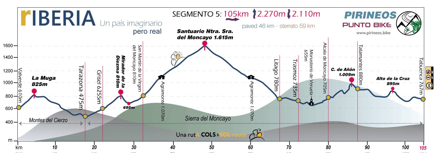
Thirty kilometers separate Tarazona from the Sanctuary of the Virgen del Moncayo. All of them, except for a brief descent of barely 2 kilometers, are uphill. If we stick strictly to the numbers, it packs 1,355 meters of accumulated elevation gain, making it the most demanding mountain pass in rIBERIA. The reality, however, is that the route is manageable, featuring good road surfaces and a steady, moderate incline except for a few specific moments. The climb to the very top can be bypassed, as a 12-kilometer section with 550 meters of elevation is shared on both the way up and down—but skipping it means removing the "lighthouse" of the route. The decision is entirely up to each rider.
Once down from this "colossus," and for the next 70 kilometers, the track follows the folds of the Sierra del Moncayo in a constant rolling terrain across its slopes—with moments of considerable physical intensity—passing through small towns that emerge quite regularly: Litago, Trasmoz, Alcalá de Moncayo... Although it runs at a lower altitude than the preceding section, the route becomes somewhat wilder and more solitary, if that is even possible. This is felt with greater intensity once we clear the Collado de Añón and navigate the somewhat rough tracks between Talamantes, Tabuenca, and Fuendejalón.
We are now in the territory known as Campo de Borja. The demanding passes are behind us, though that does not mean occasional climbs up minor hills have disappeared. Before our eyes, the now classic—because they are so common—fields of cereal, olive trees, vineyards, and wasteland unfold.
When we leave behind the welcoming town of Magallón and, after a brief effort, come to a halt at the viewpoint of the prehistoric hillfort of Cabezo El Burren, we will look toward the east. The vastness of the plains stretching out before us signals that we are at the eastern boundaries of rIBERIA. The Iberian Range, which has been our constant guide, veers south here... bidding us farewell. We now set our own course, seeking out the Ebro River once again to start closing the route's loop.
Nevertheless, there are 60 kilometers between Cabezo El Burrén and the moment we cross the Ebro in Ribaforada. In the interim, we cross the town that gives its name to the Campo de Borja region, and between the slopes of the Sanctuary of Misericordia and the "once again excessive" wind turbines of El Puntal, we find ourselves at the top of the El Buste Viewpoint. From here, if we look north and the atmosphere is clear, we can already discern with some clarity the singular landscape of Las Bardenas of Navarre and Aragón, which our track will traverse entirely from south to north.
The terrain is fast and relatively comfortable until crossing the Ebro for the second time. We have ridden 400 kilometers since we first crossed it in Lapuebla de Labarca, in La Rioja. This time, the bridge that allows it is located between Ribaforada and Fustiñana. Right after the latter, the climb to the first of the Bardenas begins: La Bardena Negra.
It is not easy to strike the right balance when speaking about the Bardenas and cycling. If we complete the ride without detouring to spend the night in one of the "Desert Cities" located on its perimeter, the track section between the entry point in Fustiñana and the exit point in Carcastillo spans 76 kilometers.
If the weather conditions are good, the route is not far from being considered something of a "greenway." The catch is that along these 76 kilometers, there are no villages or inhabited places, there is no water, and mobile phone coverage can be unstable or directly non-existent. There is no need to exaggerate the risks, but we cannot ignore them either. If it is very hot and a problem arises, you have a real problem... We must plan to be completely self-sufficient.
The 400 meters of climbing to La Plana de la Negra are, as we will see, more of an orange desert than a black one, but colors aside, they plunge us without hesitation into the heart of the Bardenero universe and its hidden corners.
A simple stretch of road, the NA-125, separates the two Bardenas. Crossing it is all it takes to enter the second one, La Bardena Blanca.
Weaving at times through Navarre and at times through Aragón, the track heads northward with little hesitation. It becomes somewhat more "humanized" near the military bombing range and, more permanently, when we reach the Monument to the Shepherd, the official northern entry point to the Bardenas Reales of Navarre.
After the "oases" of Carcastillo and Murillo El Fruto, and with the Bardenas now behind us, we return to the Zona Media of Navarre. We do so by climbing what, in sporting terms, we could well call the Ujué pass, as it is a demanding ascent. What we find at the summit is a semi-walled medieval village perched on a hill and visible from all the surrounding territories. We could say it stands as another "lighthouse" for rIBERIA, and it is undoubtedly one of the most spectacular villages in Navarre.
From the top, 20 descending kilometers separate us from the starting point of this text in Olite. Mid-descent, the wine-producing village of San Martín de Unx grants us a brief moment of relaxation.
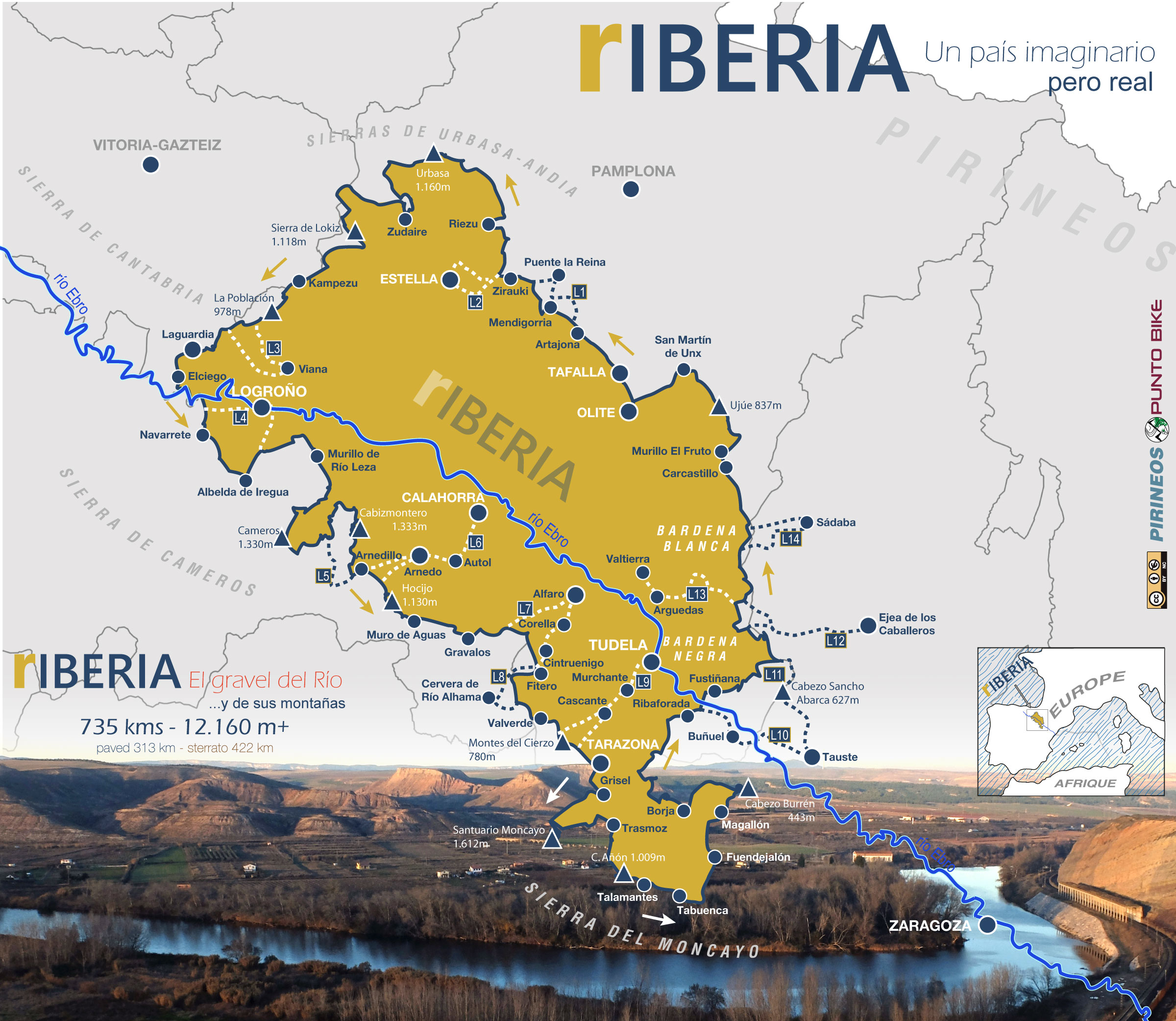 Tap to enlarge map
There is hardly a River without Mountains, and in our case, they are not far away. Their presence will shape the profiles of our tracks into mountain ranges and will define our Imaginary country —somewhat vaguely to the north and very sharply to the south.
Let no one expect a "river stroll along the banks of the Rhine"... rIBERIA is, in a way, a "harsh" Country, very cold when it's cold and scorching when it's hot. In the Ebro Basin, the wind has its own name; it is called the Cierzo, and some of the Mountains crossed by our track are the Montes del Cierzo (Cierzo Mountains)... Thus, it might just be Aeolus who decides the right length for the stages we choose to ride each day.
THE ROUTE IN DATA
What you could feel!
✔ PROFILES
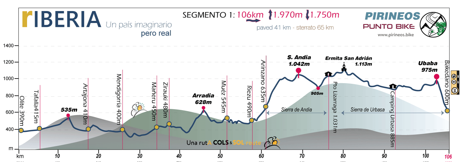
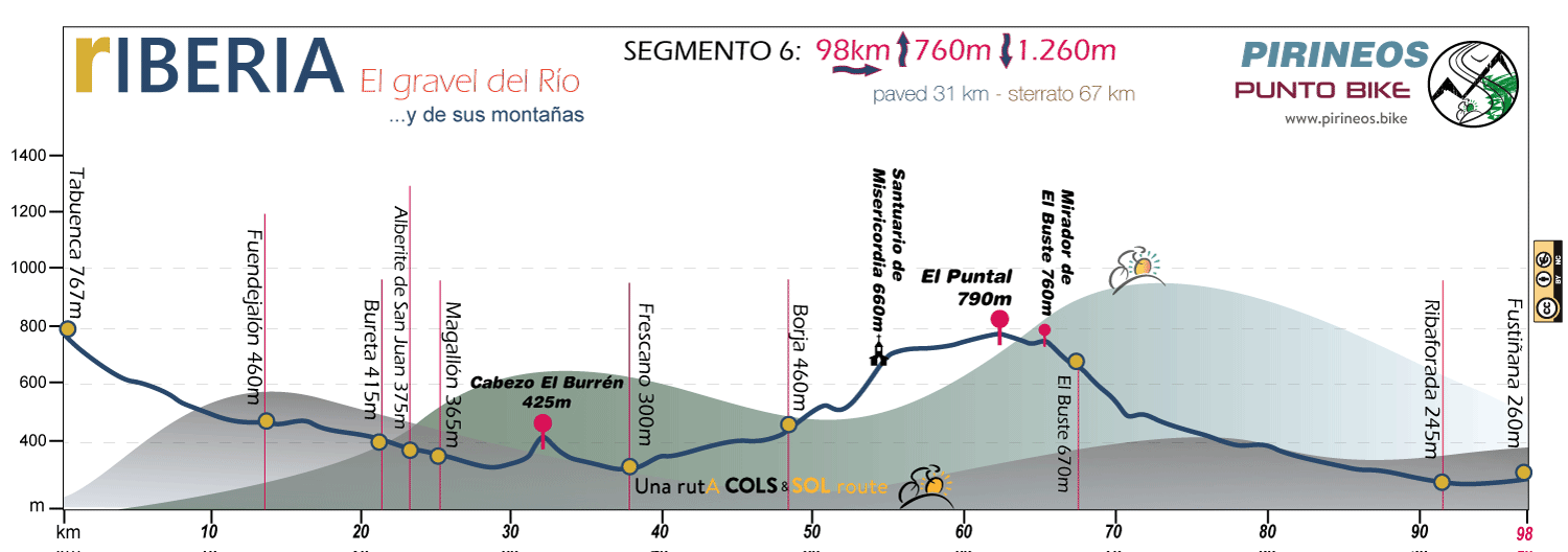
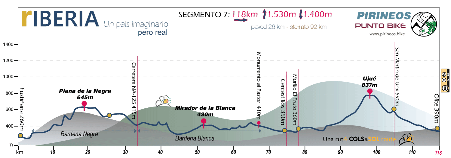
We have split the profile into 7 segments; otherwise, it would have been an excessively long chart if we had tried to maintain the complete, single profile of rIBERIA.
To be clear: each segment DOES NOT INTEND TO BE a stage. It is simply a stretch of approximately 100 kilometers for which we detail the kilometers with asphalted or paved surface —paved— and those corresponding to other types of unpaved surfaces —sterrato—. We also include the accumulated elevation gain and loss data.
With these parameters, we aim to convey, in some way, the difficulty of the area covered by the segment.
- NAVARRA
- BASQUE COUNTRY
- LA RIOJA
- ARAGON
The Middle Zone
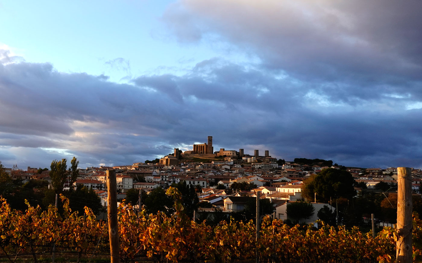
For us, Artajona Castle is more than just another simple passing point on the route. The reason is simple: when, after the effort demanded by the steep narrow streets leading up from the town, we stop at the fountain at the foot of the walls, even though it isn't labeled as such, we could say we are at the rIBERIA Viewpoint.
To the north, the view is limited by the buildings of the very same medieval space where we stand, known as El Cerco de Artajona. It is the view to the south that reveals a line of mountains on the horizon, stretching from the Sierra de los Cameros in the southwest to the Sierra del Moncayo in the southeast, marking the natural border of our "imaginary country." This is the Iberian System, with the —invisible— Ebro River at its feet.
To the west, more sensed than seen, lie the plains of the Bardenas Reales; and when we start pedaling and cross through the wall gate, the Pamplona Basin and the Urbasa-Andia Mountain Range, towards which we are heading, will emerge, shaping the northern horizon of rIBERIA.
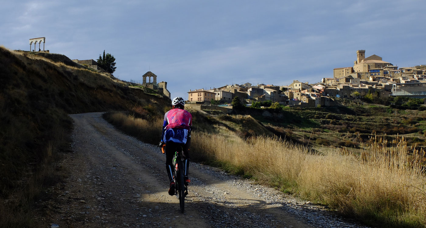
The medieval town of Ujué, with its impressive fortified church, is another lighthouse of rIBERIA. Rising to an altitude of 837 meters, it stands out over the surrounding plains—which lie at less than 400 meters—making it recognizable from quite far away as a subtle peak on the horizon, and forcing us, in sporting terms, to consider it more as a mountain pass than as a town.
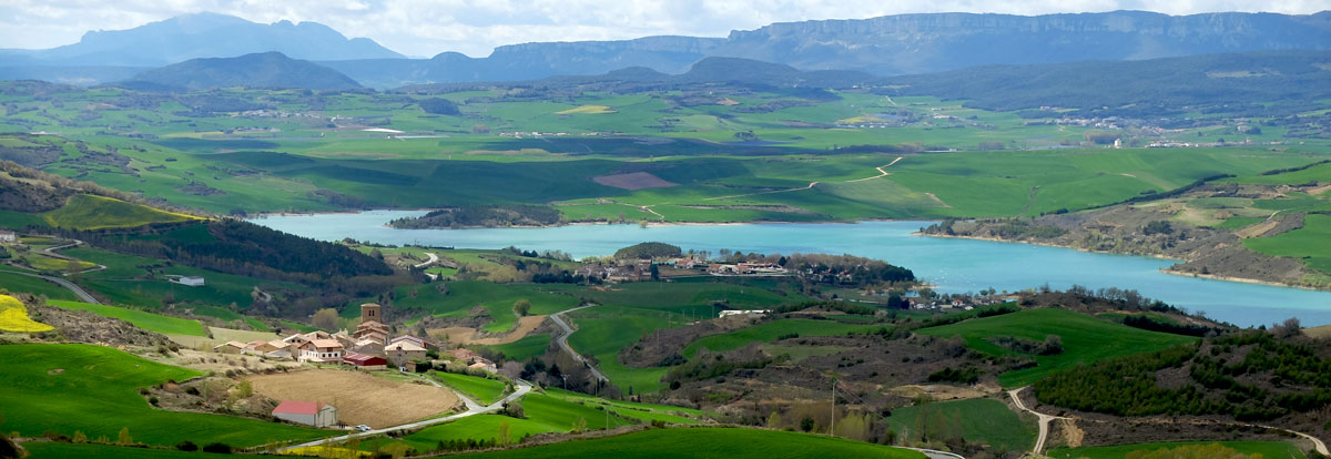
The kilometers alongside the Alloz Reservoir act as a connection between the riverbank and the mountains. The image on the horizon stops being a mere "blur" and turns into mountains with their own character. They are the prelude to the 150 kilometers of mountain terrain that the rIBERIA track traverses along its northern border.
The Andia-Urbasa and Lokiz Mountain Ranges
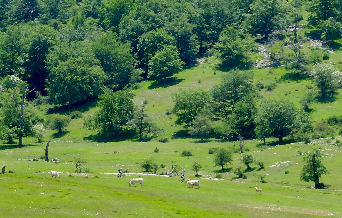
At the northernmost point of the route, the extensive meadows of the Sierra de Urbasa, and especially the intensity of its almost perennial green color, mark a sharp counterpoint to the vast crop fields that predominate in the south.
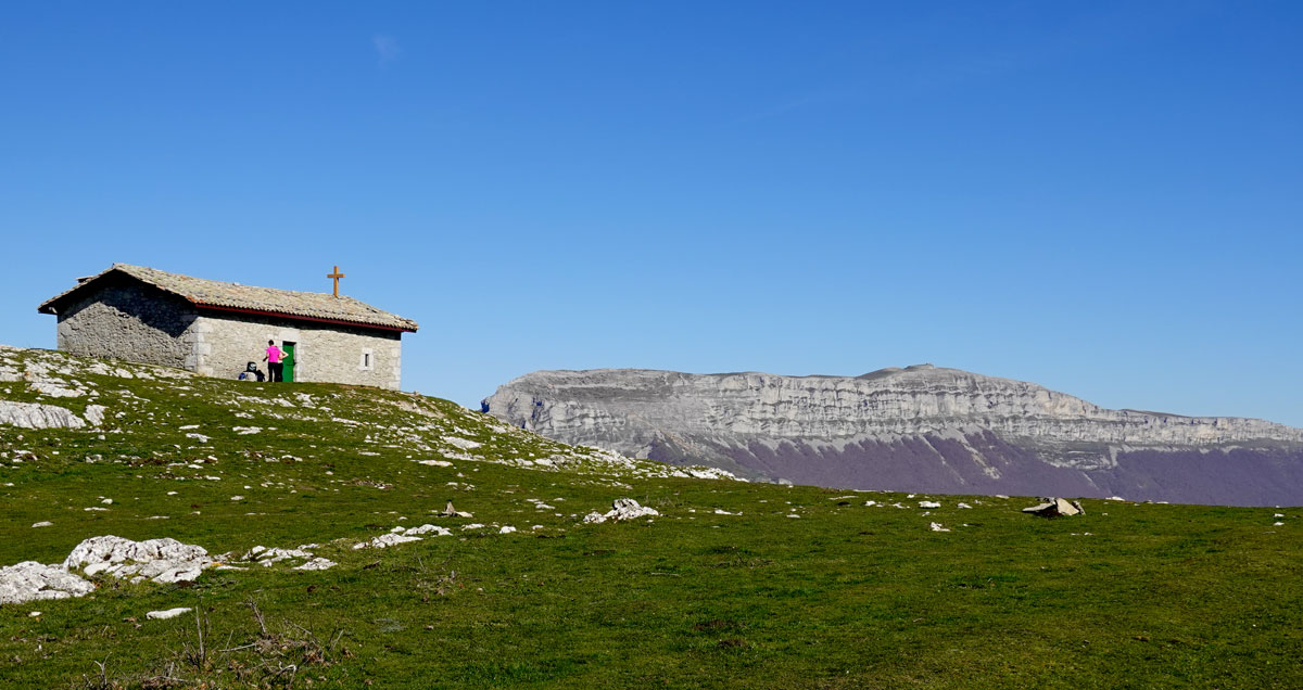
The 1,495 meters of the Beriain summit, seen in this image from the San Adrian chapel, close the northern horizon of rIBERIA.
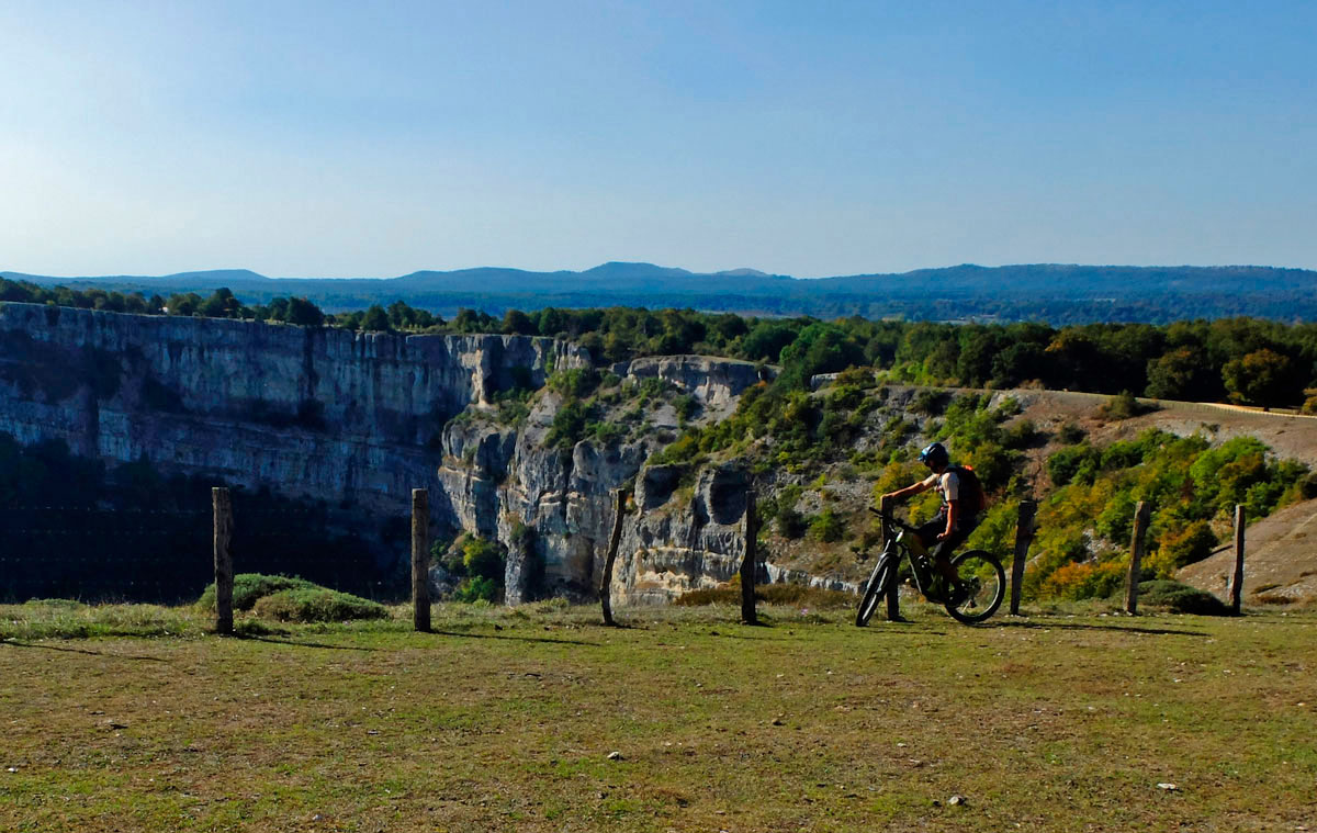
The Ubaba Viewpoint, colloquially known in Navarre as the "Balcón de Pilatos," is one of the iconic spots in the Sierra de Urbasa, and consequently, one of the landmarks of rIBERIA. Its compact rocky cliffs and the large number of massive scavenger birds soaring below our feet create a picture that we will easily keep visualizing long after our trip has come to an end.
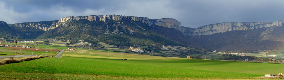
Although this is not the case from an administrative standpoint, in practice the rocky cliffs of the Sierra de Lokiz flatly delimit two distinct areas of Navarre. Above the walls lies Northern Navarre: a land of green meadows, lush forests, rainfall—the former being the cause of the latter—frequent fog... and winter snow. Below lies Middle Navarre: cereal crops, occasional vineyards, low-growing scrubwood, and a clearly milder climate.
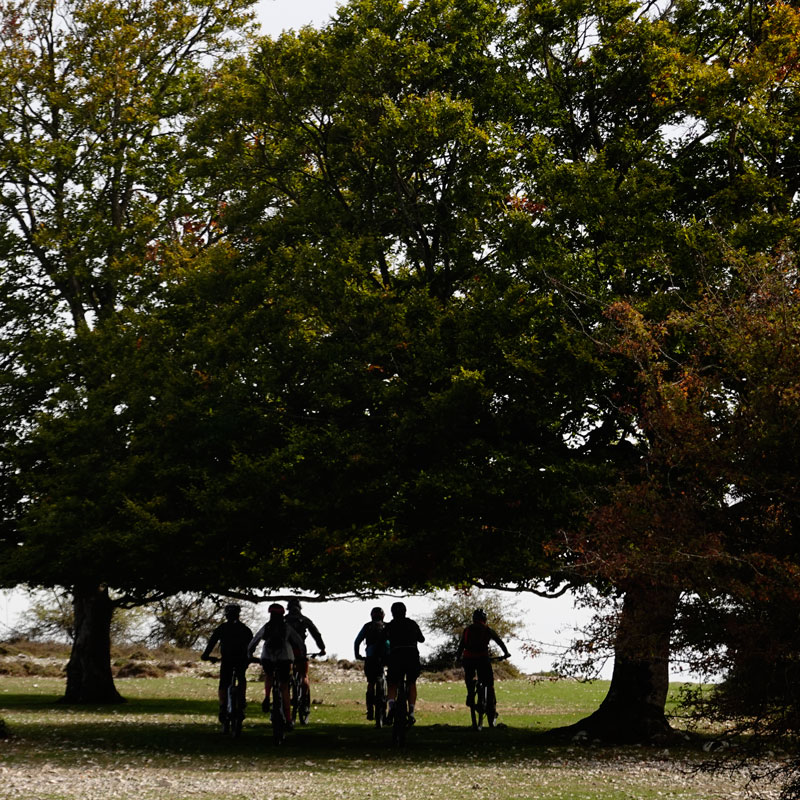
rIBERIA runs above the cliffs of the Sierra, temporarily avoiding the "temptation of the south" by heading west along the heights of the mountain range to enter the Montaña Alavesa region—now in the Basque Country Autonomous Community—without losing an ounce of that northern atmosphere of forests, mountains, and who knows, perhaps also rain and fog...
The Bardenas Reales of Navarre
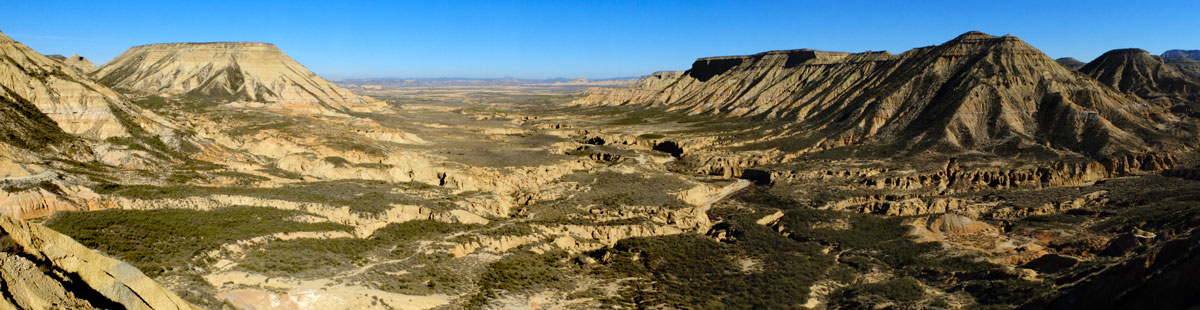
As we have said on other occasions, if we could only put one photo of the Bardenas Reales here, it would be this one.
It surprises even us that just 80 kilometers south of one of the most compact forest masses in Europe, we come almost face-to-face with one of the most desert-like spectacles in that very same Europe.
The rIBERIA track crosses from south to north this unique territory shared by the Autonomous Communities of Navarre and Aragon. If we do not detour to any of the "Desert Towns" that rim the Bardena, we will have to face a continuous section of approximately 75 kilometers where it will be wise not to forget that we are in the closest thing to a desert that can be found in Europe. No water, no supplies, and very often no mobile phone reception.
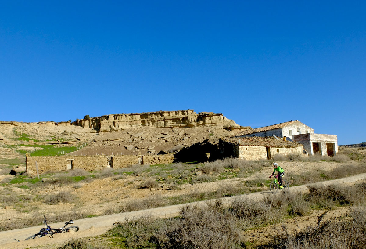
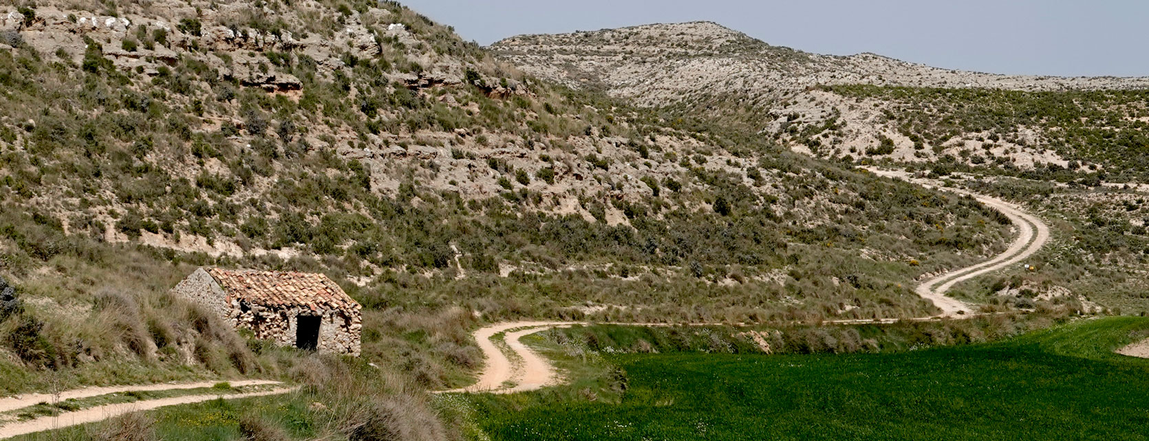
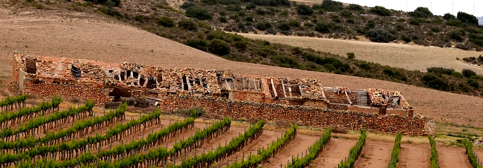
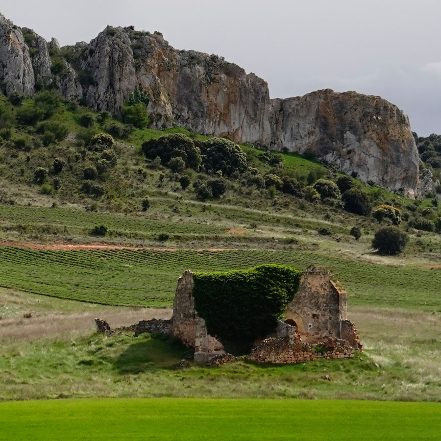
Corral de Manrique, a benchmark for the type of construction—nowadays almost always abandoned and semi-ruined—that will regularly cross our path during our pedaling through the Bardenas.
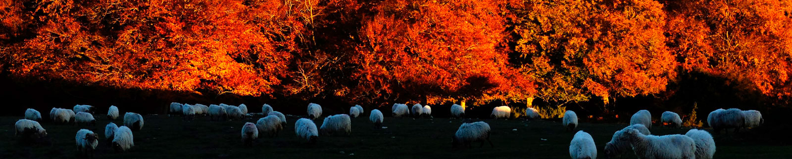
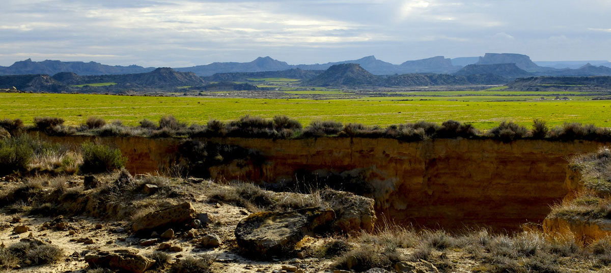
In Spain, "cañadas" are transhumance routes where the right of way and grazing rights for livestock are unquestionable.
From the winter pastures near Tauste—in the south—to the summer pastures at the very top of the Sierra de Andia—in the north—there are 160 kilometers of rIBERIA. Without sticking strictly to its layout, the route shares the environment and geography of the drover's road officially known as the Tauste - Andia Cañada. This path connects the pastures of the aforementioned geography and is therefore conceptually integrated into the rIBERIA route, linking two seemingly distant worlds: the riverbank and the mountain.
In the image above... the Sierra pastures; in the one below... the Bardenas pastures.
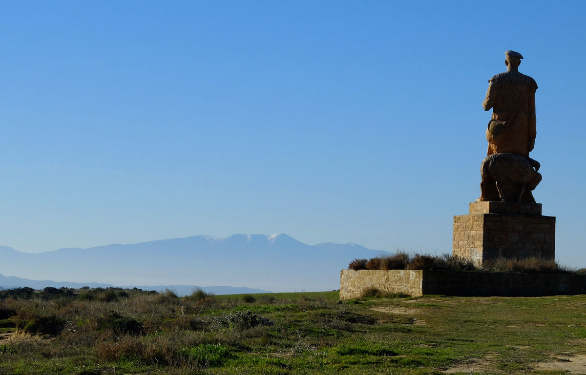
El Paso constitutes the "official" entrance to the Bardena from the north. We can say it is the point where visitors perceive that they are stepping into a semi-desert space with a personality of its own.
The Monumento al Pastor (Monument to the Shepherd) that identifies the site pays tribute to the transhumant shepherds who for centuries have repeated the cycle of bringing their sheep here in winter, which graze during the summer in the incredibly close and completely different Pyrenees.
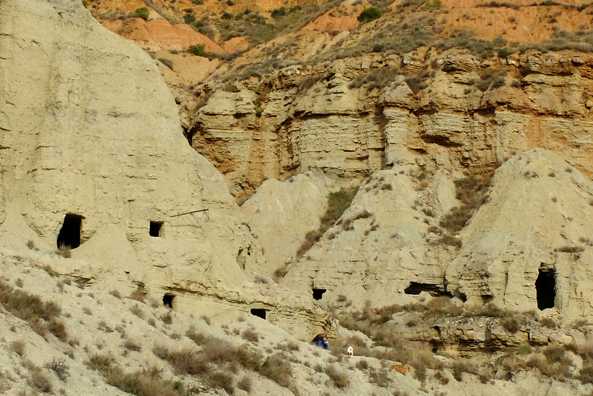
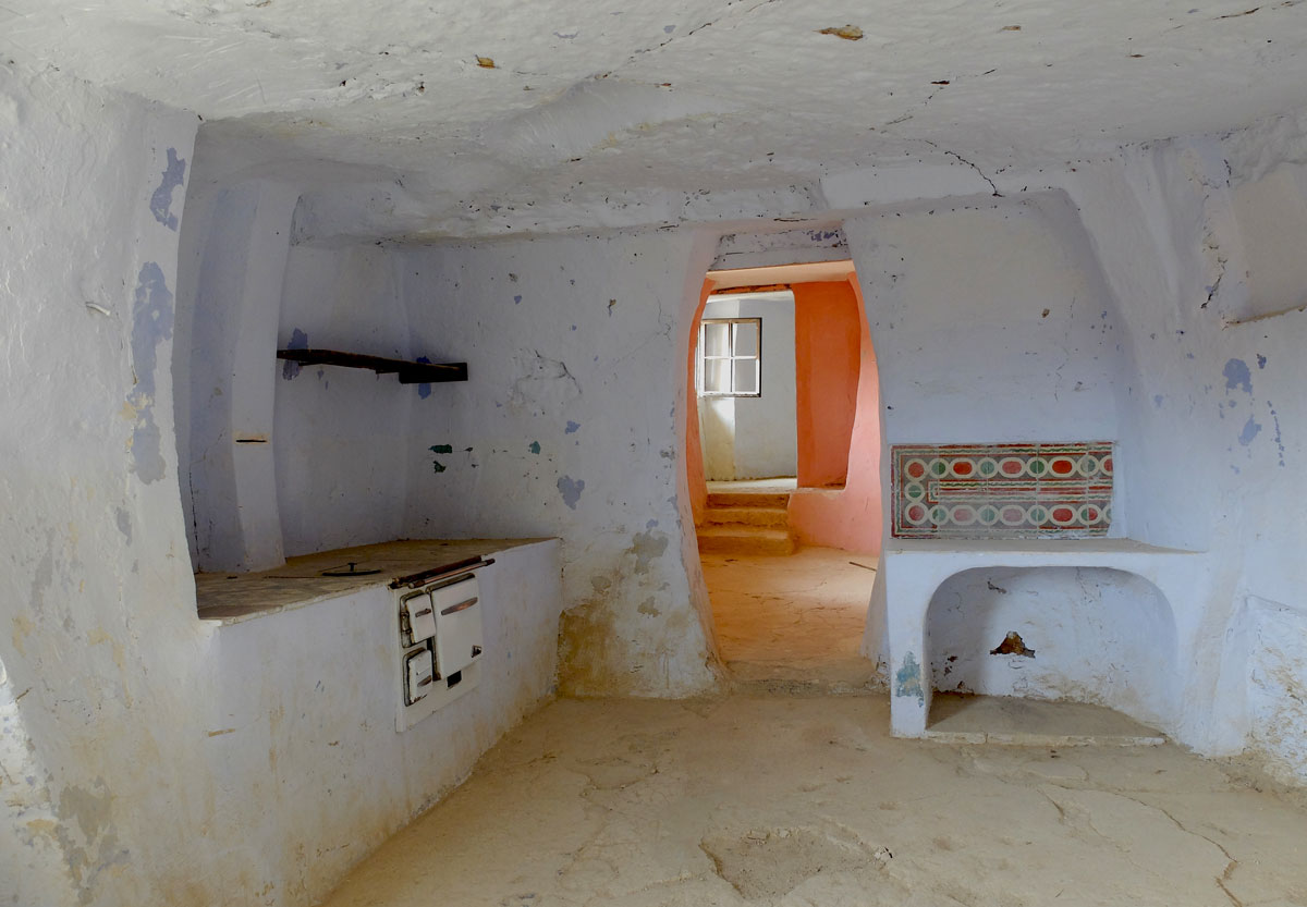
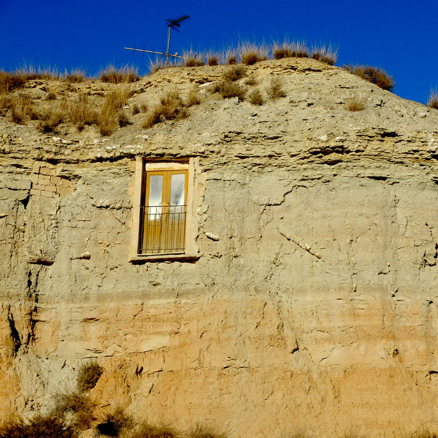
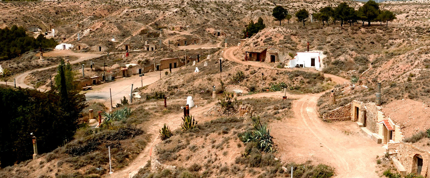
The cave-dwellings complex of Arguedas.
Despite being abandoned or mostly relegated to purely tourist uses, the cave-dwelling culture extends across many kilometers of rIBERIA, as can be seen along the way.
Their thermal stability—resulting in cool temperatures in summer and warmth in winter—is no small feat in this land of contrasts, and it certainly plays a part in the repurposing of these caves into hotels, wine cellars, and even directly back into homes.
La Rioja Alavesa
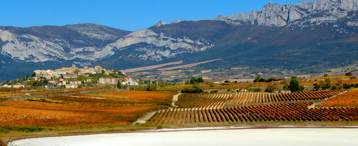
The route does not spend too many kilometers traversing the Rioja Alavesa among picture-perfect vineyards and at the foot of the clearly impressive Sierra de Cantabria, but its character brings a landscape that sticks in the memory to a journey already rich in diverse environments.
The Beron hillfort of modern-day Laguardia, located almost at the westernmost point of rIBERIA, acts as a counterpoint to the Vasconic hillfort located at Cabezo de Burren, 130 kilometers away in a straight line to the southeast and at the easternmost point of the route in Aragon.
They symbolize, in a way, what we would visualize as the prehistoric boundaries of the rIBERIA territory.
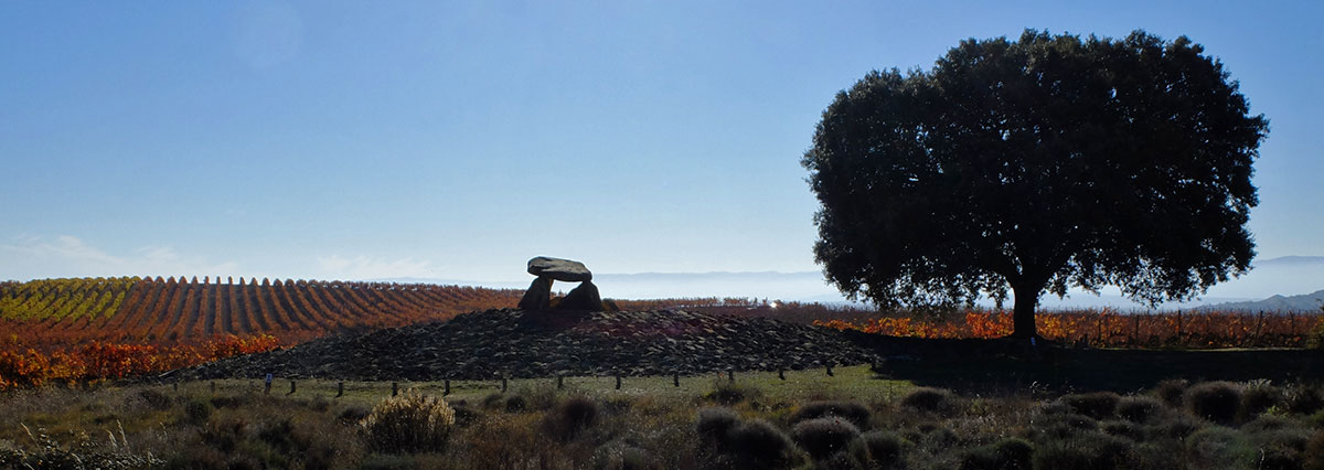
In the vicinity of Laguardia, in Elvillar, the La Hechicera Dolmen. A fitting place to rest for eternity.
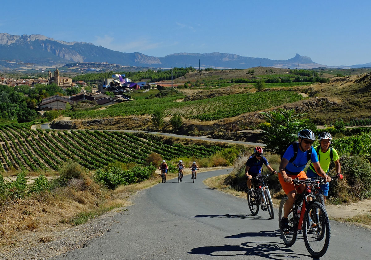
The medieval monumentality of the town of Elciego contrasts with the glamour of the Marqués de Riscal Winery. Just behind, one can glimpse the elevated plateau where Laguardia sits at the foot of the Sierra de Cantabria.
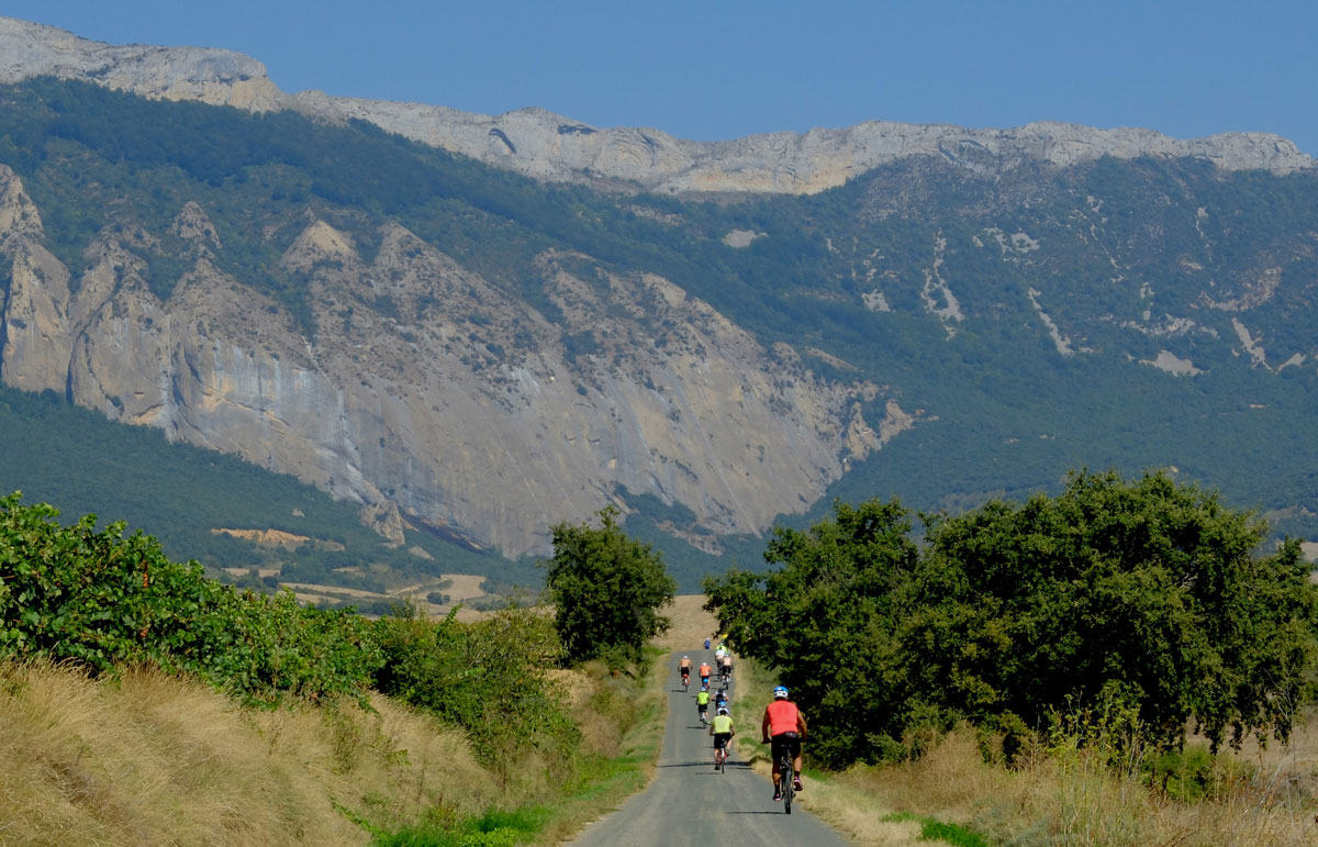
Gravel tracks beneath the massive rocky walls of the Sierra de Cantabria, between the towns of Kripan and Elvillar.
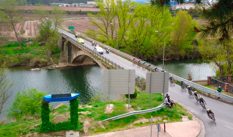
In Lapuebla de Labarca—named after the boatman service that existed to cross the river before the bridge was built—the route leaves the Basque Country and enters the Autonomous Community of La Rioja. We cross the Ebro; from now on, and for 400 kilometers until we cross the river again in Ribaforada, we will pedal through the Sistema Ibérico, the southern geography of rIBERIA.
Montaña Alavesa
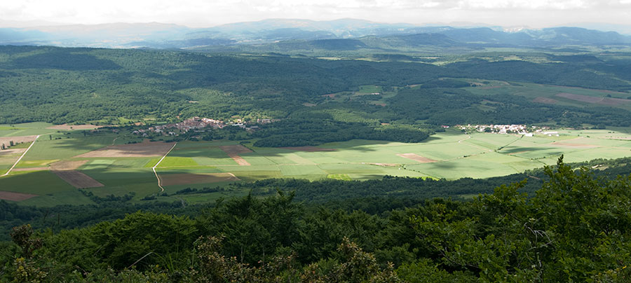
As far as geography and environment are concerned, the kilometers of rIBERIA through the Montaña Alavesa are a natural continuation of the preceding section across the Lokiz and Urbasa mountain ranges in Navarre. A green and humid landscape, with the cultural flavor of the nearby Rioja Alavesa always present.
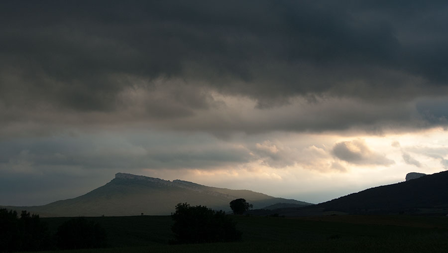
In the Montaña Alavesa, the horizons are always close at hand. This one, of La Muela de San Román, blocks our path to the west and steers rIBERIA southwards toward the Rioja Alavesa.
Eastern Rioja - Los Cameros Mountain Ranges
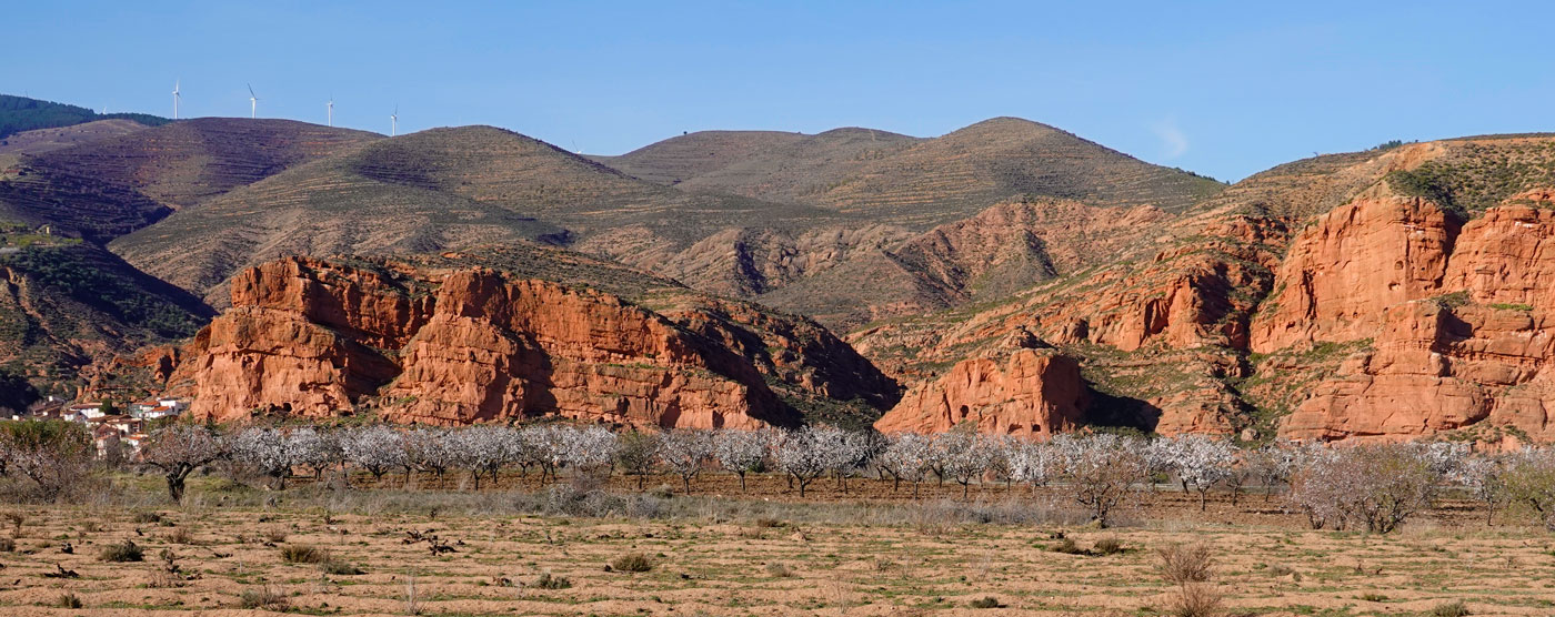
Out of the 740 kilometers of the track, 195 correspond to the section that runs through La Rioja. Of these, except for a brief initial sequence through La Rioja Alta, the entirety is located in what is known as Rioja Baja or Oriental. Contrary to what its toponymy might suggest, its geography is mountainous and rugged, and beyond the populated centers, depopulation and solitude are the norm.
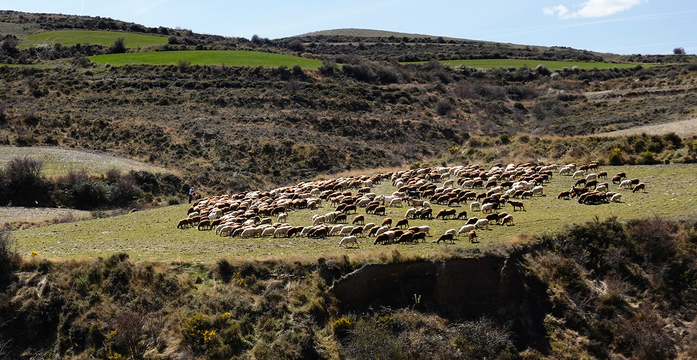
Although we will still see some examples, livestock farming is in clear decline due to a lack of generational turnover, and even though we might not see it and it shuns us, wolves are abundant.
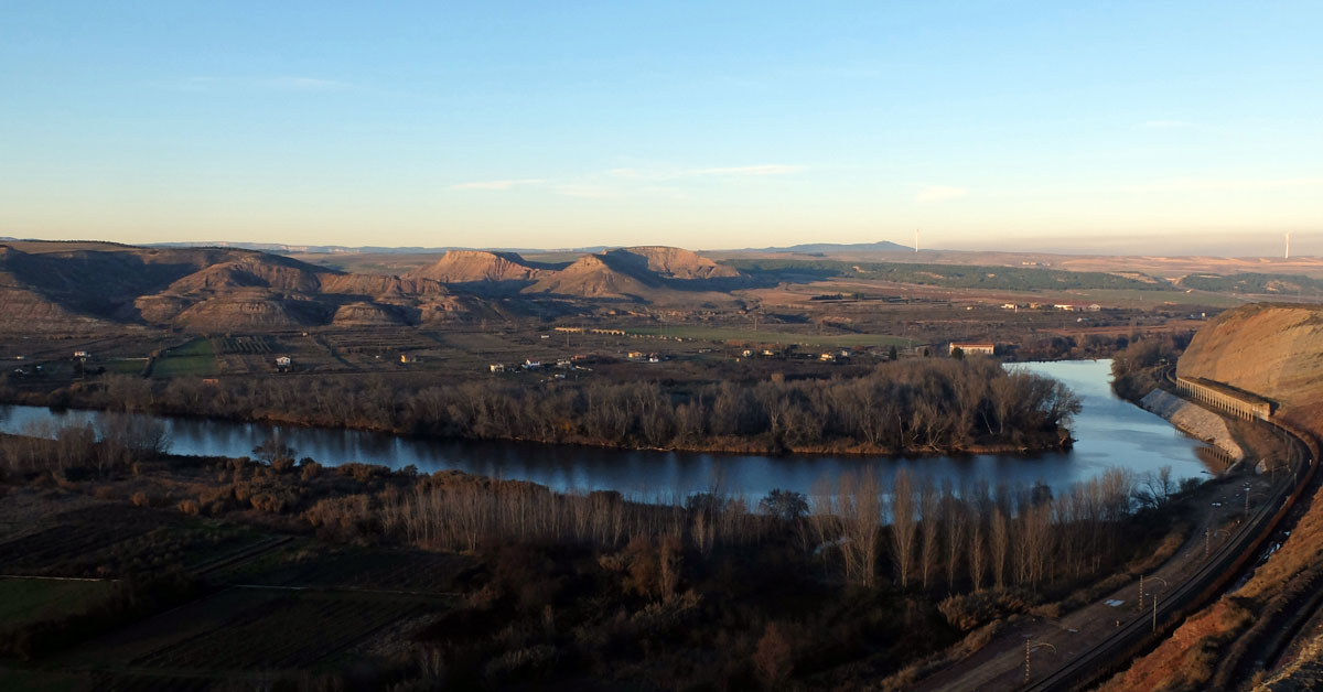
The riverside area near the Ebro is the "ultimate expression" of rIBERIA, the place where the market garden culture is still very present, both on the right bank of the river—La Rioja—and on the left—Navarre.
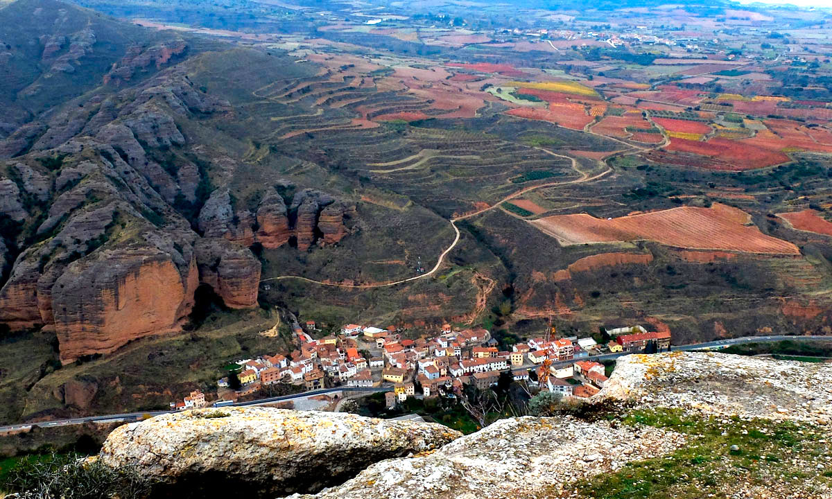
In the transition from the riverbank to the mountains, it will not be difficult to notice large sections of "terraced" land where, save for a few exceptions occupied by olive trees and vineyards, wild vegetation is reclaiming the terraces built by our ancestors to ease agricultural labor in a time when sustenance came entirely from the earth and there was little room for abandonment.
In the image, the Iregua Valley: the town of Islallana, squeezed between the rock faces of the Portal de Cameros, marks the boundary between the mountain and the riverbank.
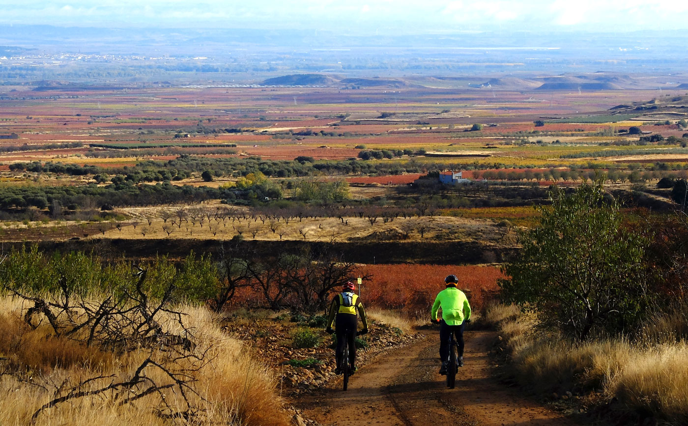
The slopes of the Sierra de Yerga slide down toward the wide-open space of the Ebro riverbank.
Silent in these mixed landscapes—a blend or border between riverbank and mountain range—lie some of the unique vineyards that bring world renown to the wines of La Rioja.
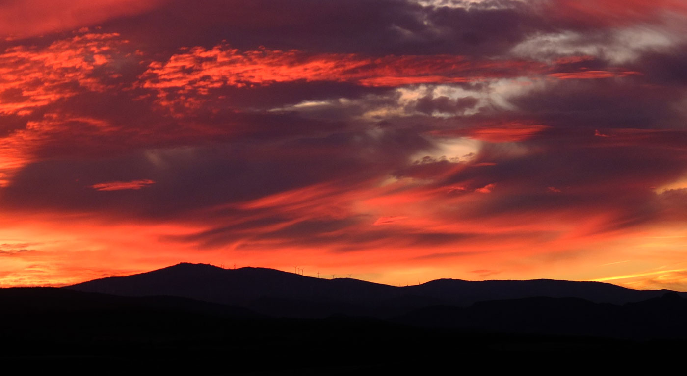
The Sierra de Yerga is one of several ranges that, with barely any gaps in the landscape, change names as they merge and give shape to the Sistema Ibérico. In the Ribera Baja of Navarre, this is the place where the sun sets.
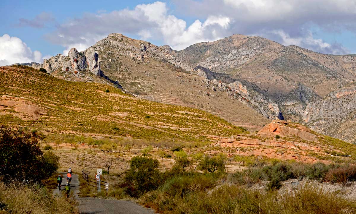
The mountains of Eastern Rioja are uniquely linked to paleontological environments. The reason for this is the abundance of footprints (ichnites) and fossilized dinosaur remains. The "Jurassic" character that emanates from these mountains is real and constant in this area of La Rioja.
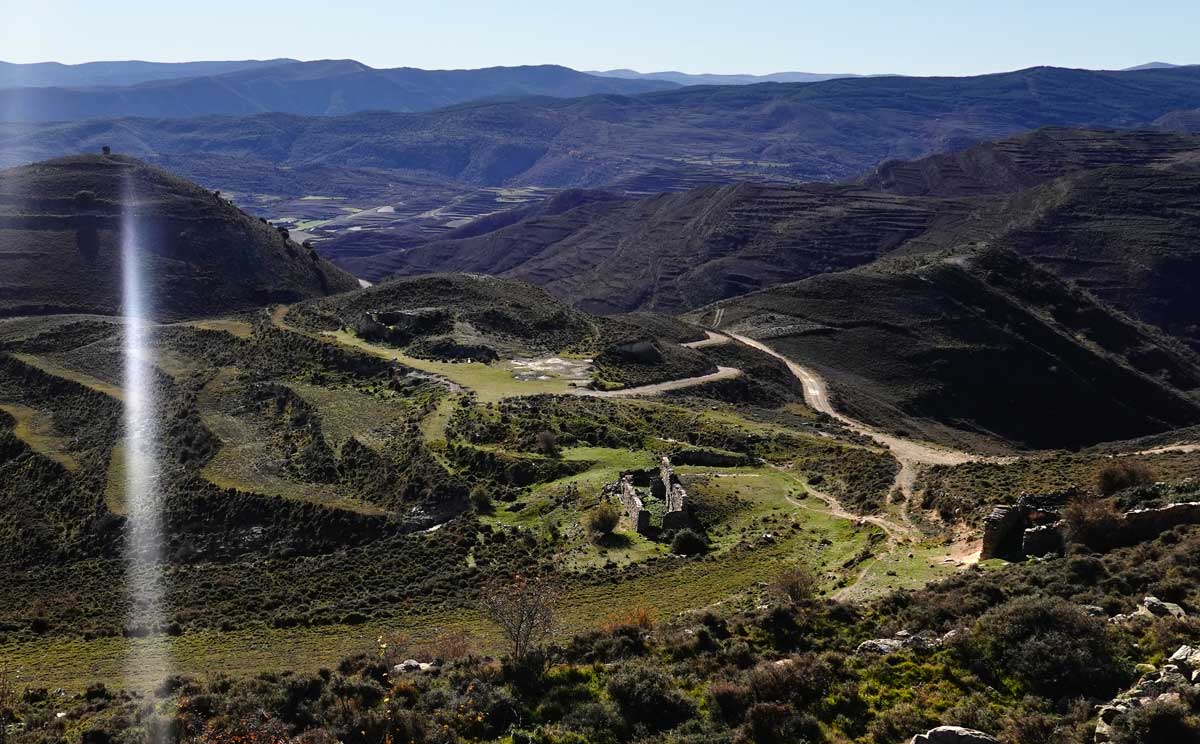
From the Alto de El Hocijo, the tracks descend steeply toward Muro de Aguas. Along the way, we observe how the ancient buildings are turning back into rock.
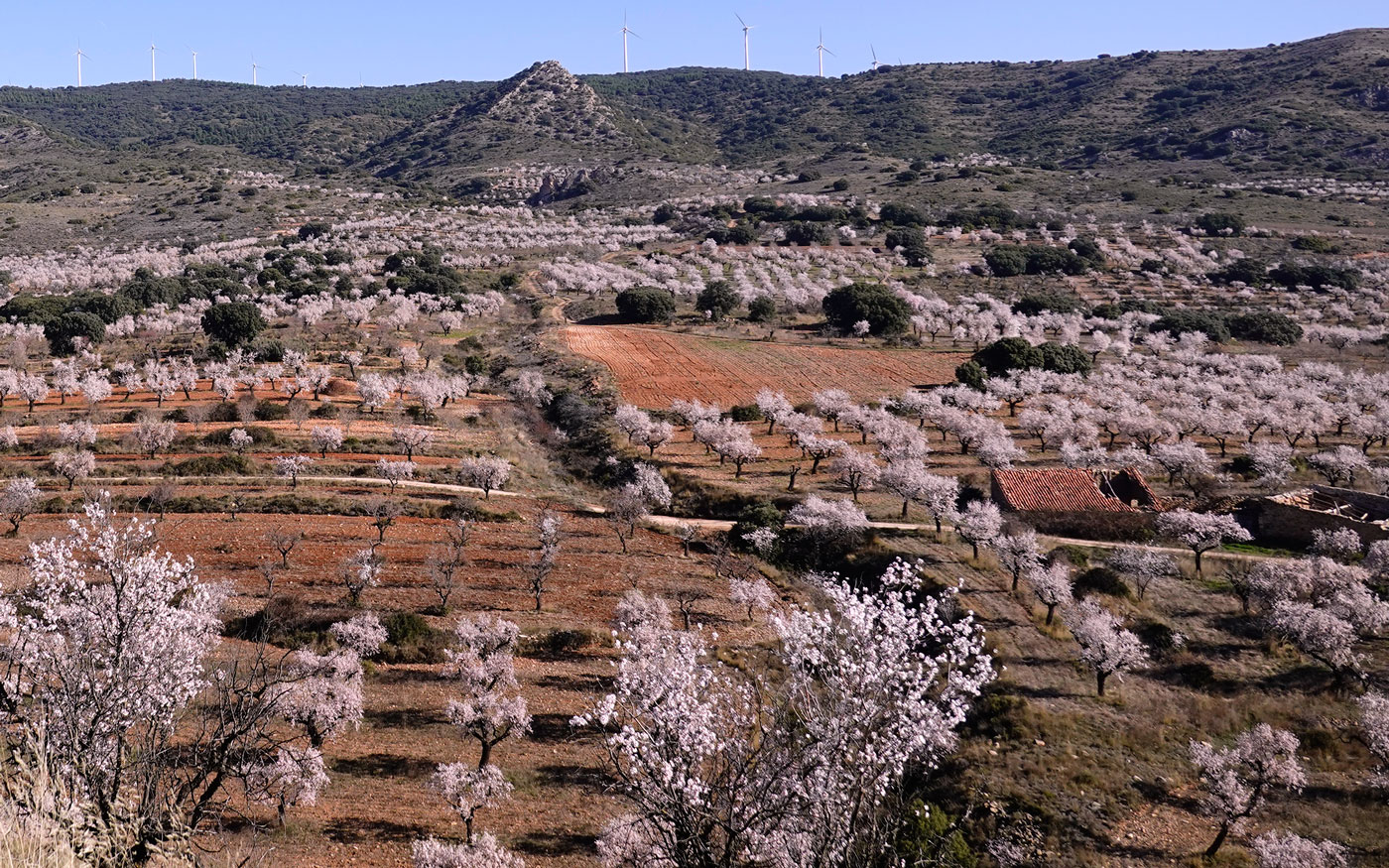
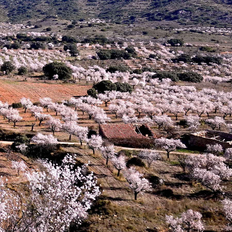
The name of the place where the photo was taken, "Mirador de los Almendros" (Almond Tree Viewpoint), already hinted that at the right time, the view from this spot would be nothing short of a "Spectacle." Including the culture of almond trees in a route like rIBERIA, which in a way stems from the market garden culture, feels almost like an obligation.
We are in Grávalos, on the southern slope of the Sierra de Yerga.
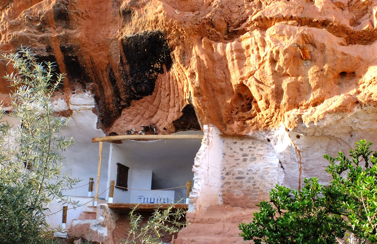
Clinging to the earth, they call it.
Moncayo Range
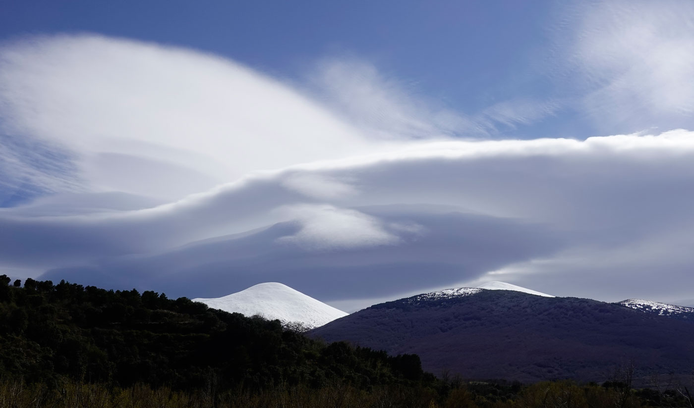
There is a lighthouse in rIBERIA. It is called Moncayo.
We are not exaggerating: unless we find ourselves in the depths of the valleys or in the Montaña Alavesa, it will be a rare kilometer where, if we scan the horizon, our eyes do not settle on the silhouette of Moncayo.
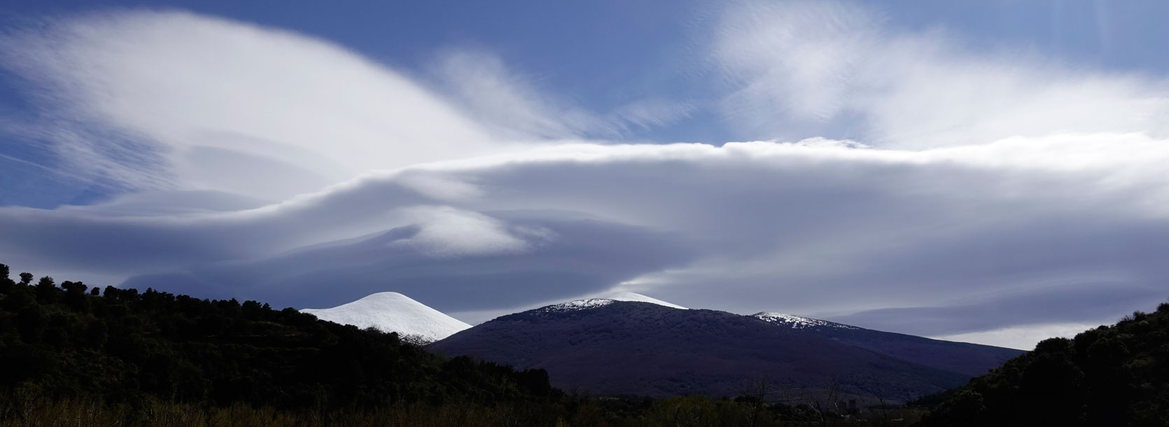
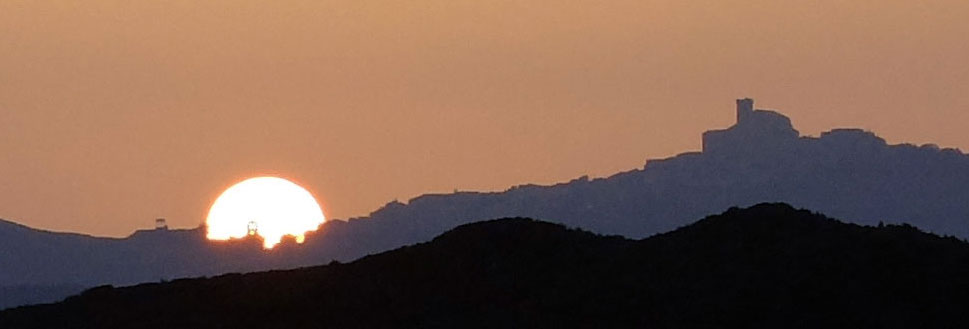
Often it will greet us hidden beneath its typical cap of clouds; other times—less frequently—clear, sharp, or even snow-capped and adorned with its characteristic cloud, as seen in the photo. In weather heavy with humidity or haze, the mountain will be a mere silhouette behind a veil, but its 2,300 meters of altitude will always make their presence felt over the 400 meters of the Ebro flowing at its feet.
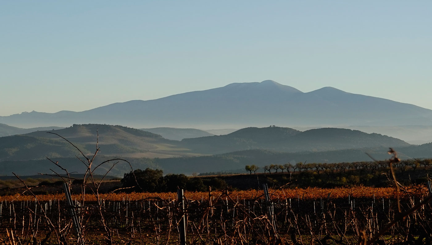
Out of the 740 kilometers of the rIBERIA. track, approximately 185 correspond to the section that runs through the Autonomous Community of Aragón. It would be almost the same as saying they run through the Sierra del Moncayo; whether or not that is administratively true, the reality is that its presence in this area is so omnipresent that anyone who does not worry too much about where borders lie will perceive it that way.
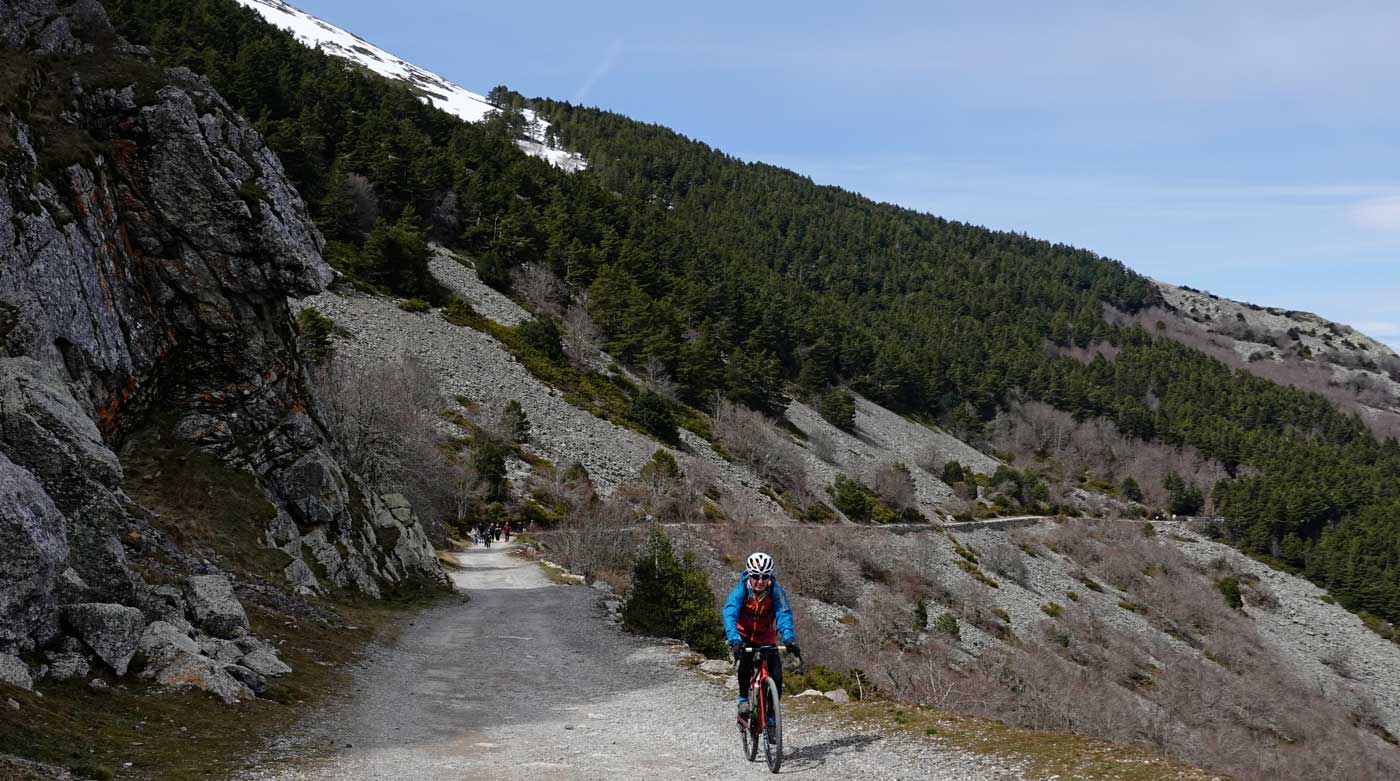
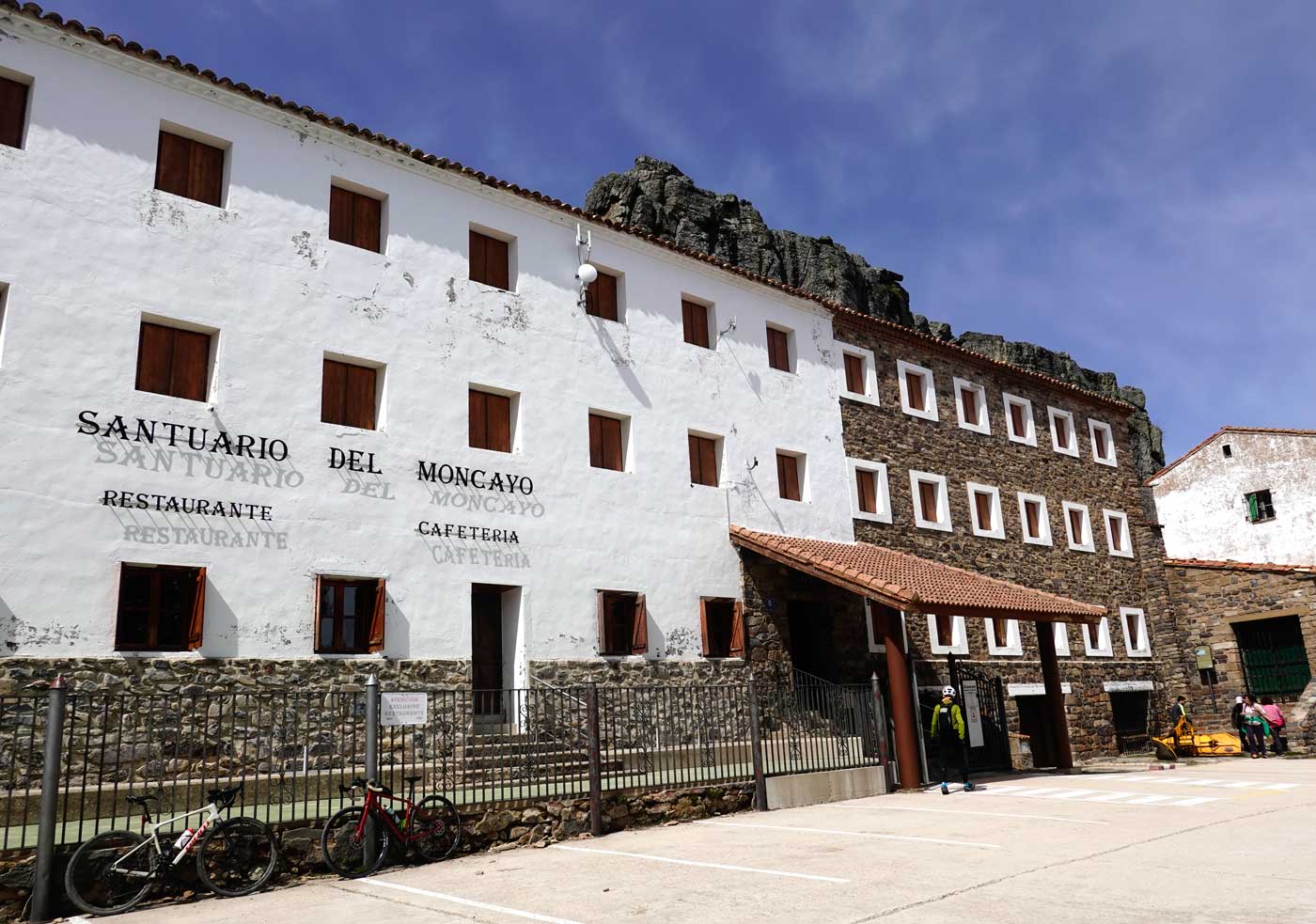
The highest point of rIBERIA corresponds to the 1,615 meters of the Santuario del Moncayo. It can be avoided, as the route overlaps for 24 kilometers on both the climb and the descent. Even so, we have included it in the track, since we could not ignore the lighthouse that has guided us, and will continue to do so, for so many kilometers.
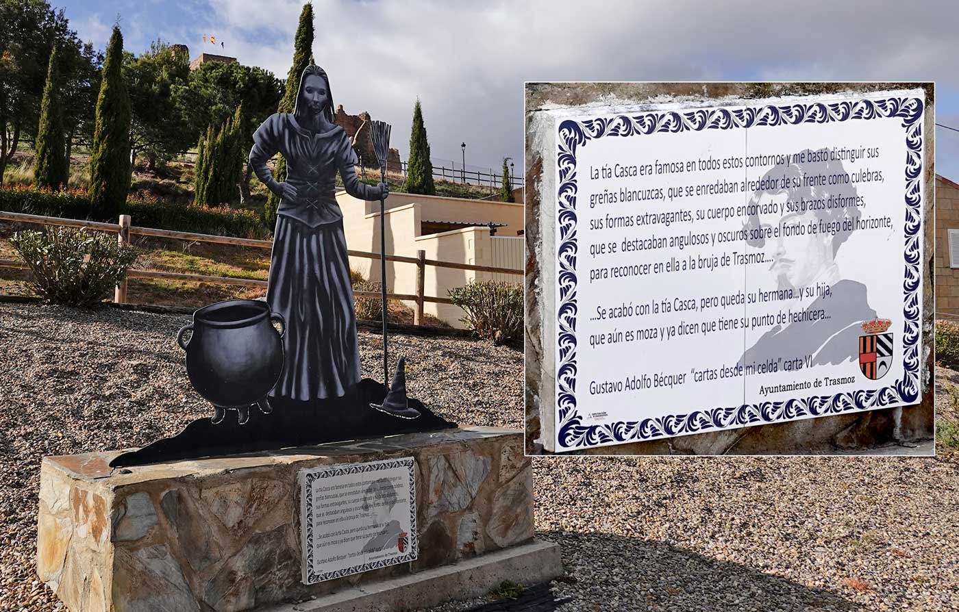
The Tía Casca never imagined that her life, which we imagine as difficult to say the least, and her death, which we know to be quite tragic, would become a source of attraction and, to a certain extent, of reclamation and pride in a future that is not so distant after all.
Aunt Casca was famous throughout these surroundings, and it was enough for me to discern her whitish, tangled hair, which twisted around her forehead like snakes, her bizarre shape, her bent body, and her misshapen arms, standing out angular and dark against the fiery background of the horizon, to recognize in her the witch of Trasmoz...
...They put an end to Aunt Casca, but her sister remains... and her daughter, who is still a young woman and they already say she has a touch of the sorceress about her...
Gustavo Adolfo Bécquer "Letters from My Cell" Letter VI
Real stories, now also stories of rIBERIA as it passes through Trasmoz, at the foot of Moncayo.
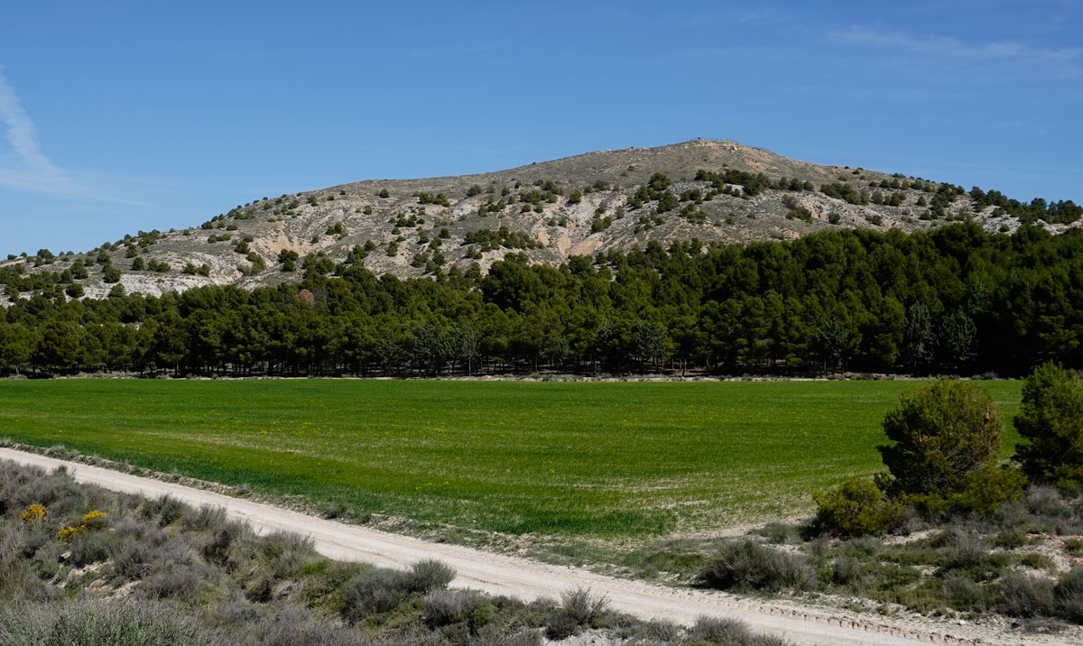
Cabezo or Cerro El Burren. An Iron Age hillfort marking the southeastern extreme of rIBERIA, in contrast to the Cerro de Laguardia mentioned in the BASQUE COUNTRY tab.
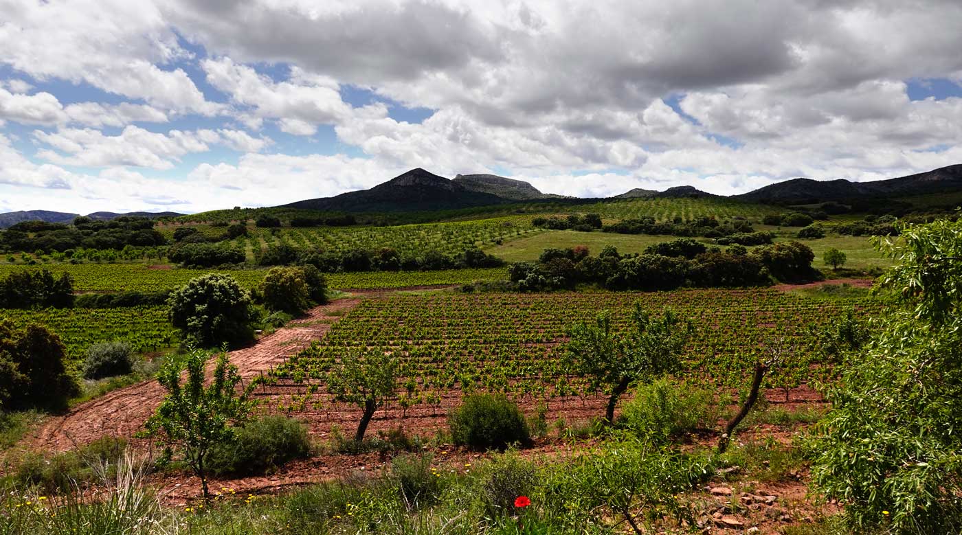
Mountain vineyards of the DO Campo de Borja near Tabuenca. To us, it feels more like DO Moncayo.
One way or another, vineyards are also a constant reference throughout rIBERIA. The DOs (Designations of Origin) and sub-zones keep changing: Riojas (Alavesa, Alta, and Oriental), Campo de Borja, and Navarre with its Valdizarbe, Tierra Estella, Ribera...
The atmosphere is practically asking us to have a rIBERIA.
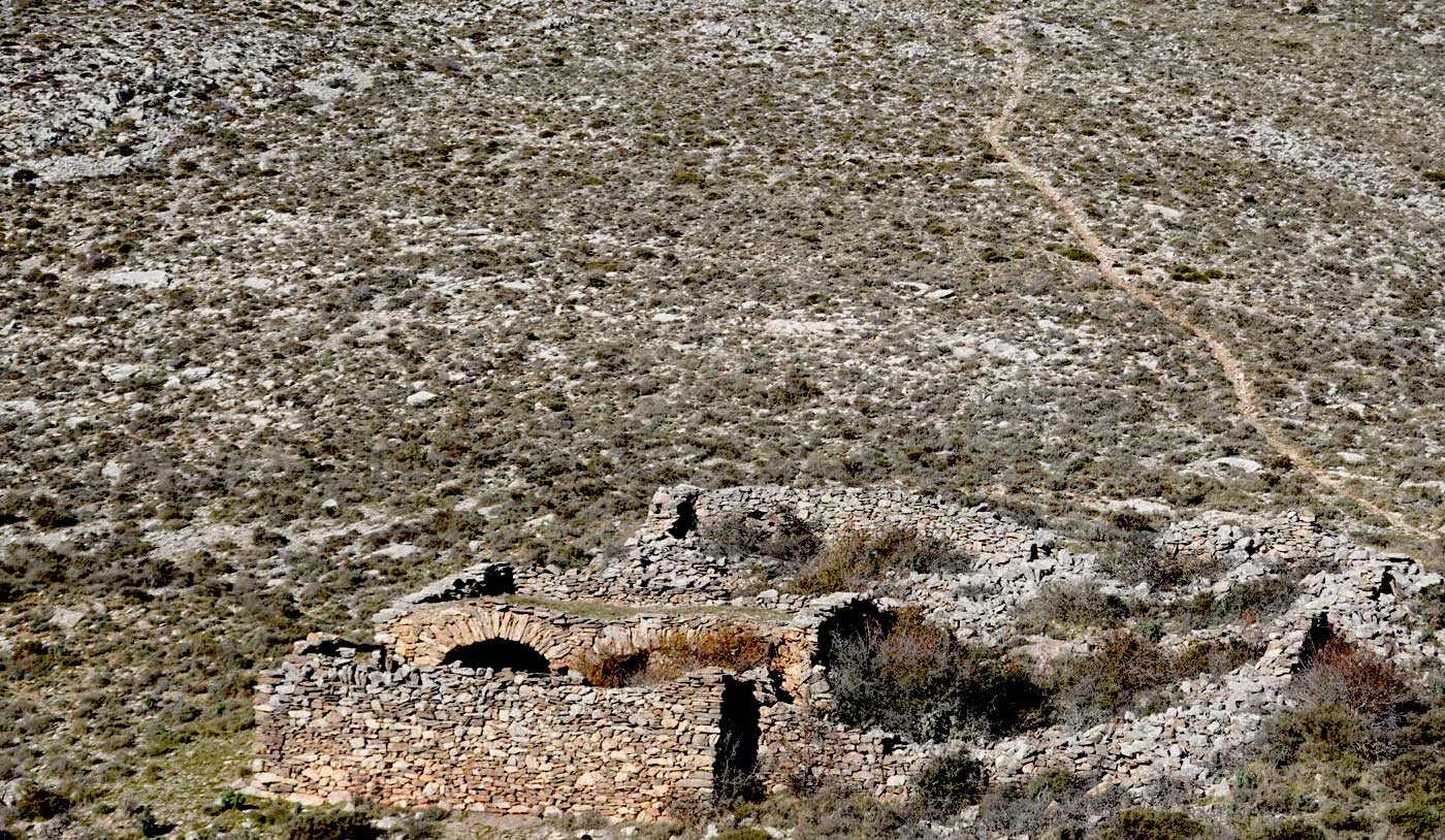
... and the stones along the way will keep growing and growing, turning houses, graves, and the cemetery into rock...
José Antonio Labordeta - Ya llegó la Sanjuanada
The Bardenas of Aragón
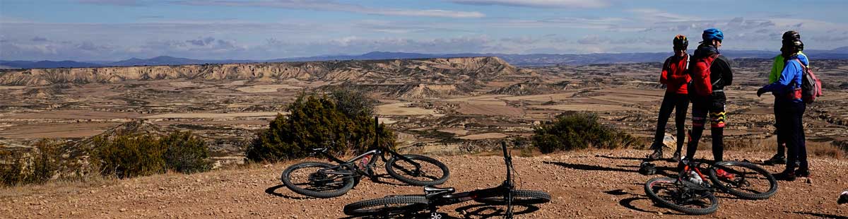
It is November, and as you can see, the cyclists are well wrapped up. La Bardena is a place of extremes. What under perfect conditions might look like a ride along a greenway, when the extremes kick in—and even more so if something goes wrong—the word "Desert" takes on its full meaning.
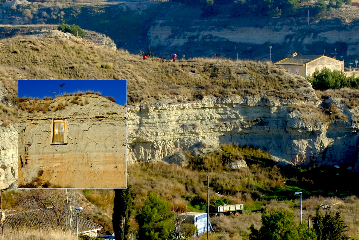
Some situations come as a surprise even to those of us who regularly travel through this region.
When I decided to approach, drawn by curiosity to see what three locals from Tauste could possibly be doing on that patch of land, they explained that they were planting melons on what—I never would have guessed—was the roof of their home, built entirely inside the earth.
Far beyond tourist uses like cave hotels or wineries, the earth continues to offer its shelter for daily life.
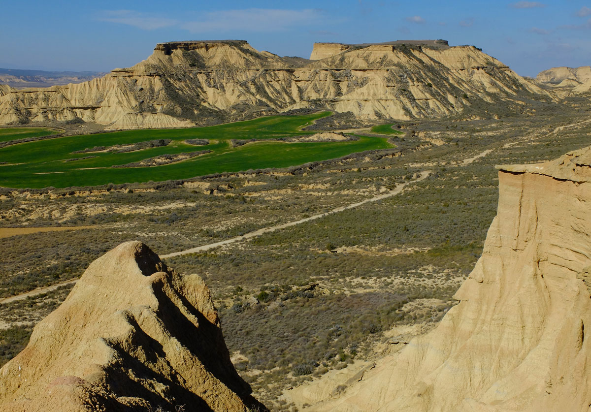
The heart of the Bardena as seen from Aragón, one of the highlight moments of rIBERIA.
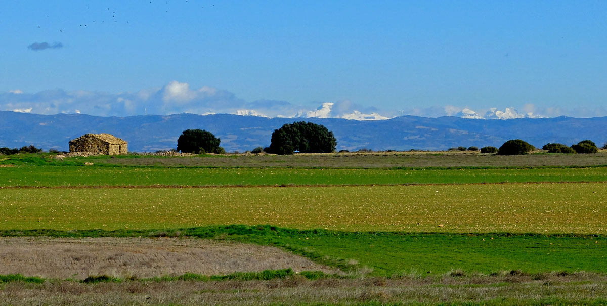
If we pedal in winter or spring, the Pyrenees mountain range, usually snow-capped, will become a prominent presence on our northern horizon.
rIBERIA IN PICTURES
- Route tracks
- Maps
- Services
✔
Like any other route track in a natural environment, the rIBERIA track is "alive." The ones you can download here are our latest updates.
You will likely find rIBERIA tracks on other websites or platforms. We only keep updated the tracks you can download right here. Directly, without registration and without requesting any kind of data.
✔
COMPLEMENTARY TRACKS
The purpose of these complementary tracks is to provide detour options to locations where spending the night is possible. They usually include the return to the main track the following day, except in a few cases where the same track serves for both the outbound and return trips.
On the map, they are labeled as L1, L2, etc.

✔ Obviously, this is not a conventional map, but it is a general outline of rIBERIA that you can download for offline consultation and that can help you organize and structure your trip.
✔
What we provide here is a list, structured by zones, of cycling-related establishments within the rIBERIA territory. These are mainly bike shops where you can request repairs and get out of a technical bind.
It is neither a complete nor a closed list; this section is also "alive." And you can certainly find more resources by searching the internet.
- ESTELLA - DANI MULTIBICIS Tienda/taller con recambios para bicicletas
+34 948546393
Link a ubicación en Google Maps - ESTELLA - BICIKOM Tienda/taller con recambios para bicicletas
+34 848419417
- www.bicikom.com -
Link a ubicación en Google Maps - ESTELLA - CICLOS LIZARRA Tienda/taller con recambios para bicicletas
+34 948550164
- www.cicloslizarra.com -
Link a ubicación en Google Maps - VIANA - CICLOS TOLEDO Shop / Workshop with spare parts for bicycles
+34 616786544
Google Maps Link - ARGUEDAS / TUDELA - CHIQUIBIKES ASSISTANCE (if posible on route), TAXIBIKE & BIKE RENT - +34 629322031
Web
Google Maps Link - TUDELA - J. MONREAL Shop / Workshop with spare parts for bicycles
+34 948824172
Google Maps Link - TUDELA - CICLOS GAMEN Shop / Workshop with spare parts for bicycles
+34 948847103
Google Maps Link - BUÑUEL - LA BICI Shop / Workshop with spare parts for bicycles
+34 662122352
Google Maps Link - LOGROñO - VINI VIDI BICI Tienda de bicicletas
+34 941257021
- www.vinividibici.com - - LOGROñO - HOGARCICLOS Tienda y taller de bicicletas
+34 941261236
- hogarciclos.com - - LOGROñO - PASIÓN CICLISTA Tienda y taller de bicicletas
+34 941048310
- pasionciclista.es - - LOGROñO - BICICLETAS JOSE MARI Tienda de bicicletas
+34 941242414
- bicicletasjosemari.com - - NÁJERA - BICICLETAS y JARDINERÍA Tienda y taller de bicicletas
+34 941363482
- bicicletasyjardineria.com - - TARAZONA - BIKES MONCAYO Tienda y taller de bicicletas
+34 976641853
Google Maps Link - EJEA DE LOS CABALLEROS - CICLOS ABADIA Shop / Workshop with spare parts for bicycles
+34 976660098
Google Maps Link
NAVARRA
LA RIOJA
ARAGON
DOWNLOADS & SERVICES
GLOBAL FAQs
Another way to find out what this is all about
- Best time to go It is possible to travel through northern Spain at any time of the year, provided there is no snow, which is relatively common in some areas but only during winter.
Spring and autumn are usually the most logical seasons; in summer it can get very hot and we must take some precautions, such as waking up early and trying to be in the shade—or at a swimming pool—during the hours when the sun makes it advisable. - Can the route be ridden in either direction? Although it could be done in both directions, the design clearly flows in a counter-clockwise direction. This is mainly due to some climbs on rough tracks that, if ridden downhill, might not be suitable for a gravel bike—though this is obviously relative and depends on the tire clearance and volume chosen for our bike.
- How many stages does the route have? The route is not structured with a set number of stages. Every cyclist has their own criteria and fitness level, so what we do is simply provide the main route track and complementary tracks to allow detours to locations where lodging or logistics might be available to spend the night and return to the track the following day. It is up to each individual to decide the mileage that suits them based on their physical condition and travel goals.
- Are the complementary tracks the fastest way to reach those locations? Not necessarily. The idea behind the complementary tracks is to provide an option to detour and return to the main track while maintaining the rIBERIA route concept. Often, the return to the main track is done via a different route than the detour taken the previous day, simply to keep offering a ride of certain interest. If you want the fastest way, it can usually be done via conventional roads or by using the information generated by any specialized App or the GPS device you are using.
- Is there any official entity managing the route? No, the route does not have any kind of official support.
- Is there any kind of on-site signage? No. Following the route must be done using GPS devices.
rIBERIA
The origin
The article we are talking about mentioned the term rIBERIA, "an alternative country" was perhaps the tagline added... ...
The point is that the concept being conveyed was that it is quite difficult to find differences between the inhabitants of this section of the Ebro riverbank now occupied by rIBERIA, regardless of whether those people live on the north or south bank of the River. And based on that, the alternative country emerged—which we are now trying to promote by turning it into a cycling route, while sincerely believing it hides a potential for other types of possible joint activities in the linked territories.
In the author's own words, the concept was coined —like almost all good things— in the warmth of a bar counter. We would add that it was not only coined but also became a photography book and a blog, also of photography. There must have been a few glasses of Rioja wine on that bar counter...
Below we include the first paragraph of the text about the project written by Carlos Traspaderne himself in 2015, along with the link to the blog where the full project is displayed, for anyone wishing to satisfy the curiosity that the text naturally sparks from the very beginning.
Riberia: a river between lands
The processes of constructing identities are long, complicated, and, for the most part, absurd. Human communities are not formed by selective affinities, but rather buffeted about by historical, political, anthropological, sociological, and other barely logical (un)reasons. When a group of people share a more or less common place, they tend to look for similarities to bind regions, nations, states, etc., almost always bounded by geographical impositions: seas, mountain ranges, rivers. Rivers like the Ebro, a flow of water that is usually complicated to ford, requiring bridges to change sides—an obvious metaphor for the purposeful meeting of neighboring peoples. But with the term Riberia, we want to symbolize not entities separated by a waterway, but the similarities between the inhabitants of the banks, which allow us the audacity to name their country as such. While in other places the river has brought together the inhabitants of both shores, between La Rioja, Navarre, and Aragon it has always been a civil trench separating those who resemble each other more than they think.
link to the tumblr blog
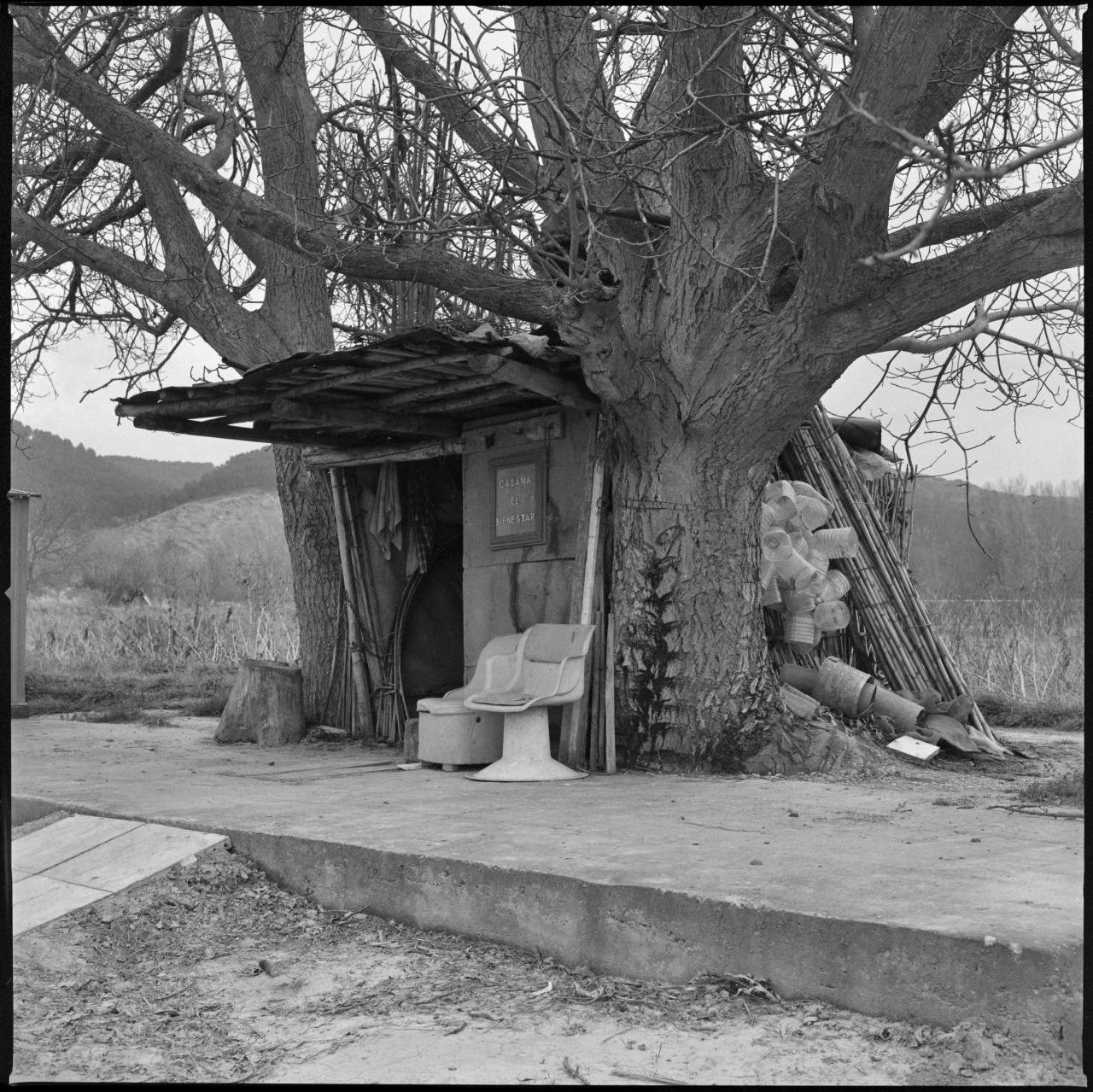
Photograph titled "El Bienestar (2)" from the book Riberia by Carlos Traspaderne.
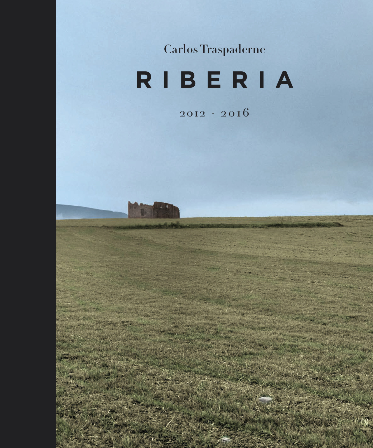
Cover of the book Riberia and online purchase link for it.
Related Tours