ASFPALT
hard

Distance: 100km Unevenness: 2600m
Exceptional route. Predominantly high mountain environment.
Reversing the direction of a well-known route may be strange, almost gives the feeling of going upstream, and yet, what would be the answer to the question of which is better? One thing is clear, and it is precisely that it is not clear... So then, we can conclude that the doubt assures that the route is nearly as good or maybe even better, which completely justifies its inclusion in the list of routes.
It is true that the ascension to Larrau by its northern slope can have a plus of beauty over the ascension to the La Piedra de San Martin Engrace, since this is a more boxed area, especially in its first half.
But in our opinion, the ascension to Larrau by South - which is what it’s raised in this proposal - is clearly superior to the initial ascent of "La Piedra" by the classic route Belagua, which with all due respect -and especially since the recent expansion of the road – can be a bit distasteful or unpleasant.
Besides this "almost highway" between "La Piedra" and Isaba it is magnificent to descend it - at high speed or pleasantly – after having reached the top of the port knowing "that the task is already done", i.e. without the lace of "now Laza’s port..." which we have in mind when we reach the Larrau in the other route. So therefore, our vote is for this one.
Tour in opposite direction to the short version of the popular touring cyclist route which is held annually the first weekend of September
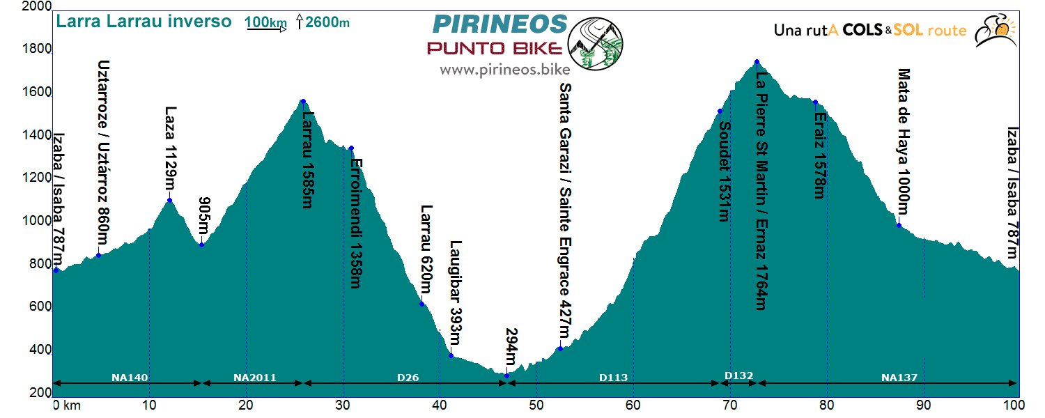
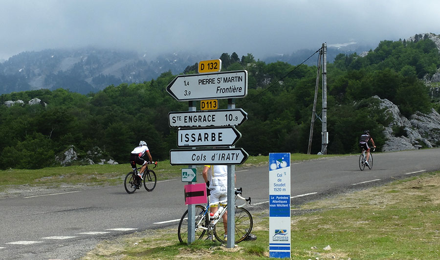
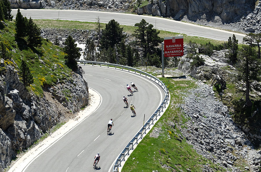
Itinerarie: Isaba NA140 - Uztárroz - Pto. Laza - NA2011 - Pto. Larrau D26 - Laugibar - D113 - Sainte Engrace - Coll de Soudet D132 - Pto. La Piedra de San Martín NA137 - Mata de Haya - Isaba
If you want to see the route on wikiloc website click on the green icon on the map.
---in traslation process---
Terreno inicialmente en ligero ascenso con una dificultad final de 2 km al 7% en la llegada al puerto de Laza.
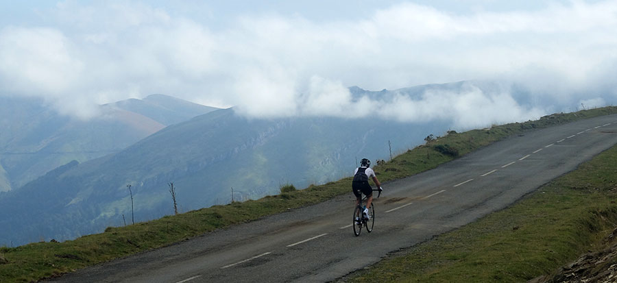
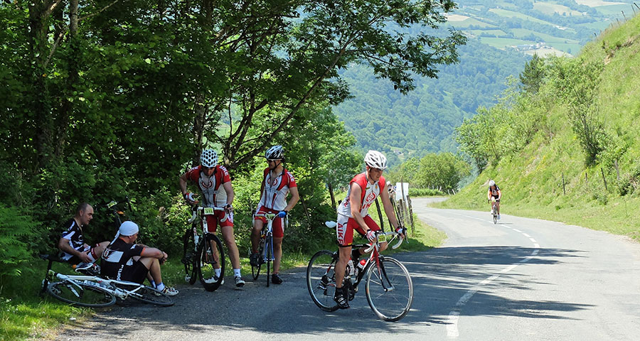
Descendemos 3,5 kilómetros, abandonamos la carretera que continúa hacia el valle de Salazar y comenzamos la ascensión al puerto de Larrau por su vertiente sur. Nos esperan 700 metros de desnivel a casi un 7% en 11 kilómetros escasos de recorrido.

Ascendiendo la vertiente sur del Larrau. A nuestra izquierda va surgiendo la Selva de Irati.
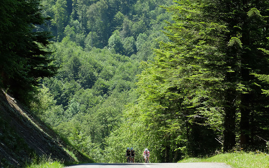
A medida que ascendemos, sin sobresaltos en forma de rampas y siempre sobre buen asfalto, el terreno irá despejándose de arbolado y a nuestra izquierda se irá haciendo visible la Selva de Irati, una de las mayores masas forestales de Europa.
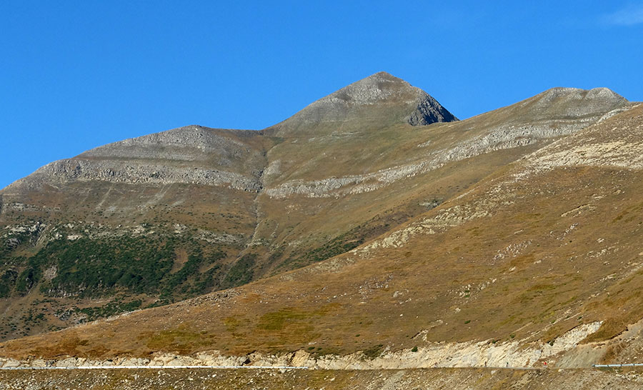
Pico de Ori. Bajo el hombro derecho se esconde el puerto de Larrau.
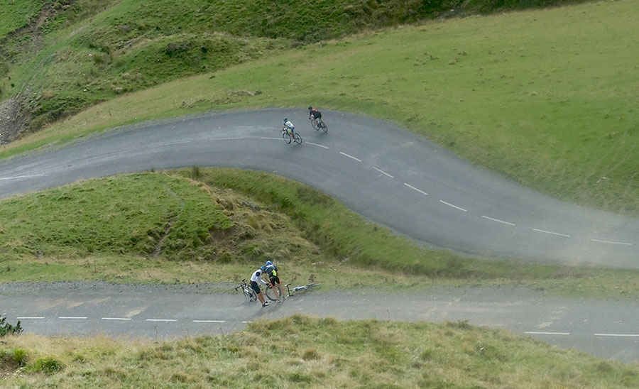
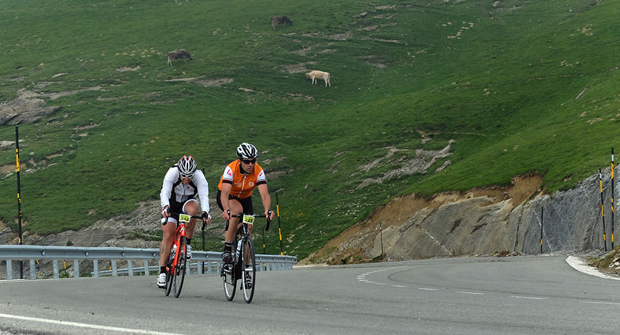
Alcanzada la cima del Larrau, parada obligatoria estando como estamos en un puerto Tour. Después vertiginoso descenso hasta Laugibar, 1200 metros de desnivel con muchas curvas y muchos kilómetros al 10 y al 11% de pendiente. Primero entre pastizales de altura con un tramo de llaneo que nos permitirá disfrutar del entorno, justo antes de pasar por el collado de Erroimendi.
Larrau. Llegando a Erroimendi
Después manos a los frenos y ojos a la carretera mientras, a nuestro alrededor, van apareciendo primero los árboles y después las edificaciones que anuncian el pueblo de Larrau, colgado todavía en las laderas del puerto.
Manos a los frenos...
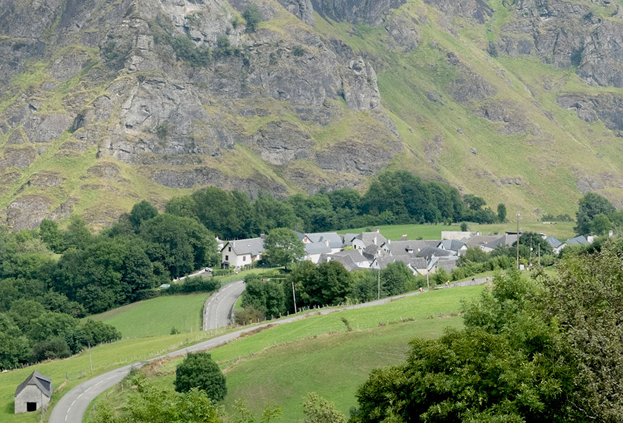
Pueblo de Larrau, bien integrado en la montaña pirenaica.
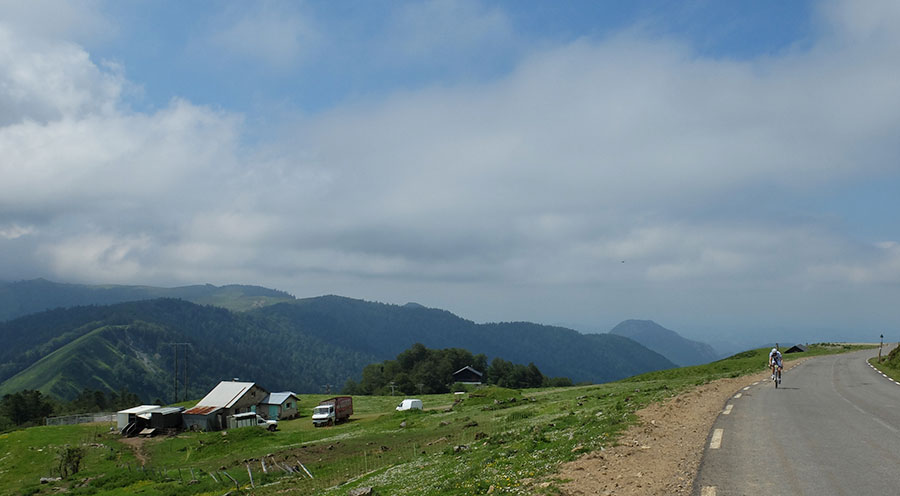
Acabado el puerto en Laugibar, seguimos rodando en ligero descenso hasta la cota 294 -punto más bajo del recorrido- donde giramos a nuestra derecha para encontrarnos con uno de los colosos indiscutibles del Pirineo, otro puerto Tour, y Vuelta 2016, como el que acabamos de descender. Casi 26 kilómetros y 1500 metros más arriba y habremos coronado La Piedra de San Martín por Sainte Engrace.
Dejamos atrás Sainte Engrace con sus espectaculares Gorges de Kakueta. -Cicloturista Pax Avant 2013-
Entretanto habremos atravesado La Caserne y Sainte Engrace, siempre por pendientes moderadas que rara vez superaran el 5% y en un entorno de un bucolismo casi subido de tono. A nuestra derecha habremos dejado las entradas a las gorges de Kakueta y Ehujarre. Estamos en uno de los espacios 5 estrellas del Pirineo en todos los sentidos, y será cuando ya llevemos 11 kilómetros de ascenso cuando comience la “fiesta”. Hay que alcanzar los 378 puntos de coeficiente de dureza APM, y en algún sitio deben de estar.
La Pierre de St Martín por St Engrace, una de las propuestas más duras del Pirineo. Un alto en las sombras del camino. Cuando el calor aprieta el puerto puede ser temible. -Cicloturista Pax Avant 2013-
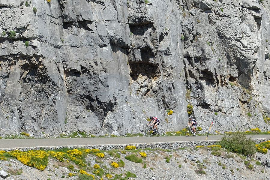
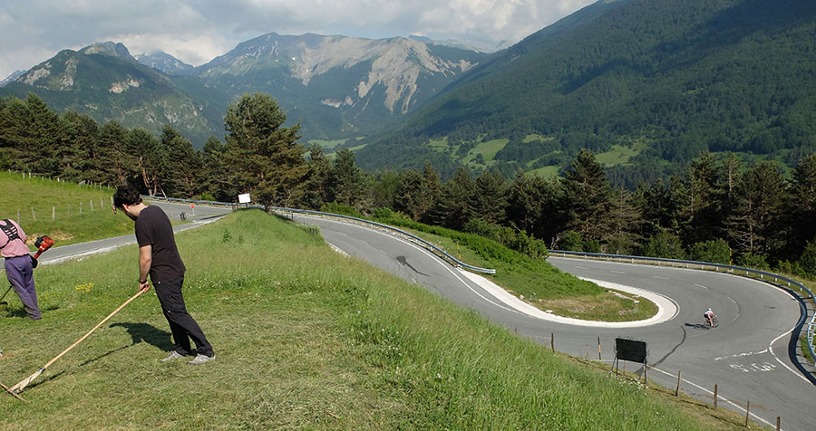
A partir de aquí, entre abundantes sombras, la pendiente se pone seria, rampas y muros se suceden, 10, 12, 14%, algún rellano para tomar aire y otra vez más de lo mismo durante 11 kilómetros que nos colocan en lo que se ha venido a llamar coll de Soudet y donde nos encontramos con la carretera que sube de Arette. En los tramos finales, antes de llegar a este punto, el paisaje se habrá ido despojando de arbolado y nos encontramos en un entorno de típicos pastizales de altura pirenaicos.
Duros tramos al 13 y 14%. Nos acercamos al cruce de Suscousse. Estamos en medio del "meollo". -Cicloturista Pax Avant 2013-

De Suscousse para arriba el terreno sigue igual de exigente -Cicloturista Pax Avant 2013-
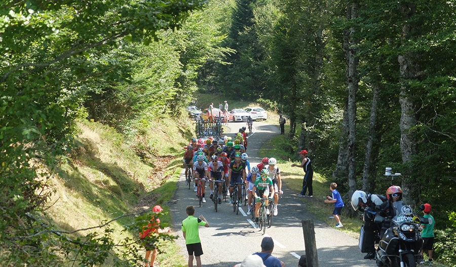
La cabeza de carrera de la etapa reina resolviendo las rampas entre Suscousse y Soudet -Vuelta a España 2016-
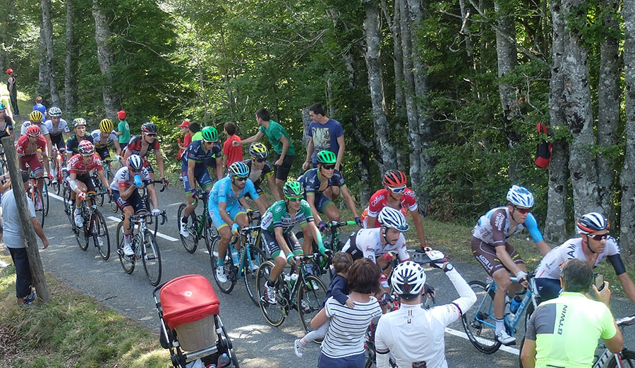
El pelotón en el mismo punto -Vuelta a España 2016-
Cercanías del COL de Soudet. El pelotón se fue para abajo pero a nosotros aún nos falta tarea.
Es lo que tendremos en los últimos 4 kilómetros en los que, dejando a nuestra izquierda la estación de esquí de Arette y pedaleando por pendientes algo más relajadas -por lo menos por debajo del 10%- alcanzaremos la cima de La Piedra de San Martin.
La pendiente se suaviza pero habitualmente aparece el viento. En fin... es el deporte que hemos elegido.
-Cicloturista Pax Avant 2013-
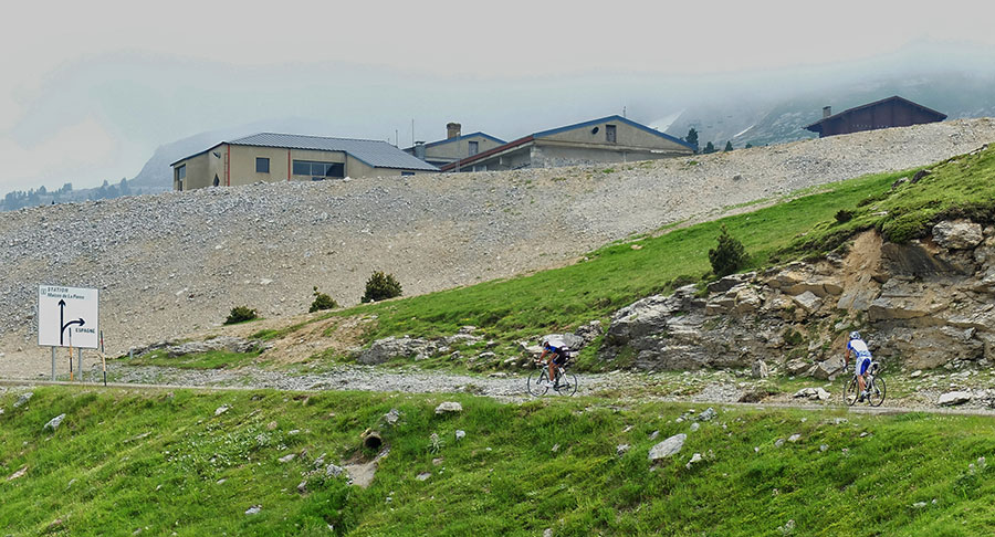
Estación de esquí Arette - La Pierre St Martín -Cicloturista Pax Avant 2013-
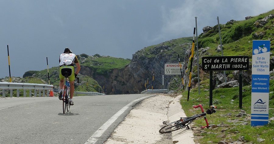
COL de La Pierre de St Martín, se acabo la tarea -Cicloturista Pax Avant 2013-
Desde aquí descenso rápido y limpio por una “casi” autopista hacia la Mata de Haya. Estamos en el complejo kárstico de Larra, el paisaje es muy característico, si no hace frio se puede disfrutar del descenso simplemente dejándose caer. De la Mata de Haya 10 kilómetros de agradable llaneo con tendencia descendente nos ponen en Isaba.
-Cicloturista Pax Avant 2013-
Algún repechito aislado aún nos hará dar algún pedal -Cicloturista Pax Avant 2013-
Cómodo descenso hacia El Rincón de Belagua -Cicloturista Pax Avant 2013-
We are where we are, in the Atlantic Pyrenees, with a plain to the North with localities at very low altitude and ports that are close to the 2000m range.
The southern slope is more "human", towns are in a higher altitude and the slopes are not so important.
The vast majority of the routes cover the ports of the "greats": Issarbe, La Piedra de St Martin, Laberouat, Bagargi, Artaburu, Arnostegi, Ahuski, Larrau...with slopes ranging between 1000 and 1700 meters. Some routes ascent one of these ports, others 2 or 3 and even more.
We anticipated this so the criteria are clear for each 6 levels that we have chosen for the ranking of the routes.
- Walks or family routes: Routes with light slopes and little travel. Suitable for untrained family groups or for people who usually don't use the bike.
- Easy: Routes with a slope that can reach 1000 meters but facing none of the large ports.
The distance will range between 40 and 60 kilometers. - Moderate: Routes with one of the "great" ports or a combination of similar difficulty. The slopes can be really important and slopes can range between 1000 and 2000 meters.
An example of "moderate" is the Artzaiak S stage through Bagargi. The port is tough, but it is the only major difficulty of the day, i.e. we have the whole day for this task, that’s why we left it in "moderate"..
The distance will vary between 60 and 100 kilometers. - Hard: Routes with a slope ranging around 2500 meters. There may have to ascend 2 ports of the "greats" or one and several of the "minor".
The distance will vary between 90 and 130 kilometers. An example of how difficult it can be, will be the short route of the well-known Larra-Larrau. - Very hard: Routes ranging from the 2500 and 4000 meters of altitude. Sometimes there may have to ascend the 3 ports of the '' greats ''. The distance will exceed the 100 kilometers and may reach the 200.
The long route of Larra-Larrau is one of the exponents of how difficult this route is. - Challenge: In these times there is a public that demands "more" yet. To them arises the concept of "challenge": stages of more than a day in "non-stop" mode, 4500-5000 or even more meters of altitude routes, individual or group time trial with 3000 meters of altitude and over 100 kilometers of route.
Finally, a variety of what riders would usually call "nonsense" which to be more elegant, here we call it, 'Challenges'.
 Return