

PIRINEO VASCO - SAKANA - ARALAR PUNTO BIKE
Sports bicycle touring in Sakana Valley - Basque Pyrenees -
The Valley of La Sakana and the Sierra de Aralar are located in the
geographical area commonly known as the Montes Vascos. These are
situated outside of what we topographically call the Pyrenees, but
geographically they are clearly the continuity of the same geological
structure in its way towards what more to the west will denominate
Cantabrian Mountain range.
We are facing a peculiar geography that a priori and as far as road
cycling is concerned it would seem to have nothing special if we try
to differentiate it from other places, but it is not so, for a sum
of different reasons here we have a
PUNTO BIKE in its own right. On the
one hand the valley - oriented cleanly from west to east - is
crossed by a highway that absorbs all the traffic, leaving to
cyclists an almost exclusive use of the old road that runs more or
less parallel to that highway. On the other hand, the fact that the
valley is situated between the Sierras of Aizkorri and Aralar in the
North and those of Andia, Urbasa and Entzia in the South has
generated a network of roads that - with their respective Mountain
passes- ascend such Sierras in their way to the neighboring regions
causing an endless number of possibilities when it comes to creating
cycle routes.
Thus, towards the North we find the Ports of
Otzaurte, Lizarrusti, San Miguel de Aralar
and Zuazarrate. If we look to the South,
the ports are:
Opakua, Urbasa, Lizarraga, Arteta and
Ultzurrun. We do not forget also the
borders of the valley that in the West communicate with the Llanada
Alavesa and to the East with the region of the Ultzama and
Leizaldea. An arsenal of luxury when it comes to preparing tours.
In addition, to the said above we must add that the territory that
we find when we move in different directions from La Sakana is of an
environmental and cultural variety much greater than the distance
kilometers could make us think. This variety can be appreciated by
taking a look at the Commented Photos tab at the bottom of this
page.
Read more...
- less -
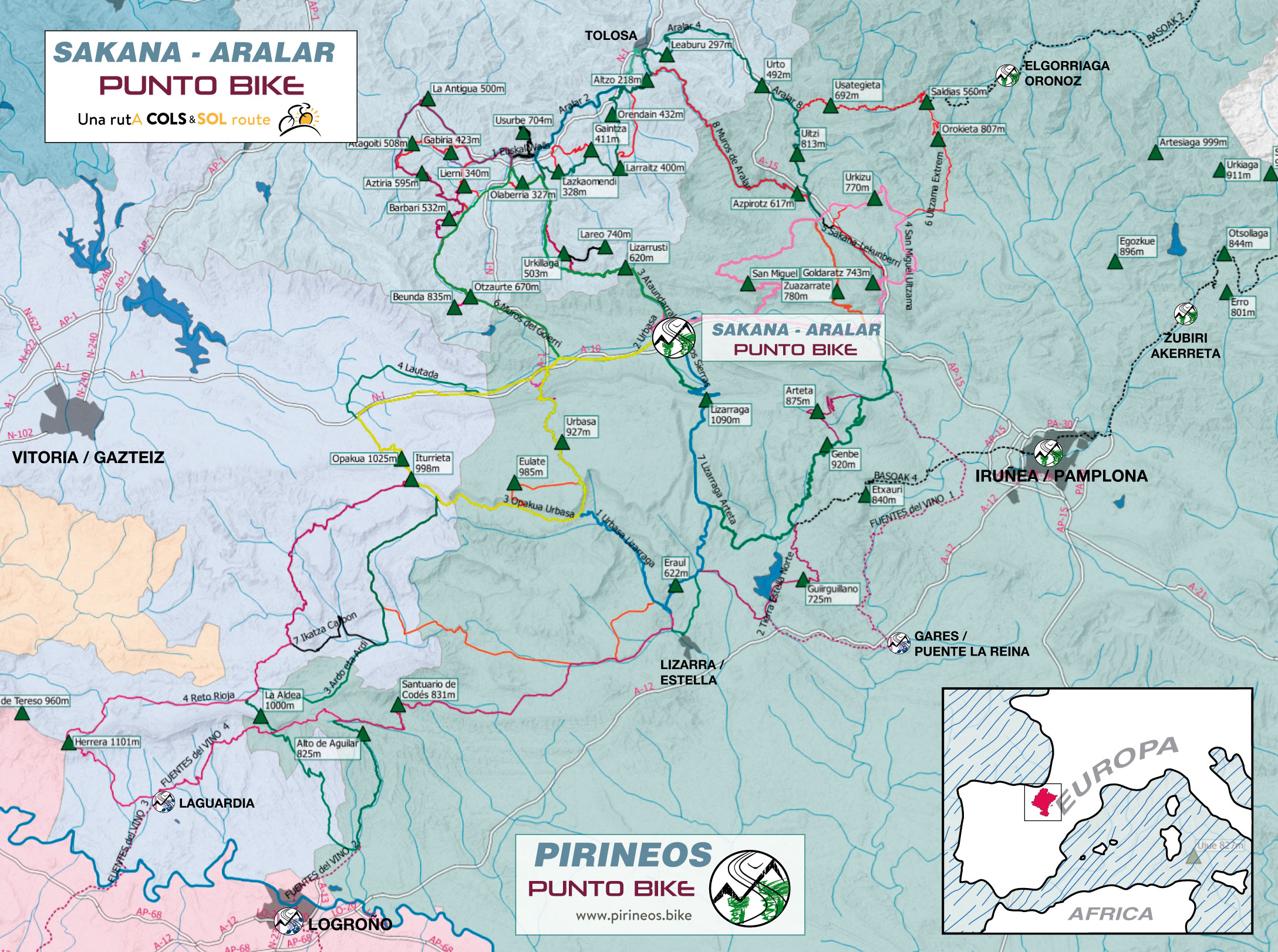 Tap to enlarge map
Proposals for sports bicycle touring on asphalt with point of departure and arrival in Sakana Valley and Lizarrusti Parketxea.
The two points are very close together so that all routes presented
below may begin at any of the 2 points.
We have chosen Arbizu as a starting point for being centered in the
Sakana Valley. If we stay anywhere else in the valley, the distances
between the villages are not great and we can easily adjust the stage.
1 Day Routes, SAKANA-ARALAR PUNTO BIKE
LEVEL 1
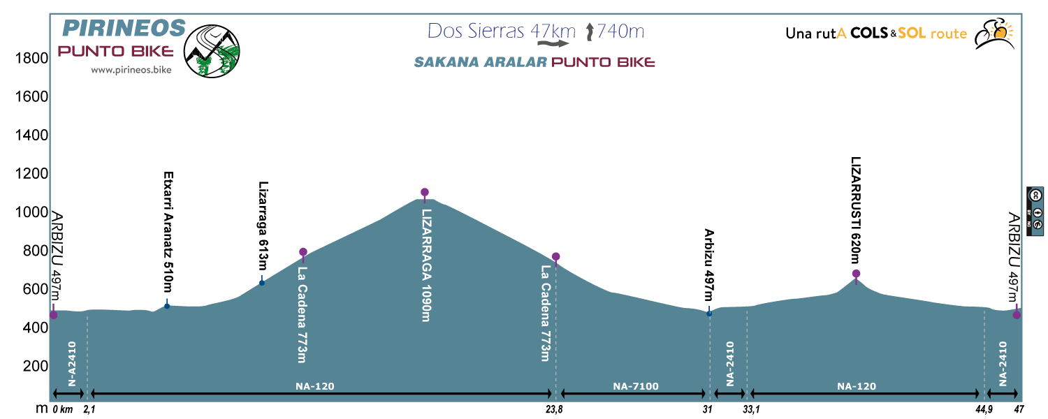
Route 1: Dos Sierras
Distance: 47km Unevenness:
740m
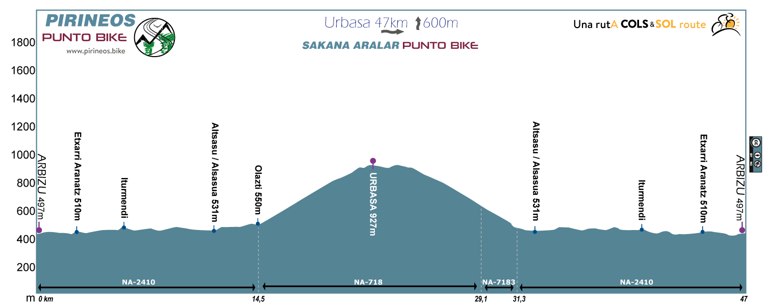
Route 2: Urbasa
Distance: 47km Unevenness:
600m
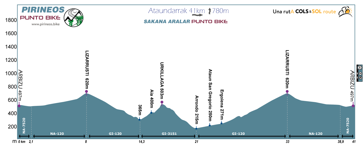
Route 3: Ataundarrak
Distance: 41km Unevenness:
780m
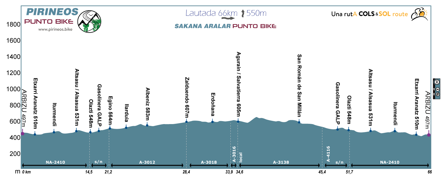
Route 4: Lautada
Distance: 66km Unevenness:
550m
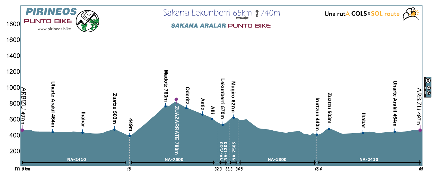
Route 5: Sakana-Lekunberri
Distance: 65km Unevenness:
740m
LEVEL 2
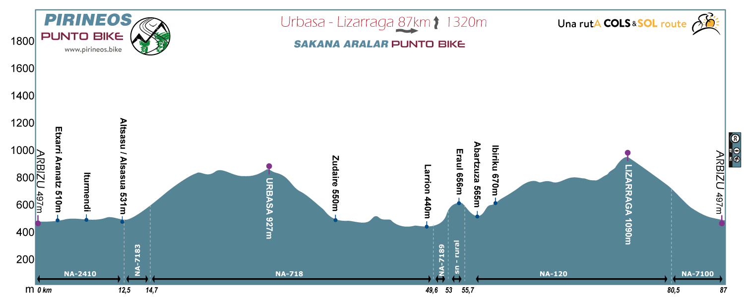
Route 1: Urbasa-Lizarraga
Distance: 87km Unevenness:
1320m
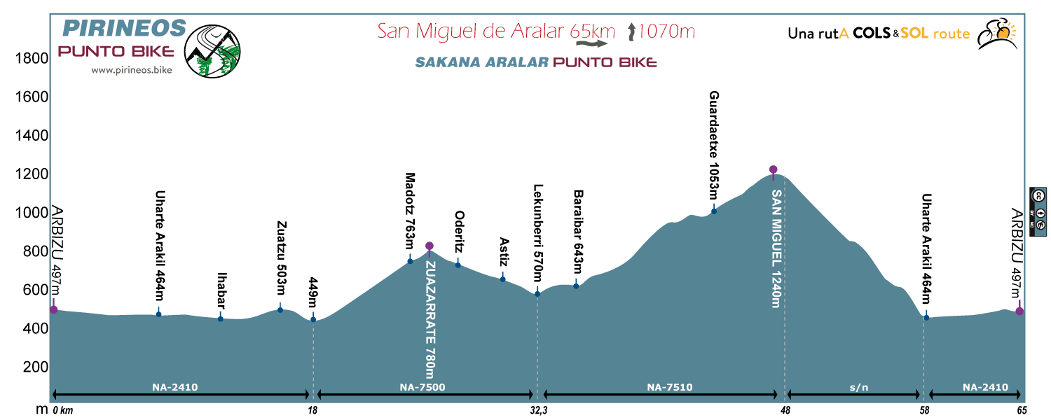
Route 2: San Miguel de Aralar
Distance: 65km Unevenness:
1070m
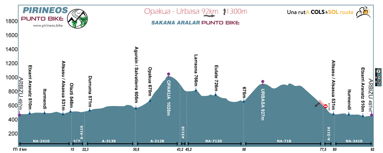
Route 3: Opakua Urbasa
Distance: 92km Unevenness:
1200m
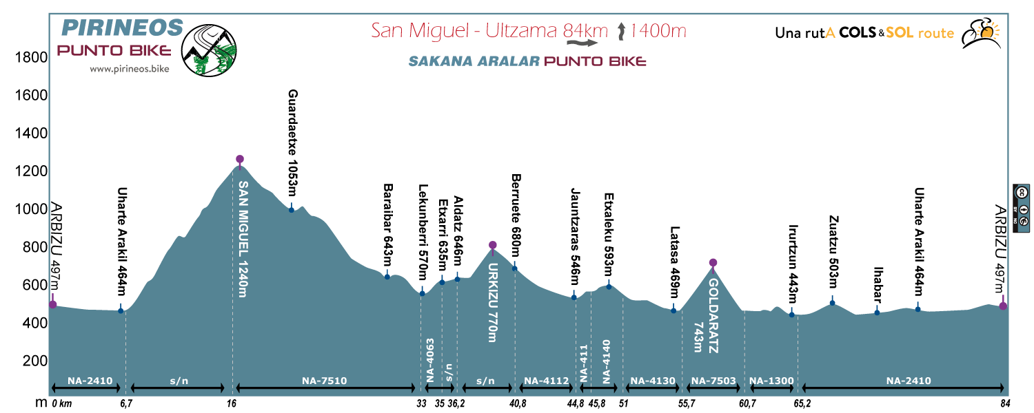
Route 4: San Miguel Ultzama
Distance: 84km Unevenness:
1400m
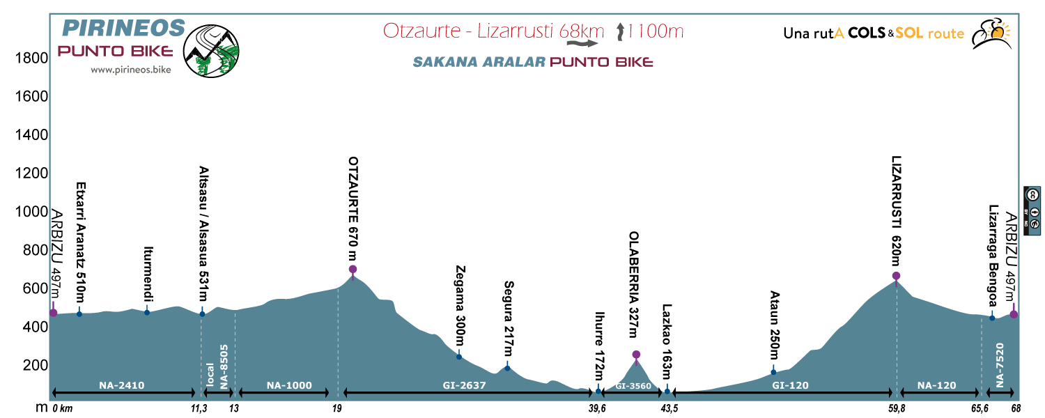
Route 5: Otzaurte Lizarrusti
Distance: 68km Unevenness:
1100m
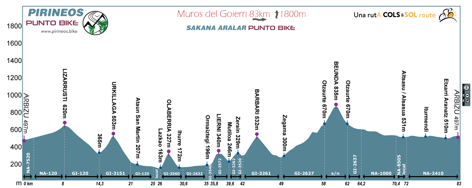
Route 6: Muros del Goierri
Distance: 83km Unevenness:
1800m
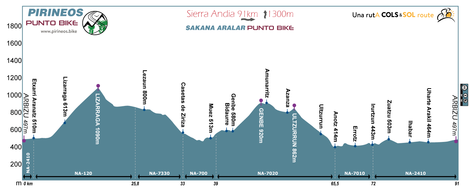
Route 7: Sierra Andia
Distance: 91km Unevenness:
1300m
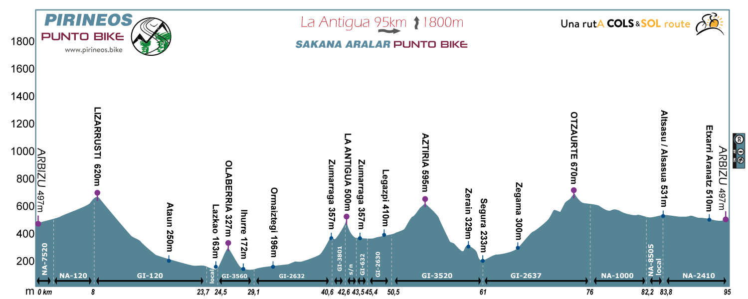
Route 8: La Antigua
Distance: 95km Unevenness:
1800m
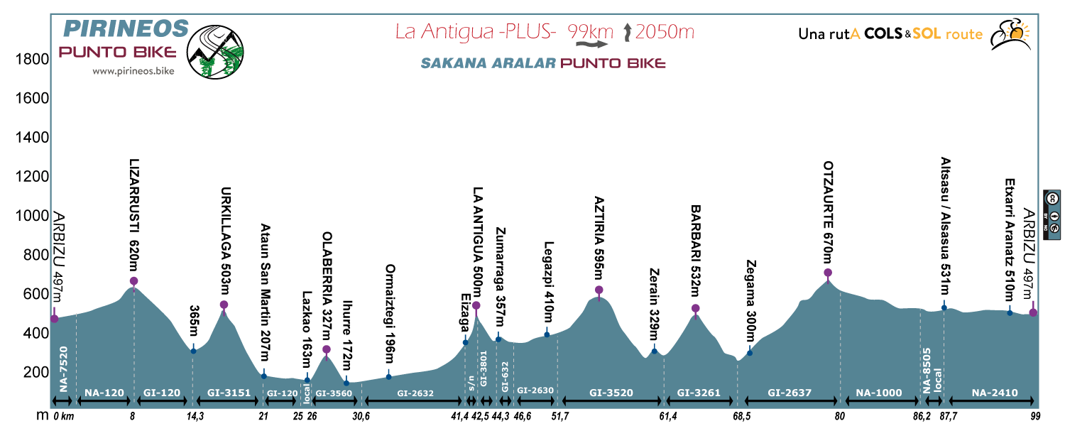
Route 9: La Antigua PLUS
Distance: 99km Unevenness:
2050m
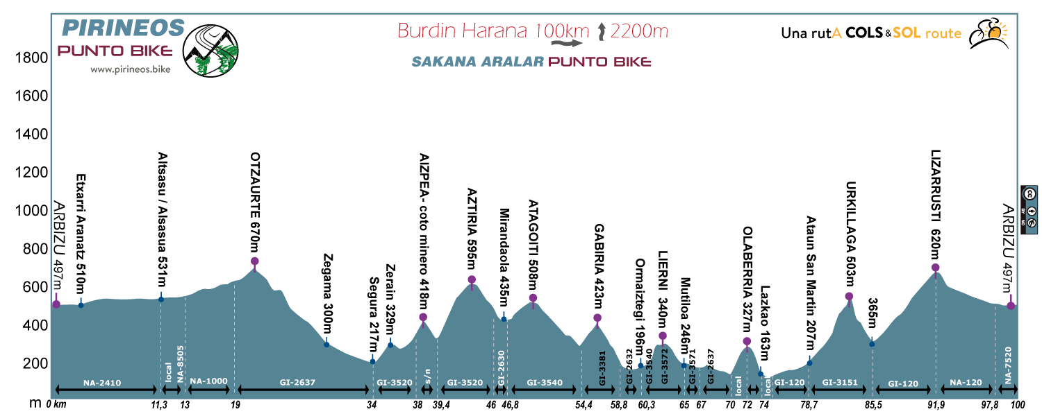
Route 10: Burdin Harana
Distance: 100km Unevenness:
2200m
LEVEL 3
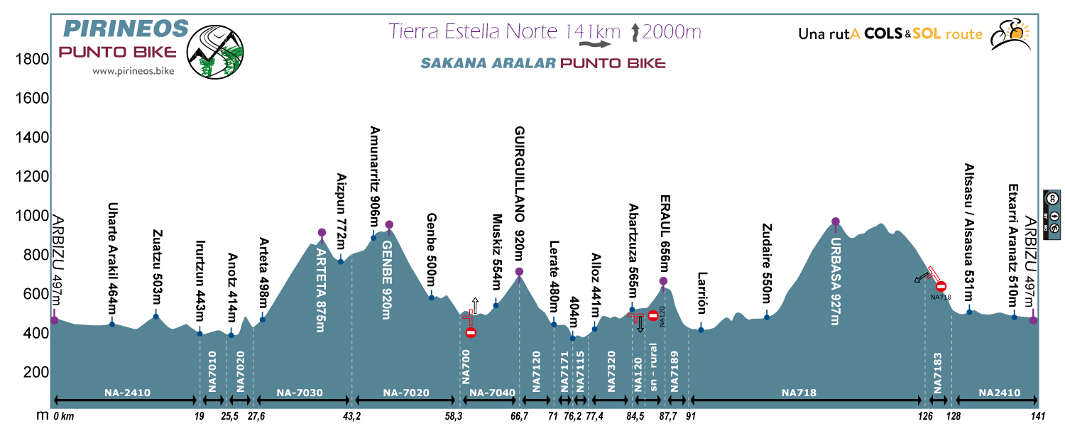
Route 2: Tierra Estella Norte
Distance: 141km Unevenness:
2000m
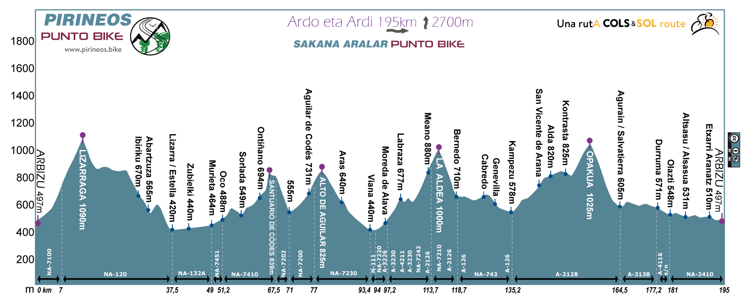
Route 3: Ardo eta Ardi
Distance: 195km Unevenness:
2700m
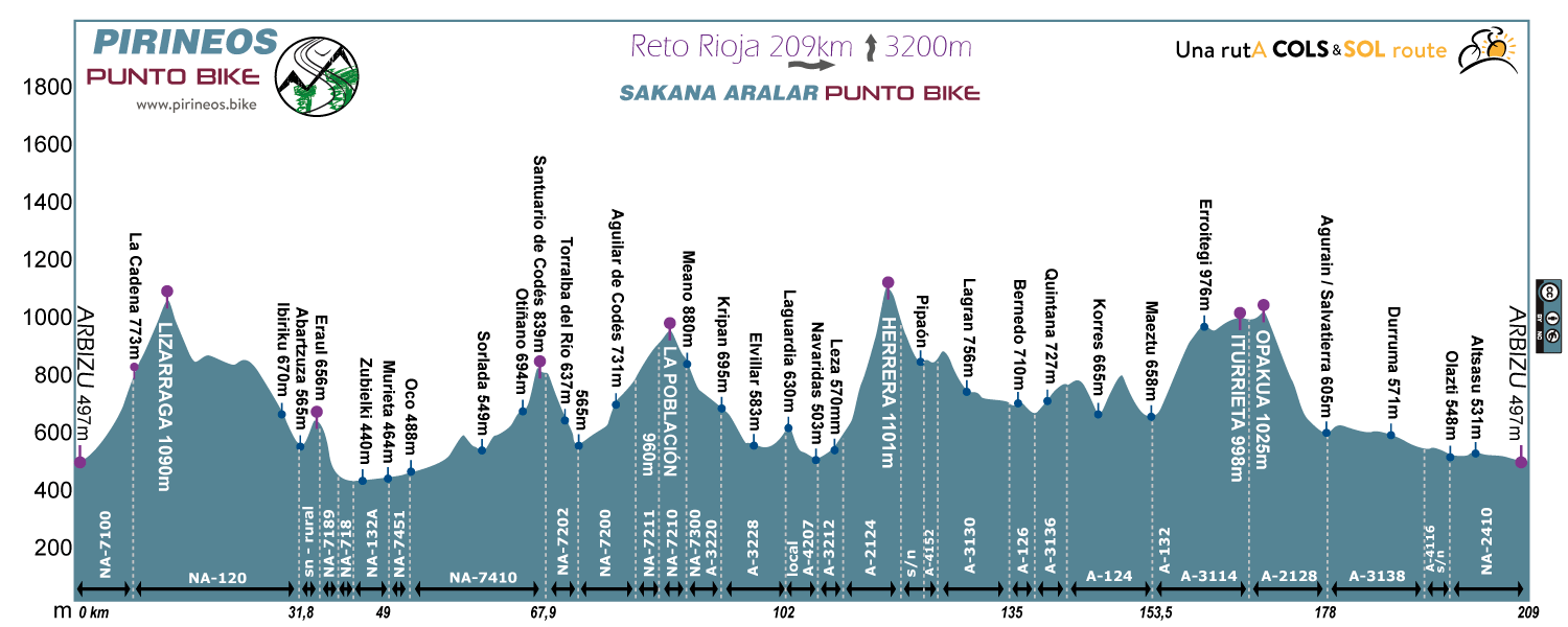
Route 4: Reto Rioja
Distance: 209km Unevenness:
3200m
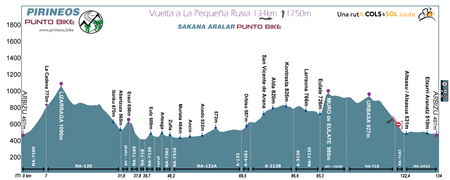
Route 5: Vuelta a La Pequeña Rusia
Distance: 134km Unevenness:
1750m
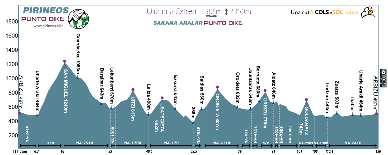
Route 6: Ultzama Extrem
Distance: 130km Unevenness:
2350m
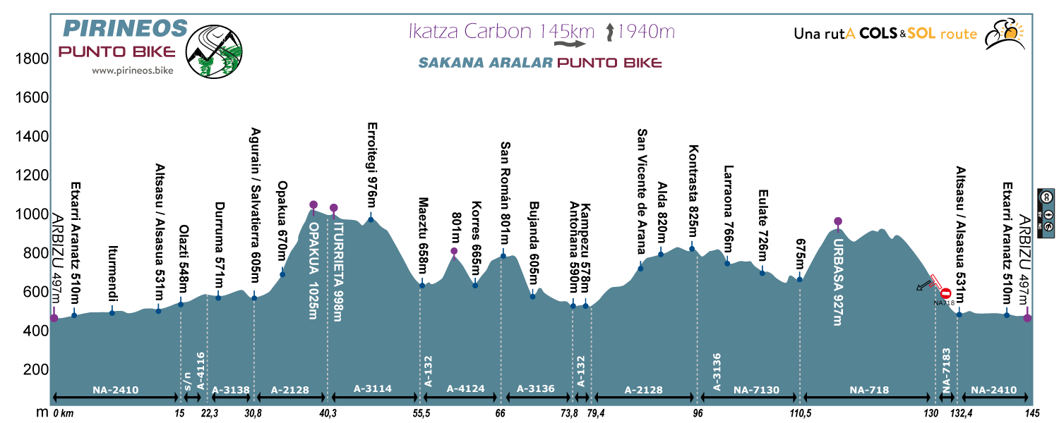
Route 7: Ikatza Carbon
Distance: 145km Unevenness:
1940m
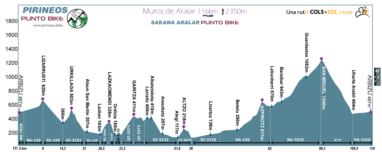
Route 8: Muros de Aralar
Distance: 116km Unevenness:
2350m
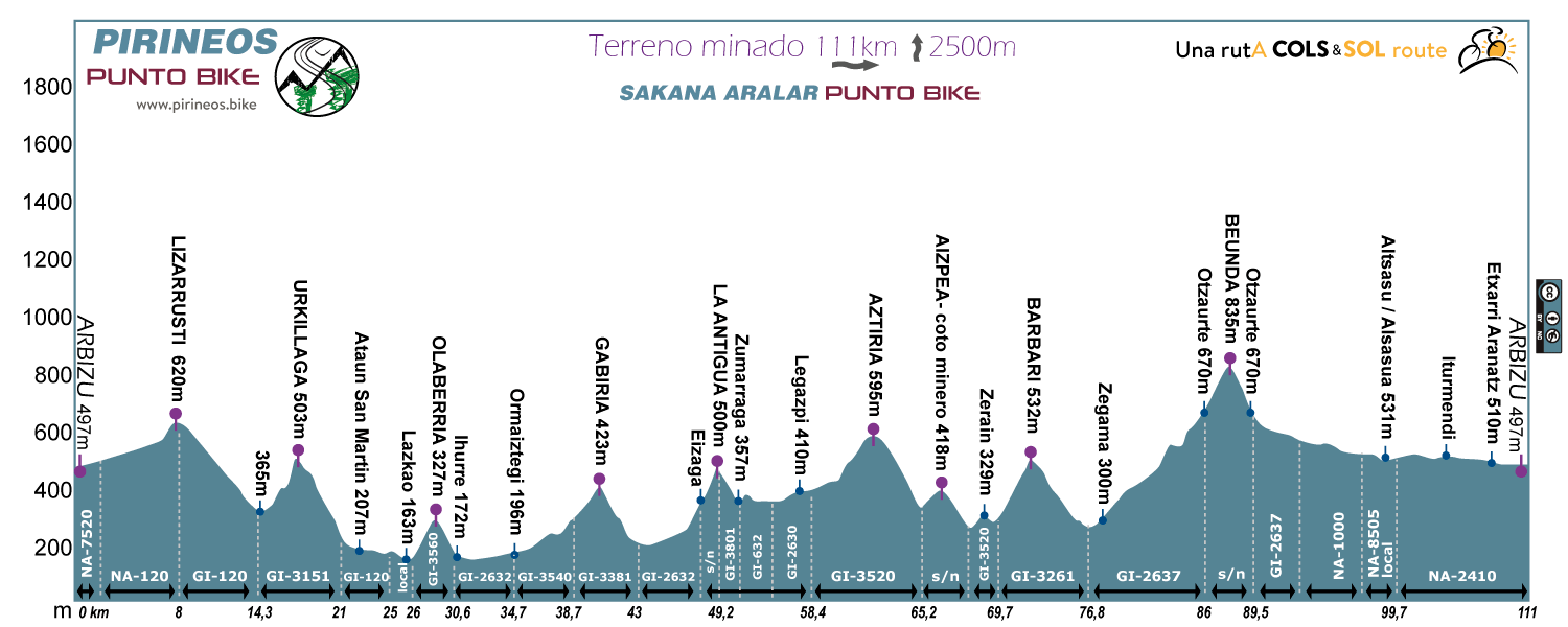
Route 9: Terreno minado
Distance: 111km Unevenness:
2500m
1 Day Routes, ARALAR 360º
Although a priori seems excessive, the 8 options of tour back to Aralar that we have proposed have their sense. The first 4 start heading towards the South, towards Navarra. The latest 4 are in the opposite direction, they begin northward entering Gipuzkoa. Thus, ports that in one case are up, on the others are lower, which can make the route very different.
The blues are the shortest possible options. The reds, include either San Miguel de Aralar or some of the "devils" of the Goierri from Gipuzkoa. And the purples, the +, take all the walls they can and also widen beyond the usual limits of the Aralar mountain Range, deepening into the area of Leitza.
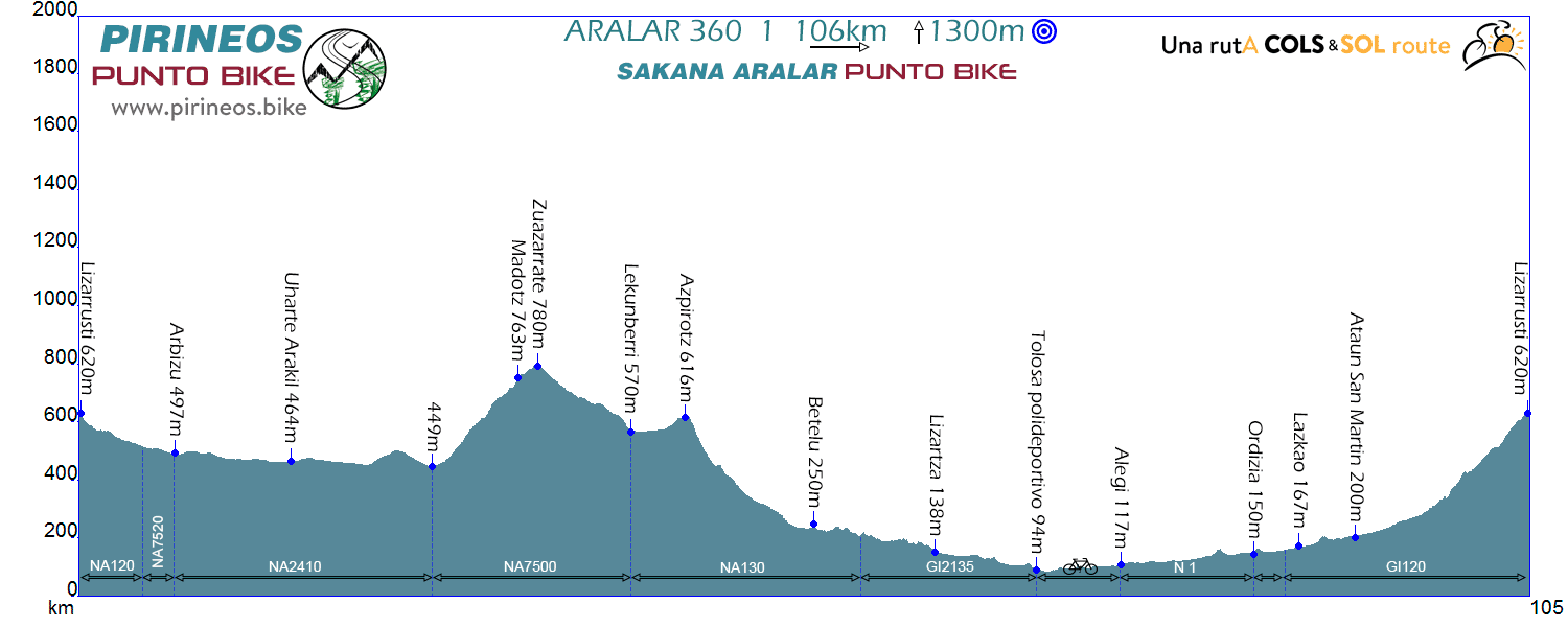
Route Aralar 360º 1
Distance: 106km Unevenness:
1.300m
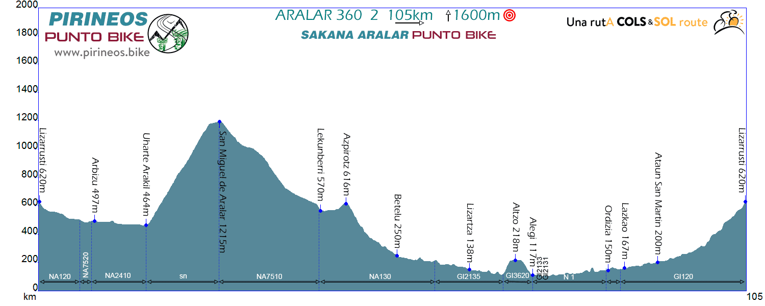
Route Aralar 360º 2
Distance: 105km Unevenness:
1.600m
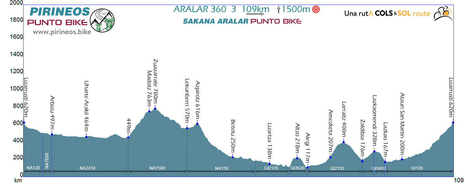
Route Aralar 360º 3
Distance: 109km Unevenness:
1.500m
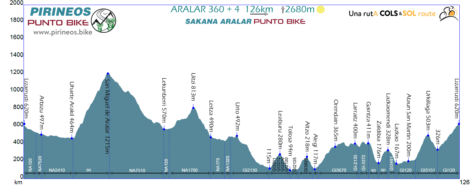
Route Aralar 360º 4 PLUS
Distance: 126km Unevenness:
2.680m
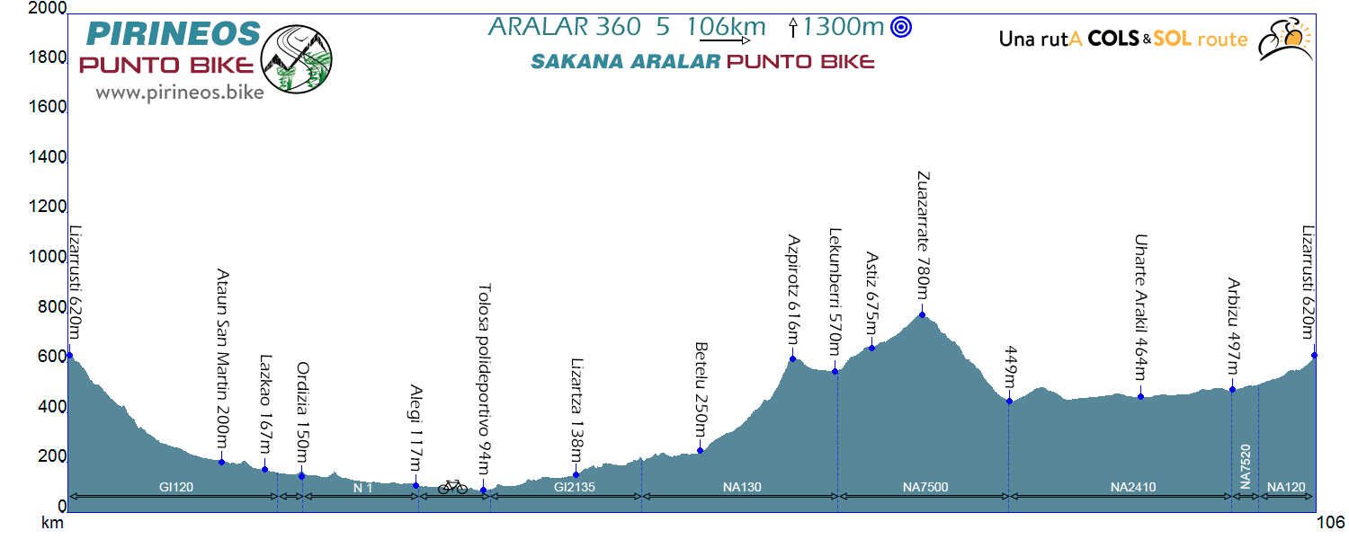
Route Aralar 360º 5
Distance: 106km Unevenness:
1.300m
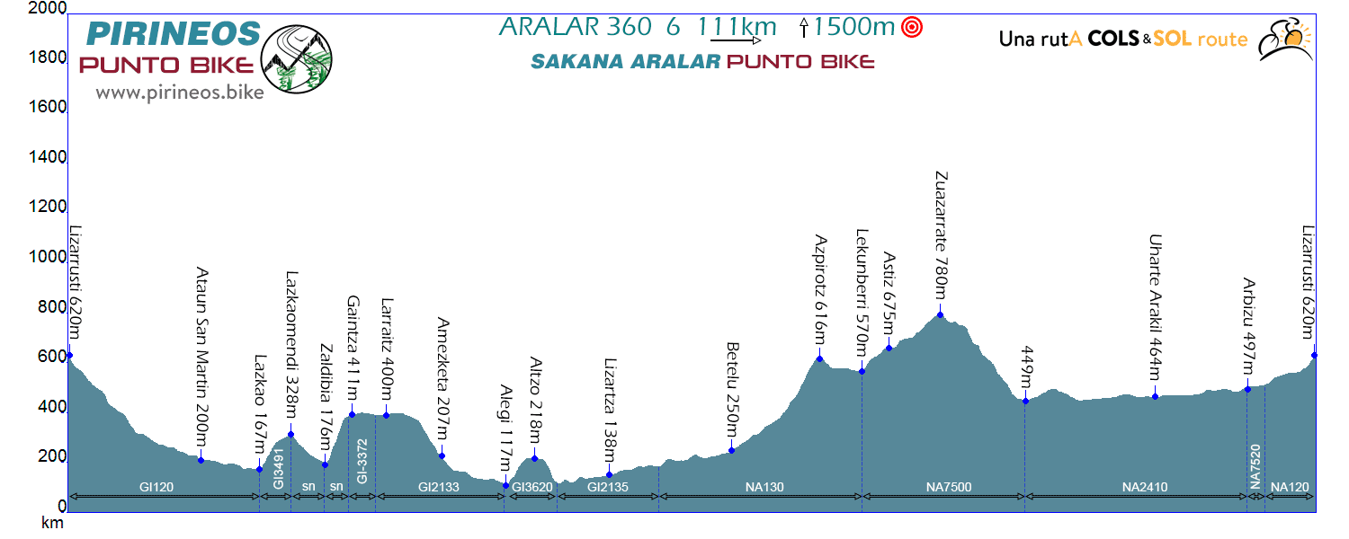
Route Aralar 360º 6
Distance: 111km Unevenness:
1.600m
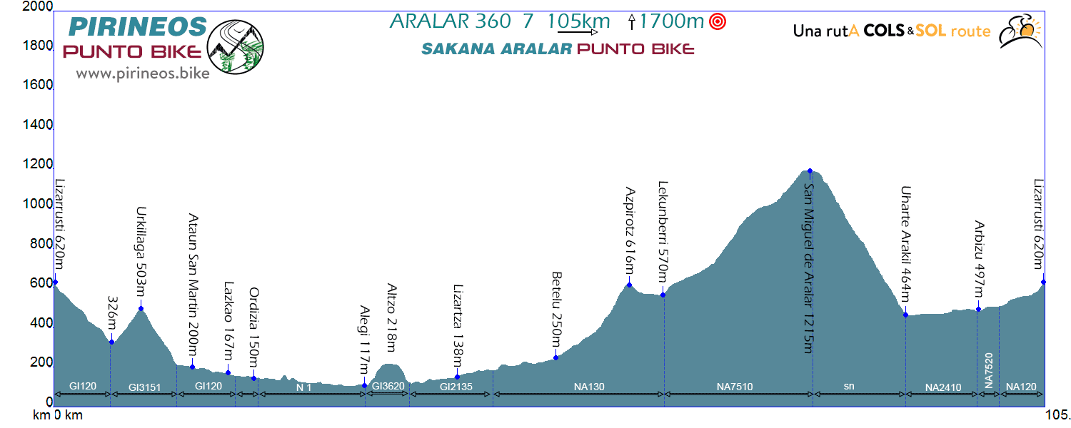
Route Aralar 360º 7
Distance: 105km Unevenness:
1.700m
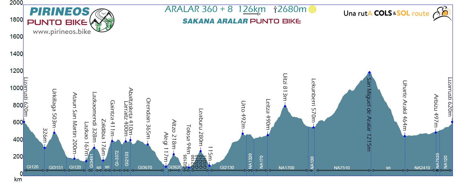
Route Aralar 360º 8
Distance: 126km Unevenness:
2.680m
Point to point Stages, BASOAK and FUENTES del VINO
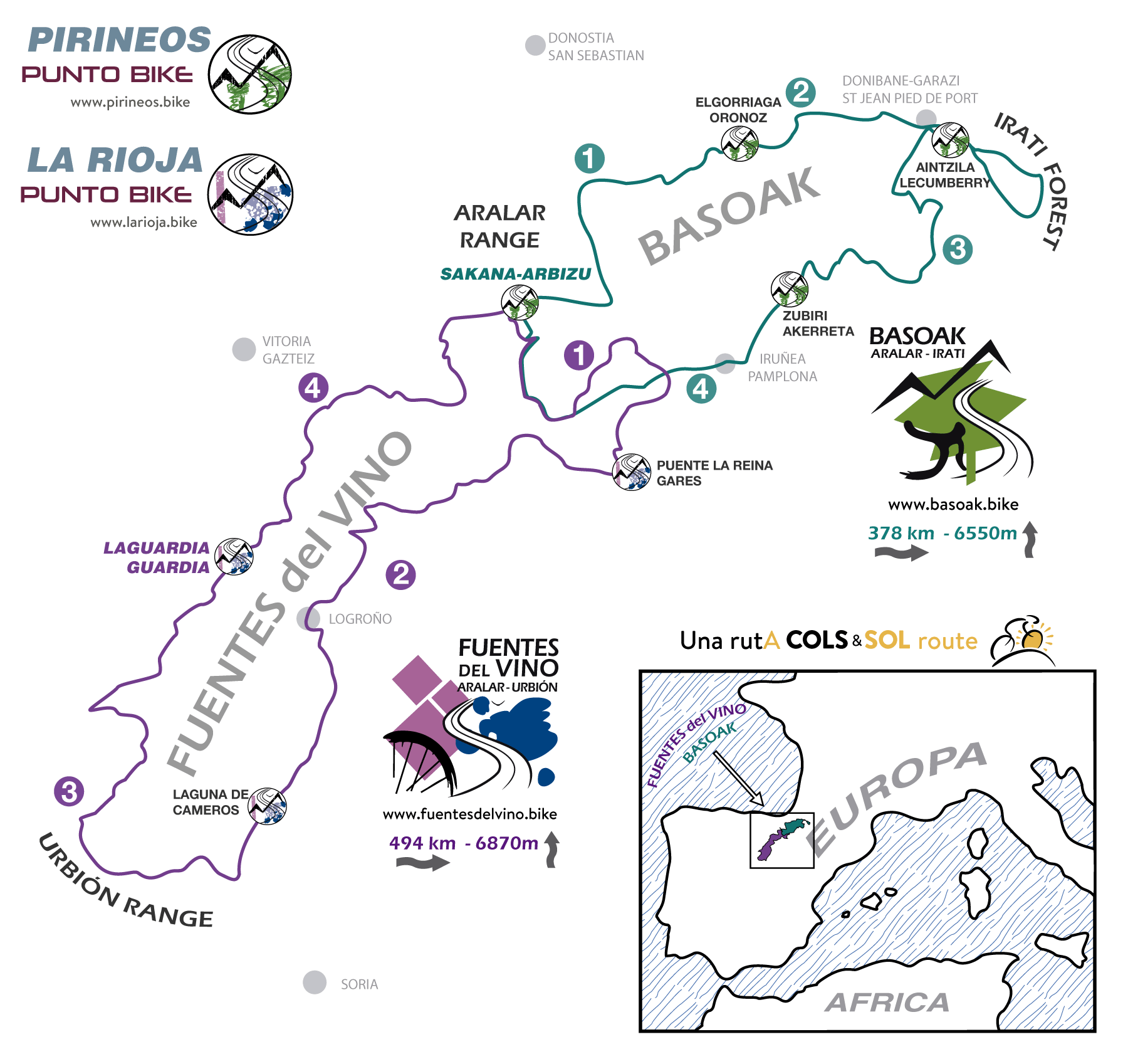
BASOAK, Aralar - Irati and
FUENTES del VINO, Aralar - Urbión, are 2
routes initially set to take over 3, 4 or 5 days each.
Both have two posible common starting points located in Arbizu
-Sakana Valley- or in the ancient city of Pamplona.
FUENTES del VINO can be started as well in
the city of Laguardia in LA RIOJA Alavesa.
On each routes web pages you will find all you need to organize
the journey: GPS tracks, maps, guide rail, roadmaps and links to
all services you may need if you want to do it on your own.
www.basoak.bike
-
www.fuentesdelvino.bike
If you prefer to hire a lodging service with baggage
transport or accompanying in route, this is one of the links where
you can do it.
Proposals PIRINEOS
PUNTO BIKE
BASOAK is strongly directed to the East, cycling for two days by the Basque Pyrenees to the Irati forest, one of the largest woods in Europe. The route returns to Aralar in another 2 days, by the southern slopes of the Pyrenees first and crossing the Pamplona and Sierra de Andia later.
FUENTES del VINO is also strongly directed but this time to the South, through Navarra’s lands first and La Rioja later, until reaching the Urbión clump in the province of Soria. The return is again through the vineyards of La Rioja and the lonely roads of the Montaña Alavesa.
Both routes maintain the same philosophy: do "sport bicycle
touring" but trying that at the end of the day there is still
enough energy for something else besides resting until dinner.
This is done to allow us at the end to have enough time to be able
to learn - even slightly - where we are. Be it by getting into a
pool, strolling through a forest, wandering through a village, or
reading a book.
It is true that some stage of
FUENTES del VINO, even without excessive
climbing, takes time. But there is nothing which can’t be fixed by
waking up a little bit earlier...
Know the possibilities - Commented photos
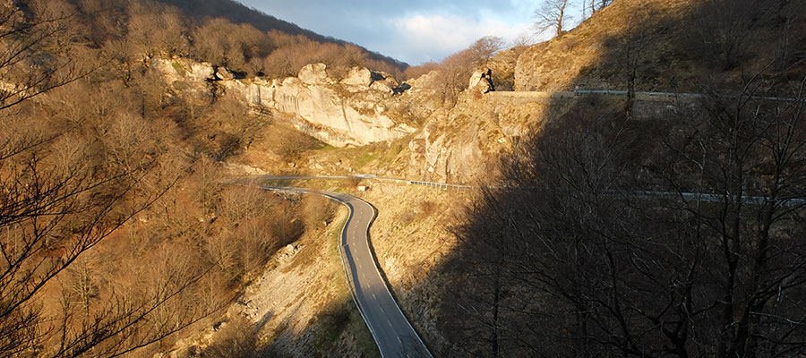
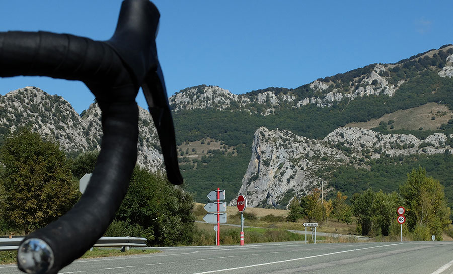
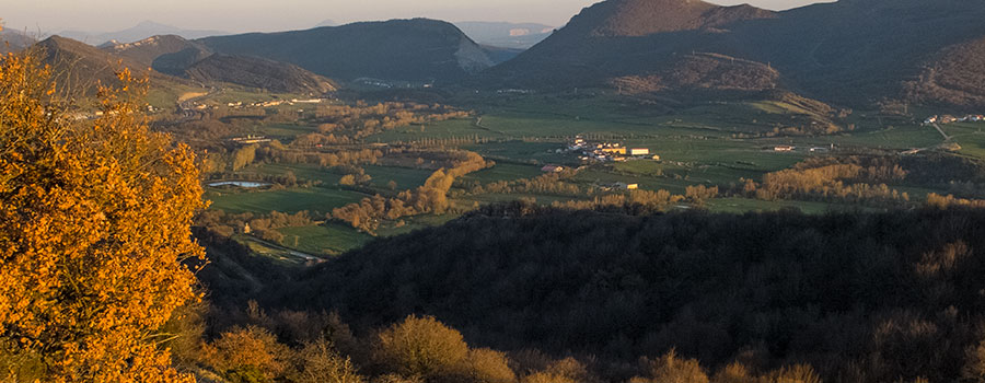
In the northwest end of Navarra, halfway between The Middle Zone
and Navarra North is
the Sakana Valley. The
PUNTO BIKE is encased between
the Sierras de Aralar and Aizkorri in the North, and Andia,
Urbasa and Entzia in the South.
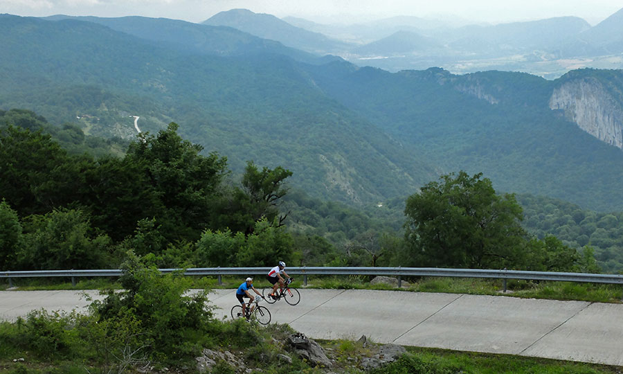
In the images, road with wide and smooth curves in Urbasa (photo
1), a rock formation known as Las Dos hermanas, at the eastern
end of the valley (photo 2) and view of the valley in the
direction of Pamplona (photo 3).
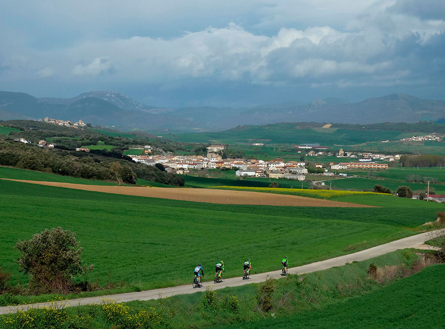
Tierra Estella is among many other
things, traditional cycling land, in this sense, one of its
greatest exponents is the professional race "Grand Prix
Indurain" held annually on its roads.
Its location, in the South of the Sakana Valley, makes it very
frequent to travel on its roads. To reach Tierra Estella we will
always have to climb some of the Mountain passes that protect
it;
- Lizarraga, Urbasa, Opakua, Arteta,
Ultzurrun -
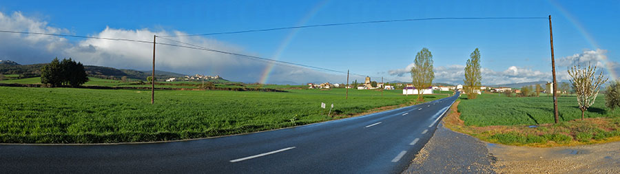
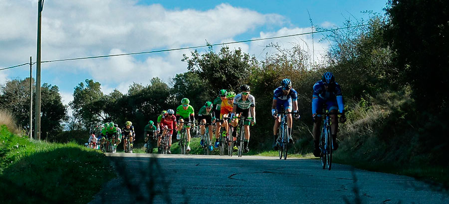
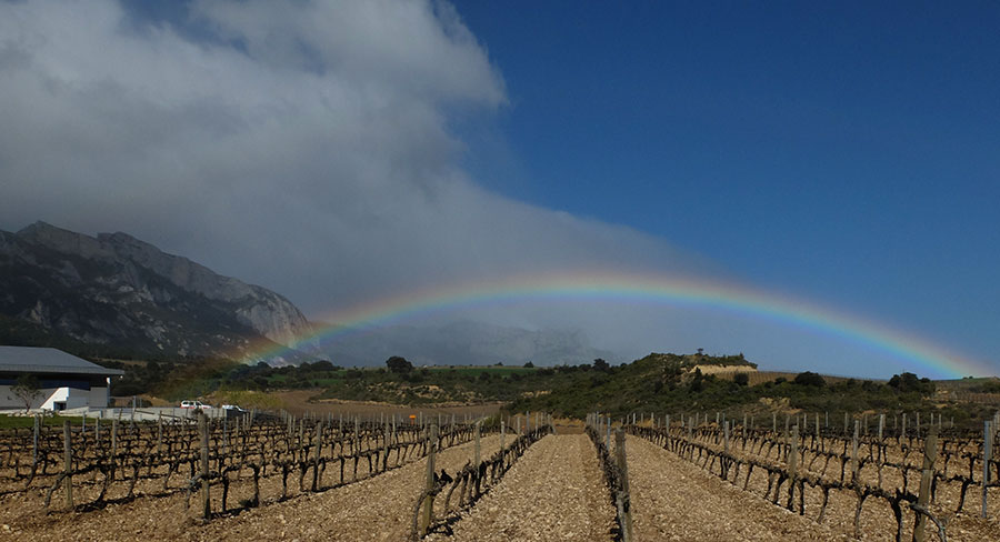
In the images, spring rainbow in the environs of Aritzala and
broken race in the descent of the Col of
Eraul towards Abartzuza during the
edition of Grand Prix Indurain 2017. In front Simon Yates raced
towards the goal in the Puy of Estella.
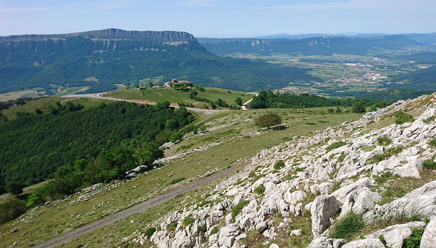
In the North of the Sakana Valley, in the Sierra de Aralar, the Artxueta mountain and the San Miguel, Sanctuary , stand as the representatives of difficult cycling in the area. If we want hard route we include the ascent from Uharte Arakil, if we want to smooth we climb from Lekunberri.
The Sierra de Aralar is shared between Gipuzkoa and Navarra. The
massif has dimensions that allow to carry out routes of a
certain extent by its perimeter. It is not excessive but
considerable, since we speak of a minimum that exceeds slightly
the 100 kilometers.
It is what we call the Aralar Tour a
route with many options and a very different environment
depending on the slope that we are traveling. In the south
- Navarra - uniform and predictable roads and
landscape, in the north - on the Gipuzkoa slope - an
infinite number of small roads, constant ups and downs between
farmhouses and small mountain villages, intense Lizarrusti
forest on the western slope, and Gipuzkoa Industrial present but
without high interference on route.
We are talking about routes with classic scents which run
precisely for a territory in which they abound and that is
"seat" of one of the greatest fan group in the world, the Basque
fans, that is always present in the ditches of all the great
cycling races.
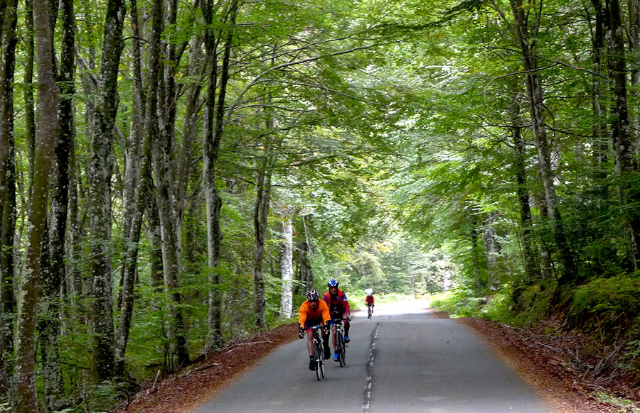
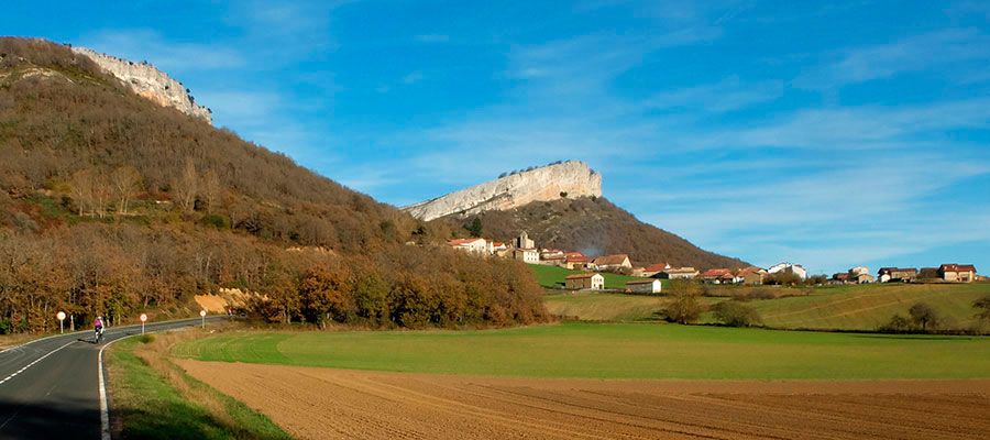
At its westernmost point NAVARRE touchs with Alava in the
"Cuadrilla" - region - of the
Montaña Alavesa. With regard to
cycling, we can define it as a group of small villages
overflowing with authenticity with intercalated natural spaces
that follow each other regularly and wide enough to allow any
type of itinerary.
In the pictures; Daily environment in any of the routes of the
area, pedaling between the beechs (photo 1), and La Muela de San
Román (photo 2) on the village of the same name, forests and
crops in equal parts.
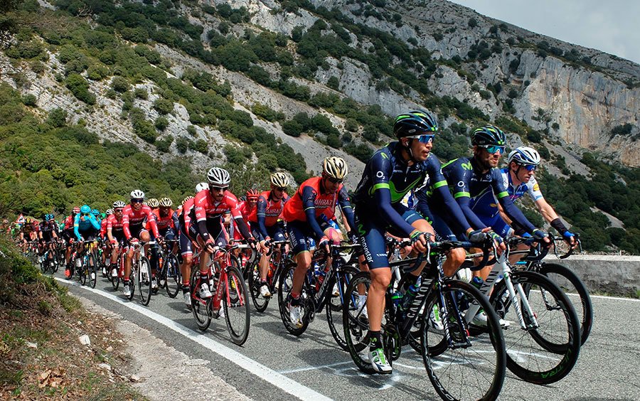
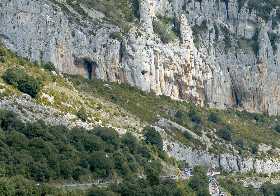
The port of Etxauri is the
prototype Col
that we can find in this area of Navarra. 6,8 km of route,
430 meters of unevenness, sun and shade in equal parts and
excellent viewpoints of a good part of NAVARRA and the
neighboring Communities.
The fact that it is located directly above the Pamplona Basin,
and the spectacular surroundings with the road under the walls
of the climbing school, makes it included in routes that usually
return to La Sakana crossing the Sierra Andia trough the
Lizarraga Mountain Pass.
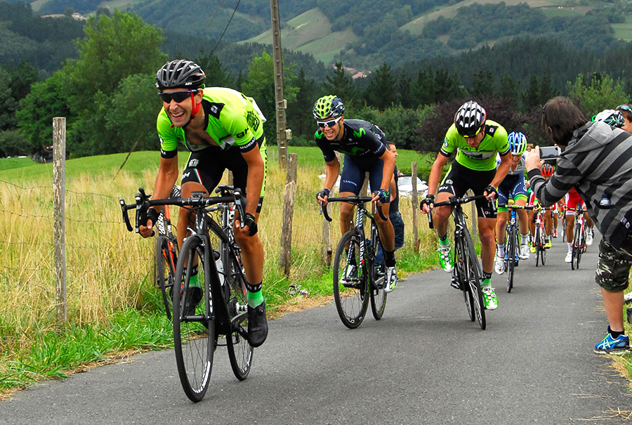
In the photographs the peloton of the Euskal Itzulia 2017
ascends under the cliffs of the port. In the foreground
Movistar, with the final winner of that edition of the event
- Alejandro Valverde - in the front, approaches the
top well guarded by the Trek-Segafredo of Alberto Contador.
Although it is not usual, some times what we want cyclists is to
face us as hard as we put ahead. For these cases we keep the
Diablillos Vascos.
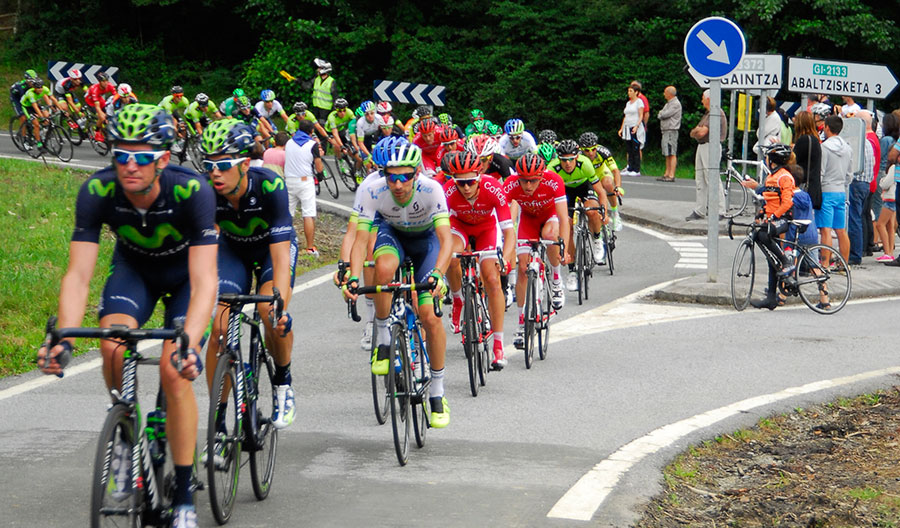
In the
second photograph we have one of the TOPs TEN of the area, the
fearsome "Gaintza Wall"
- 1,6 kilometers at 15,3% -
where Alberto Contador sentenced his Vuelta to the Basque
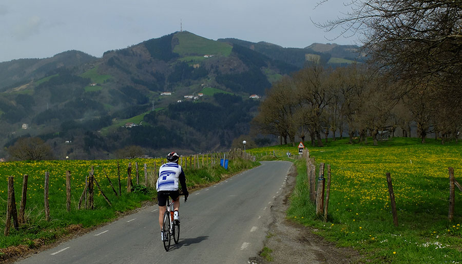
Country 2014. In the first photograph we descend Lazkaomendi
with the view set in the ascent to
Usurbe, - the mount with the
antenna in the top - the absolute TOP TEN of the zone and
whose hardness we accustom to simplify simply saying that
its wall comes to be like "Half of the ANGLIRU".
The relative proximity of the wine region of
La Rioja produces an irresistible
attraction for rolling between vineyards. It is not close, so
what comes up is the challenges of the routes
Reto Rioja and
Ardo eta Ardi (Sheep and
Wine).
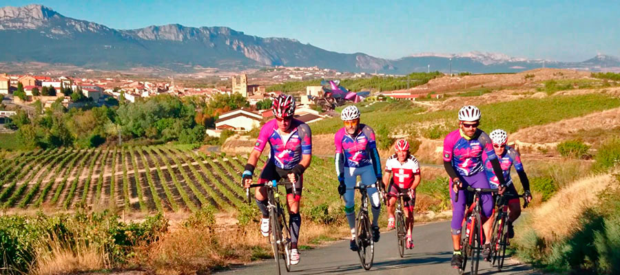
In the first image the new facilities of Bodegas
Rothschild Vega-Sicilia under the
Sierra de Cantabría in the Alava village of Samaniego. On these
lines pedaling between the vineyards of the
Marqués de Riscal winery in Elciego,
behind the charismatic building designed by Frank Gehry.
Another option to take into account when we are in the Sakana is
to roll north, towards Gipuzkoa towards what the industrialists
of the district have agreed to promote internationally like
Goierri Valley.
The routes are developed along the low slopes of the
Aizkorri and
Aralar ranges and by a mixed
agricultural / industrial territory with a strong imprint of
mining past.
The routes are always alive and changing; A stretch of forest, a
small port between hamlets, a ratonero descent, we circled a
locality of a certain entity ... and again up by another ramp.
Aroma and flavor of classic,
Tour to the Basque Country, which is
quite logical being as we are in the heart of the core ... it is
rare the year that the Basque round does not go down these
roads.
We could think that traffic can be a problem in
this geography, but the reality is that the highways absorb the
circulation.
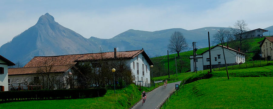
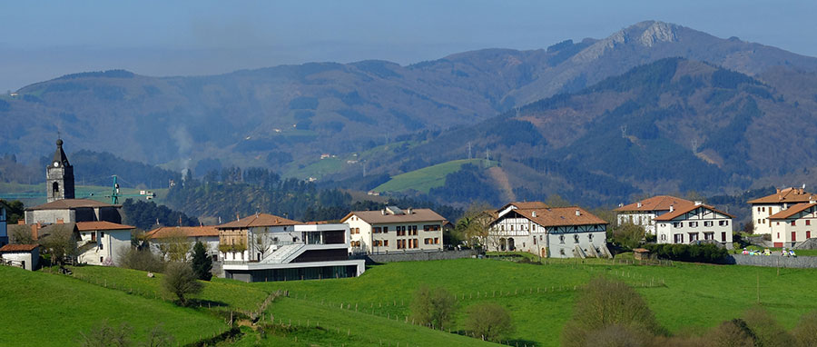
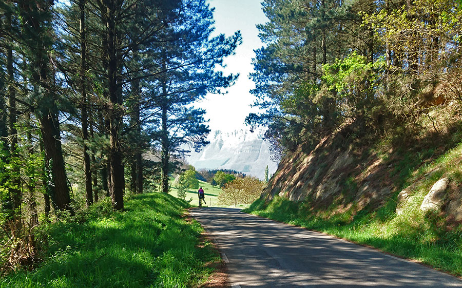
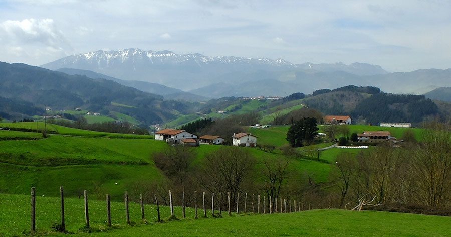
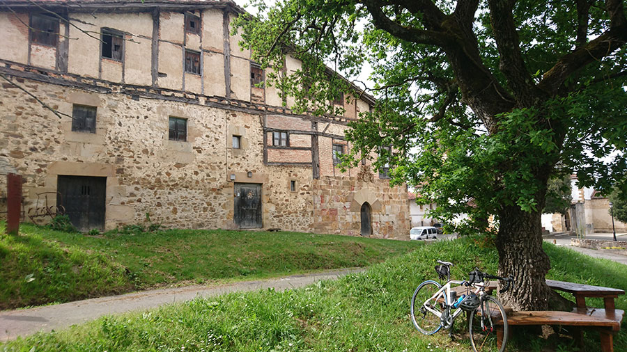
In the images, stop at the Alto de
Barbari between Segura and Zegama
(photo 1), typical landscape of the agricultural Gipuzkoa
- with the Aizkorri mountain range on the horizon -
(photo 2) and Medieval farmhouse in Zerain (photo 3).