ASFPALT
hard

Distance: 152km Unevenness: 2150m
Tour that moves away from the Pyrenean mountain of Navarre in search of what one commonly finds in the south.
We have designed 2 demanding tours from Isaba to the south. The initial claim was clearly having, as commonly said, "a bullet in the chamber" for those days where bad weather and cold cling to the Pyrenean ports contradicting the calendar.
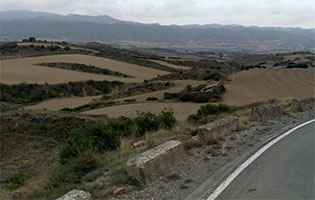
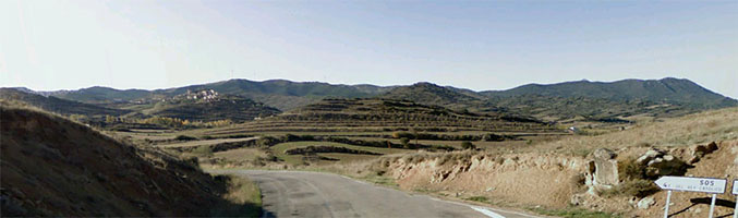
Then, when we have been touring the routes, we have "discovered" that they are not a second option... and that they are not just a simple joke. And here is where we start to see that “it has something...” I don’t know... intangible, maybe as always, the attraction of the desert or at least of the desert-like is what brings those emotions up. Long road stretches, with more risk of wild boars than of cars, to then arrive to villas that cannot hide a much busier past than their current one.
In short: Long stretches of South which lead the mind to a state of different.
Extremo Sur is the softest of the 2 routes to the South. The other one is Almadieros.
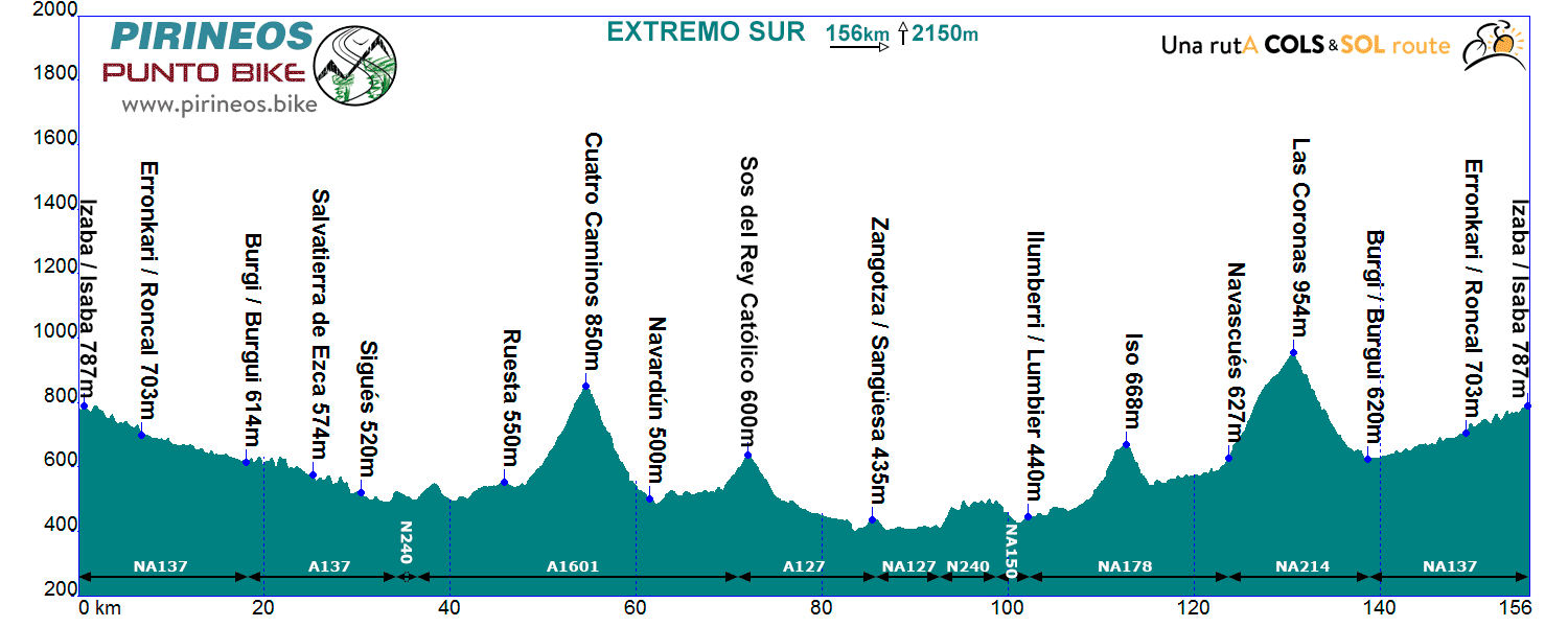
Itinerarie: Isaba NA137 - Burgui - A137 - Sigües - N240 - A1601 - Ruesta - Pto. Cuatro Caminos - Navardún - A127 Sos del Rey Católico - Sangüesa NA127 - N240 - NA150 Lumbier - NA178 Pto. Iso - Navascués NA214 - Burgui NA137 - Isaba
If you want to see the route on wikiloc website click on the green icon on the map.
we are working in this web
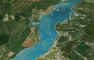
La ruta arranca sin dudas valle abajo, siguiendo el curso del Ezca, hasta el pantano de Yesa. Abandonamos los valles y pueblos pirenaicos y nos adentramos en lo que se ha venido a llamar Prepirineo. Tomamos dirección Huesca y enseguida encontramos el paso hacia la vertiente sur del pantano.
Tras dejar atrás el pueblo abandonado de Ruesta nos encontramos la primera dificultad montañosa de la jornada, los 250 metros de desnivel del puerto de Cuatro Caminos con sus 6 km al 4%. De lo alto nos dejamos caer (7,5 km al 5%) hasta Navardún, en la cuenca del Onsella. De aquí nos quedan 7 kilómetros tranquilos, entre tierras de labranza, antes de volver a esforzarnos un poco para ascender hasta la villa de Sos de Rey Católico (2 km al 5%) que, a modo de faro terrestre, ordena el paisaje y orienta a todo tipo de viajeros en muchos kilómetros a la redonda. Nos quedan aún 82 kilómetros, pero estamos en un sitio que invita al avituallamiento.
Dejamos atrás la villa en cómodo descenso hasta buscar Sangüesa, donde abandonamos la cuenca del Onsella para entrar en la del río Irati. Tras dejar Liédena a nuestra derecha y sin muchas dificultades, salvo que el viento norte nos la esté jugando, alcanzaremos Lumbier.
Seis kilómetros más tarde, tras pasar Domeño, comienza el suave ascenso al puerto de Iso (4 km al 4%). A los 2 kilómetros de descenso podemos detenernos en el espectacular mirador de la Foz de Arbayún. Tras un bonito descenso nos encontraremos a la orilla del Salazar, que nos acompañará durante 7 kilómetros de suave ascenso hasta Navascués, donde comienza la ascensión al puerto de Las Coronas (7 km al 4,5%).
El puerto, a caballo entre la cuenca del Salazar y la del Ezca, vuelve a impregnarnos de ambiente pirenaico. Desde lo alto, vemos como quedan al sur las grandes extensiones de cereal que nos han acompañado durante buena parte de la jornada y como aparecen al norte las cumbres pirenaicas o las nubes que las cubren, todo puede ser. Tras un bonito descenso a Burgi (8 km al 4%) tomamos hacia el norte la orilla del Ezca, que seguiremos hasta Isaba en 17 kilómetros de suave pero constante ascenso, atravesando las localidades de Roncal y Urzainqui.
We are where we are, in the Atlantic Pyrenees, with a plain to the North with localities at very low altitude and ports that are close to the 2000m range.
The southern slope is more "human", towns are in a higher altitude and the slopes are not so important.
The vast majority of the routes cover the ports of the "greats": Issarbe, La Piedra de St Martin, Laberouat, Bagargi, Artaburu, Arnostegi, Ahuski, Larrau...with slopes ranging between 1000 and 1700 meters. Some routes ascent one of these ports, others 2 or 3 and even more.
We anticipated this so the criteria are clear for each 6 levels that we have chosen for the ranking of the routes.
- Walks or family routes: Routes with light slopes and little travel. Suitable for untrained family groups or for people who usually don't use the bike.
- Easy: Routes with a slope that can reach 1000 meters but facing none of the large ports.
The distance will range between 40 and 60 kilometers. - Moderate: Routes with one of the "great" ports or a combination of similar difficulty. The slopes can be really important and slopes can range between 1000 and 2000 meters.
An example of "moderate" is the Artzaiak S stage through Bagargi. The port is tough, but it is the only major difficulty of the day, i.e. we have the whole day for this task, that’s why we left it in "moderate"..
The distance will vary between 60 and 100 kilometers. - Hard: Routes with a slope ranging around 2500 meters. There may have to ascend 2 ports of the "greats" or one and several of the "minor".
The distance will vary between 90 and 130 kilometers. An example of how difficult it can be, will be the short route of the well-known Larra-Larrau. - Very hard: Routes ranging from the 2500 and 4000 meters of altitude. Sometimes there may have to ascend the 3 ports of the '' greats ''. The distance will exceed the 100 kilometers and may reach the 200.
The long route of Larra-Larrau is one of the exponents of how difficult this route is. - Challenge: In these times there is a public that demands "more" yet. To them arises the concept of "challenge": stages of more than a day in "non-stop" mode, 4500-5000 or even more meters of altitude routes, individual or group time trial with 3000 meters of altitude and over 100 kilometers of route.
Finally, a variety of what riders would usually call "nonsense" which to be more elegant, here we call it, 'Challenges'.
Without altimetry
 Return